|
 |
|
||||
|
FAA Information
Effective:
2005-10-27
Airport Identifier:
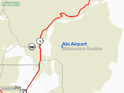
AK46
Longitude/Latitude:
149-02-35.4800W/61-37-43.7900N
Elevation:
750 ft / 228.60 m (Estimated)
Land: 0
acres
From nearest city: 2
nautical miles N of Palmer, AK
Location:
Matanuska Susitna County, AK
Magnetic Variation:
24E (1995)
Ownership:
Privately owned
Owner:
Interact Minitria
Address:
Hco-4 Box 9100
Phone number:
907-745-3124
Manager:
Doug Prins
Address:
Hco-4 Box 9100
Phone number:
907-745-3124
Airport Use:
Private
Wind indicator:
Yes
Segmented Circle:
No
Control Tower:
No
Attendance Schedule:
ALL/ALL/ALL
Sectional chart:
Anchorage
Region:
AAL - Alaska
Boundary ARTCC:
ZAN - Anchorage
Responsible ARTCC:
ZAN - Anchorage
Tie-in FSS:
PAQ - Palmer
FSS Phone:
907-745-2495
FSS Toll Free:
LC745-2495
Alternate FSS:
ENA - Kenai
Alt. FSS Toll
Free:
1-800-WX-BRIEF Runway InformationRunway 07/25
Radio Navigation Aids
Based Aircraft
Abi Airport Address: Matanuska Susitna County, AZ Tel: 907-745-3124 Images and information placed above are from
We don't guarantee the information is fresh and accurate. The data may be wrong or outdated. For more up-to-date information please refer to other sources. |
||||||||||||||||||||||||||||||||||||||||||||||||||||||||||||||||||||||||||||||||||||||||||||||||||||||||||||||||||||||||||||||||||||||||||||||||||||||||||||||||||||||||||||||||||||

 |
|
Copyright 2004-2026 © by Airports-Worldwide.com, Vyshenskoho st. 36, Lviv 79010, Ukraine Legal Disclaimer |