 |
|
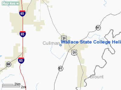
Wallace State College Heliport |
|
|
Location
& QuickFacts
|
FAA Information Effective: |
2007-01-18 |
|
Airport
Identifier: |
4AL3 |
|
Airport
Status: |
Operational |
|
Longitude/Latitude: |
086-47-27.0000W/34-04-01.0000N
-86.790833/34.066944 (Estimated) |
|
Elevation: |
630 ft / 192.02 m (Estimated) |
|
Land: |
0
acres |
|
From
nearest city: |
2 nautical miles NW of Hanceville, AL |
|
Location: |
Cullman County, AL |
|
Magnetic Variation: |
01W (1995) |
Owner
& Manager
|
Ownership: |
Privately owned |
|
Owner: |
Wallace State Community College |
|
Address: |
P.o. Box 2000, 801 Main Street, N.w.
Hanceville, AL 35077-2000 |
|
Phone
number: |
256-352-8035 |
|
Manager: |
Bert Mackentepe |
|
Address: |
P.o. Box 2000
Hanceville, AL 35077-2000 |
|
Phone number: |
256-352-8035 |
Airport
Operations and Facilities
|
Airport Use: |
Private |
|
Wind
indicator: |
Yes |
|
Segmented
Circle: |
No |
|
Control
Tower: |
No |
|
Lighting
Schedule: |
RDO-CTL
ACTVT ROTG BCN - 123.45. |
|
Beacon Color: |
Clear-Green-Yellow (heliport) |
|
Sectional chart: |
Atlanta |
|
Region: |
ASO - Southern |
|
Boundary ARTCC: |
ZTL - Atlanta |
|
Tie-in FSS: |
ANB - Anniston |
|
FSS Toll Free: |
1-800-WX-BRIEF |
Airport
Services
|
Runway Information
Helipad H1
|
Dimension: |
75 x 75 ft / 22.9 x 22.9 m |
|
Surface: |
CONC, |
|
|
Runway H1 |
Runway |
|
Traffic
Pattern: |
Left |
Left |
|
Radio Navigation
Aids
|
ID |
Type |
Name |
Ch |
Freq |
Var |
Dist |
|
CPP |
NDB |
Cole Spring |
|
230.00 |
01W |
18.2 nm |
|
ARF |
NDB |
Saratoga |
|
296.00 |
02W |
30.3 nm |
|
BH |
NDB |
Mcden |
|
224.00 |
01W |
33.5 nm |
|
HUA |
NDB |
Redstone |
|
287.00 |
00W |
38.3 nm |
|
PLR |
NDB |
Pell City |
|
257.00 |
01E |
40.8 nm |
|
CWH |
NDB |
Capshaw |
|
350.00 |
01W |
42.5 nm |
|
BEQ |
NDB |
Bessemer |
|
368.00 |
00E |
45.9 nm |
|
GAD |
VOR/DME |
Gadsden |
070X |
112.30 |
02E |
35.7 nm |
|
DCU |
VOR/DME |
Decatur |
075X |
112.80 |
01W |
35.7 nm |
|
TDG |
VOR/DME |
Talladega |
025X |
108.80 |
02E |
47.6 nm |
|
VUZ |
VORTAC |
Vulcan |
091X |
114.40 |
02E |
24.5 nm |
|
RQZ |
VORTAC |
Rocket |
059X |
112.20 |
02E |
44.6 nm |
|
BHM |
VOT |
Birmingham Muni |
|
110.00 |
|
30.3 nm |
Remarks
- SEE
AERONAUTICAL STUDY 98-JAN-0100-NRA.
Based
Aircraft
|
Aircraft
based on field: |
2 |
|
Helicopters: |
2 |
Wallace State College Heliport
Address:
Cullman County, AL
Tel:
256-352-8035
Images
and information placed above are from
http://www.airport-data.com/airport/4AL3/
We
thank them for the data!
| General
Info |
| Country |
United
States |
| State |
ALABAMA
|
| FAA ID |
4AL3
|
| Latitude |
34-04-01.000N
|
| Longitude |
086-47-27.000W
|
| Elevation |
630 feet
|
| Near City |
HANCEVILLE
|
We don't guarantee the information is fresh and accurate. The data may
be wrong or outdated.
For more up-to-date information please refer to other sources.
|
|


