 |
|
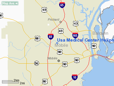
USA Medical Center Heliport |
Location
& QuickFacts
|
FAA Information Effective: |
2007-01-18 |
|
Airport
Identifier: |
AL52 |
|
Airport
Status: |
Operational |
|
Longitude/Latitude: |
088-06-28.0020W/30-42-41.6810N
-88.107778/30.711578 (Estimated) |
|
Elevation: |
28
ft / 8.53 m (Estimated) |
|
Land: |
0
acres |
|
From
nearest city: |
0 nautical miles N of Mobile, AL |
|
Location: |
Mobile County, AL |
|
Magnetic Variation: |
02E (1985) |
Owner
& Manager
|
Ownership: |
Publicly owned |
|
Owner: |
Univ Of So Alabama Med Center |
|
Address: |
2451 Fillingim St
Mobile, AL 36617 |
|
Phone number: |
205-471-7100 |
|
Manager: |
Bill Glisson |
|
Address: |
2451 Fillingim St
Mobile, AL 36617 |
|
Phone number: |
205-471-7126 |
Airport
Operations and Facilities
|
Airport Use: |
Private
MEDICAL. |
|
Wind indicator: |
Yes |
|
Segmented Circle: |
No |
|
Control Tower: |
No |
|
Lighting Schedule: |
DUSK-DAWN |
|
Landing fee charge: |
No |
|
Sectional chart: |
New Orleans |
|
Region: |
ASO - Southern |
|
Boundary ARTCC: |
ZHU - Houston |
|
Tie-in FSS: |
ANB - Anniston |
|
FSS on Airport: |
No |
|
FSS Toll Free: |
1-800-WX-BRIEF |
Airport
Communications
|
Runway Information
Helipad H1
|
Dimension: |
60 x 60 ft / 18.3 x 18.3 m |
|
Surface: |
CONC, |
|
|
Runway H1 |
Runway |
|
Traffic
Pattern: |
Left |
Left |
|
Radio Navigation
Aids
|
ID |
Type |
Name |
Ch |
Freq |
Var |
Dist |
|
MO |
NDB |
Wisle |
|
248.00 |
02E |
10.5 nm |
|
ESU |
NDB |
Summerdale |
|
204.00 |
01E |
23.5 nm |
|
NPA |
TACAN |
Pensacola |
119X |
|
01E |
46.2 nm |
|
BIX |
TACAN |
Keesler |
055X |
|
01E |
46.3 nm |
|
NUN |
VOR |
Saufley |
|
108.80 |
01E |
42.5 nm |
|
BFM |
VORTAC |
Brookley |
075X |
112.80 |
04E |
6.5 nm |
|
SJI |
VORTAC |
Semmes |
100X |
115.30 |
05E |
13.0 nm |
|
GCV |
VORTAC |
Greene County |
104X |
115.70 |
05E |
30.3 nm |
Remarks
Based
Aircraft
|
Aircraft
based on field: |
1 |
|
Helicopters: |
1 |
Usa Medical Center Heliport
Address:
Mobile County, AL
Tel:
205-471-7100, 205-471-7126
Images
and information placed above are from
http://www.airport-data.com/airport/AL52/
We
thank them for the data!
| General
Info |
| Country |
United
States |
| State |
ALABAMA
|
| FAA ID |
AL52
|
| Latitude |
30-42-41.681N
|
| Longitude |
088-06-28.002W
|
| Elevation |
28 feet
|
| Near City |
MOBILE
|
We don't guarantee the information is fresh and accurate. The data may
be wrong or outdated.
For more up-to-date information please refer to other sources.
|
|


