|
 |
|
||||
|
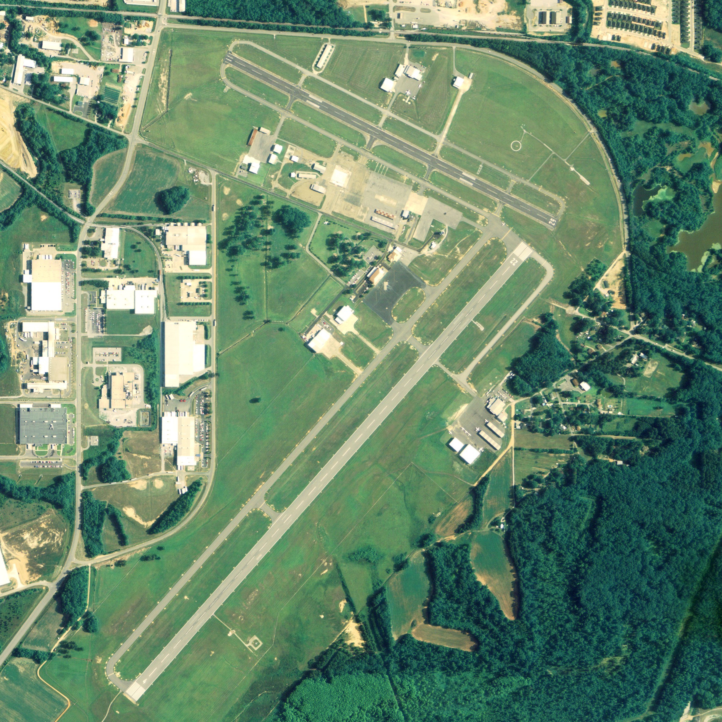
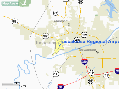
Tuscaloosa Regional Airport (IATA: TCL, ICAO: KTCL, FAA LID: TCL) is a city-owned, public-use airport located three nautical miles (6 km) northwest of the central business district of Tuscaloosa, a city in Tuscaloosa County, Alabama, United States. According to the FAA's National Plan of Integrated Airport Systems for 2009â2013, it is classified as a general aviation airport. As per FAA records, the airport had 2,030 commercial passenger boardings (enplanements) in calendar year 2007 and 1,612 enplanements in 2008. The majority of this traffic was athletic charters from the University of Alabama. HistoryIn 1939 Oliver Parks was brought to Alabama to set up a Civilian Pilot Training Program, CPTP, for the University of Alabama. A brick hanger was built on the property and the first class of students were licensed before the end of 1939. The airport was opened in April 1940 as Van De Graaff Field. It originally consisted of 4 turf runways: 00/18 (2500 by 500 feet), 04/22 (3777 by 600 feet), 09/27 (4082 by 600 feet), 13/31 (5208 by 600 feet). World War IIDuring the World War II, the field was revamped to include a single main runway (the current 11/29). The rest of the filed was usable as an all-way field. The Civil Aeronautics Administration designated van de Graff Field as an intermediate field (#59). It operated as a United States Army Air Forces primary (phase 1) pilot training field. Training was provided under contact by the Alabama Institute of Aeronautics, Inc. Flying training was performed primarily with Fairchild PT-19s, in addition to PT-17 Stearmans and a few P-40 Warhawks. Military operations were inactivated on September 8, 1944, with the drawdown of AAFTC's pilot training program. The airfield was turned over to city control at the end of the war though the War Assets Administration. Commercial Air ServicesRunway 11/29 was paved in the early 1950s. A northeast-southwest runway (4/22) was constructed in 1970, along with a passenger terminal, in order to facilitate jet service. Commercial airline service to Tuscaloosa commenced on June 10, 1949, on a 25-seat Douglas DC-3 as one of the original six destinations served by Southern Airways. Service on Southern would continue to grow in serving Tuscaloosa with the Martin 4-0-4 and eventually McDonnell-Douglas DC-9 aircraft by the 1970s. Service would peak in the mid-1970s with eight daily arrivals and departures to Atlanta, Memphis and New Orleans. Southern merged into Republic Airlines in 1979, and service was discontinued altogether on June 1, 1984, as most passengers were drawn to nearby Birmingham's airport. Briefly following the exit of Republic, Sunbelt Airlines provided 2 daily flights to Memphis from June 1 through its elimination of service on September 13, 1984. On April 15, 1986, American Eagle commenced service between Tuscaloosa and Nashville. The service was initially operated by Air Midwest and operated three times daily from Tuscaloosa on 19 seat-turboprop aircraft. Service ended with the closure of the Nashville hub in June 1996, with service being redirected to Dallas/Fort Worth on 34 seat-turboprop aircraft with an intermediary stop in Jackson. Due to dwindling ridership, the city voluntarily removed itself from the Essential Air Service program resulting in service being discontinued on April 18, 1997. Atlantic Southeast Airlines provided daily service between Tuscaloosa and Atlanta between 1982 and June 1992. GP Express would continue service to Atlanta from June 6, 1992, through the elimination of the EAS subsidy for its operation on June 30, 1994. No airlines have offered commercial flight services since the departure of American Eagle in 1997. Attempts to Restore Commercial ServiceDuring the 2000s, the city of Tuscaloosa and the airport attempted to lure commercial service back to the airport. Between 2002 and 2006, the airport received $2.2 million in federal, state, and local money to improve its facilities, including $400,000 from the FAA as part of a program to help restore commercial airline service to smaller cities. The city matched the grant with $100,000 of local funding. In 2006, the city authorized paying $8500 to a consulting firm to court airlines in an effort to revive commercial service to the airport. City and airport officials stated their belief that the area was in a different economic picture with the Mercedes-Benz plant located in the city (the only one in North America) and new developments in and around the campus of the University of Alabama, including an expansion to Bryant-Denny Stadium DayJet announced per seat VLJ service on two pilot planes nonstop to 14 hubs in 3 states in July 2008 from Tuscaloosa. However, DayJet discontinued all passenger service operations on September 19, 2008 citing their inability to raise financing needed for continued operations. Jet charters continue to periodically operate at Tuscaloosa. Facilities and aircraftTuscaloosa Regional Airport covers an area of 724 acres (293 ha) which contains two asphalt paved runways: 4/22 is 6,499 by 150 feet (1,981 x 46 m) and 11/29 measures 4,001 by 100 feet (1,220 x 30 m). Runway 4 is equipped with an Instrument Landing System and approach lights, allowing landings in visibility as low as a half mile. For the 12-month period ending April 30, 2009, the airport had 56,045 aircraft operations, an average of 153 per day: 76% general aviation, 22% military. 2% air taxi, and <1% scheduled commercial. At that time there were 117 aircraft based at this airport: 73% single-engine, 10% multi-engine, 10% jet and 7% helicopter. The above content comes from Wikipedia and is published under free licenses – click here to read more.
Runway InformationRunway 04/22
Runway 11/29
Radio Navigation Aids
Remarks
Based Aircraft
Operational StatisticsTime Period: 2004-06-01 - 2005-05-31
Tuscaloosa Regional Airport Address: Tuscaloosa County, AL Tel: 205-349-2010, 205-349-0114 Images
and information placed above are from We thank them for the data!
We don't guarantee the information is fresh and accurate. The data may
be wrong or outdated.
|
|||||||||||||||||||||||||||||||||||||||||||||||||||||||||||||||||||||||||||||||||||||||||||||||||||||||||||||||||||||||||||||||||||||||||||||||||||||||||||||||||||||||||||||||||||||||||||||||||||||||||||||||||||||||||||||||||||||||||||||||||||||||||||||||||||||||||||||||||||||||||||||||||||||||||||||||||||||||||||||||||||||||||||||||||||||||||||||||||||||||||||||||||||||||||||||||||||||||||||||||||||

 |
|
Copyright 2004-2026 © by Airports-Worldwide.com, Vyshenskoho st. 36, Lviv 79010, Ukraine Legal Disclaimer |