 |
|
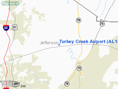
Location
& QuickFacts
|
FAA Information Effective: |
2007-01-18 |
|
Airport
Identifier: |
AL16 |
|
Airport
Status: |
Operational |
|
Longitude/Latitude: |
086-43-24.9680W/33-43-36.3650N
-86.723602/33.726768 (Estimated) |
|
Elevation: |
640 ft / 195.07 m (Estimated) |
|
Land: |
0
acres |
|
From
nearest city: |
4 nautical miles NW of Pinson, AL |
|
Location: |
Jefferson County, AL |
|
Magnetic Variation: |
01W (1985) |
Owner
& Manager
|
Ownership: |
Privately owned |
|
Owner: |
Carolyn Davis |
|
Address: |
7815 Mc Combs Mill Rd
Pinson, AL 35126 |
|
Phone number: |
205-681-1565 |
|
Address: |
|
Airport
Operations and Facilities
|
Airport Use: |
Private |
|
Segmented
Circle: |
No |
|
Control
Tower: |
No |
|
Sectional
chart: |
Atlanta |
|
Region: |
ASO - Southern |
|
Boundary
ARTCC: |
ZTL - Atlanta |
|
Tie-in
FSS: |
ANB - Anniston |
|
FSS
Toll Free: |
1-800-WX-BRIEF |
|
Runway Information
Runway 18/36
|
Dimension: |
2500 x 100 ft / 762.0 x 30.5 m |
|
Surface: |
TURF, |
|
|
Runway 18 |
Runway 36 |
|
Traffic
Pattern: |
Left |
Left |
|
Obstruction: |
35 ft trees, 20.0 ft from runway |
35 ft trees, 20.0 ft from runway |
|
Radio Navigation
Aids
|
ID |
Type |
Name |
Ch |
Freq |
Var |
Dist |
|
BH |
NDB |
Mcden |
|
224.00 |
01W |
14.3 nm |
|
PLR |
NDB |
Pell City |
|
257.00 |
01E |
25.8 nm |
|
BEQ |
NDB |
Bessemer |
|
368.00 |
00E |
26.9 nm |
|
CPP |
NDB |
Cole Spring |
|
230.00 |
01W |
38.9 nm |
|
SCD |
NDB |
Sylacauga |
|
284.00 |
03W |
38.9 nm |
|
ARF |
NDB |
Saratoga |
|
296.00 |
02W |
40.3 nm |
|
TDG |
VOR/DME |
Talladega |
025X |
108.80 |
02E |
35.3 nm |
|
GAD |
VOR/DME |
Gadsden |
070X |
112.30 |
02E |
35.3 nm |
|
VUZ |
VORTAC |
Vulcan |
091X |
114.40 |
02E |
9.4 nm |
|
OKW |
VORTAC |
Brookwood |
047X |
111.00 |
00E |
39.4 nm |
|
LDK |
VORTAC |
Crimson |
125X |
117.80 |
03E |
49.5 nm |
|
BHM |
VOT |
Birmingham Muni |
|
110.00 |
|
10.0 nm |
Remarks
Based
Aircraft
|
Aircraft
based on field: |
3 |
|
Single
Engine Airplanes: |
3 |
Turkey Creek Airport
Address:
Jefferson County, AL
Tel:
205-681-1565
Images
and information placed above are from
http://www.airport-data.com/airport/AL16/
We
thank them for the data!
| General
Info |
| Country |
United
States |
| State |
ALABAMA
|
| FAA ID |
AL16
|
| Latitude |
33-43-36.365N
|
| Longitude |
086-43-24.968W
|
| Elevation |
640 feet
|
| Near City |
PINSON
|
We don't guarantee the information is fresh and accurate. The data may
be wrong or outdated.
For more up-to-date information please refer to other sources.
|
|


