 |
|
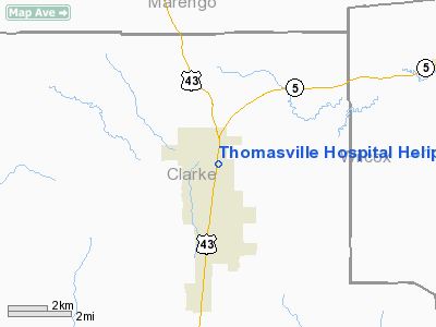
Thomasville Hospital Heliport |
Location
& QuickFacts
|
FAA Information Effective: |
2007-01-18 |
|
Airport
Identifier: |
AL48 |
|
Airport
Status: |
Operational |
|
Longitude/Latitude: |
087-44-15.0140W/31-55-50.5480N
-87.737504/31.930708 (Estimated) |
|
Elevation: |
265 ft / 80.77 m (Estimated) |
|
Land: |
0
acres |
|
From
nearest city: |
0 nautical miles N of Thomasville, AL |
|
Location: |
Clarke County, AL |
|
Magnetic Variation: |
01E (1985) |
Owner
& Manager
|
Ownership: |
Privately owned |
|
Owner: |
Thomasville Hospital |
|
Address: |
Po Box 429
Thomasville, AL 36784 |
|
Phone number: |
205-636-4431 |
|
Manager: |
Thomasville Hospital |
|
Address: |
Po Box 429
Thomasville, AL 36784 |
|
Phone number: |
205-636-4431 |
Airport
Operations and Facilities
|
Airport Use: |
Private
MEDICAL USE. |
|
Segmented
Circle: |
No |
|
Control
Tower: |
No |
|
Sectional
chart: |
New Orleans |
|
Region: |
ASO - Southern |
|
Boundary
ARTCC: |
ZTL - Atlanta |
|
Tie-in
FSS: |
ANB - Anniston |
|
FSS
on Airport: |
No |
|
FSS
Toll Free: |
1-800-WX-BRIEF |
|
Runway Information
Helipad H1
|
Dimension: |
60 x 60 ft / 18.3 x 18.3 m |
|
Surface: |
CONC, |
|
|
Runway H1 |
Runway |
|
Traffic
Pattern: |
Left |
Left |
|
Radio Navigation
Aids
|
ID |
Type |
Name |
Ch |
Freq |
Var |
Dist |
|
BCZ |
NDB |
Choctaw |
|
228.00 |
01E |
22.5 nm |
|
RZO |
NDB |
Marengo |
|
391.00 |
01E |
32.3 nm |
|
EOG |
NDB |
Greensboro |
|
417.00 |
01E |
40.5 nm |
|
SE |
NDB |
Pollk |
|
344.00 |
01W |
46.0 nm |
|
JYU |
VOR/DME |
Junior |
083X |
113.60 |
01W |
45.4 nm |
|
MVC |
VORTAC |
Monroeville |
115X |
116.80 |
04E |
34.4 nm |
|
EWA |
VORTAC |
Kewanee |
085X |
113.80 |
04E |
45.1 nm |
Remarks
- PRVDD
PVT USE; OPNS ARE CONDUCTED FROM 130-180; AREA IS MARKED; WIND INDICATOR
IS MAINTAINED; OPNS ARE RESTRICTED TO MAX 10 KNOT TAILWIND; TREES ARE
REMOVED.
Thomasville Hospital Heliport
Address:
Clarke County, AL
Tel:
205-636-4431
Images
and information placed above are from
http://www.airport-data.com/airport/AL48/
We
thank them for the data!
| General
Info |
| Country |
United
States |
| State |
ALABAMA
|
| FAA ID |
AL48
|
| Latitude |
31-55-50.548N
|
| Longitude |
087-44-15.014W
|
| Elevation |
265 feet
|
| Near City |
THOMASVILLE
|
We don't guarantee the information is fresh and accurate. The data may
be wrong or outdated.
For more up-to-date information please refer to other sources.
|
|


