|
|
Thomas C Russell Field Airport |
| Thomas C. Russell Field |
 |
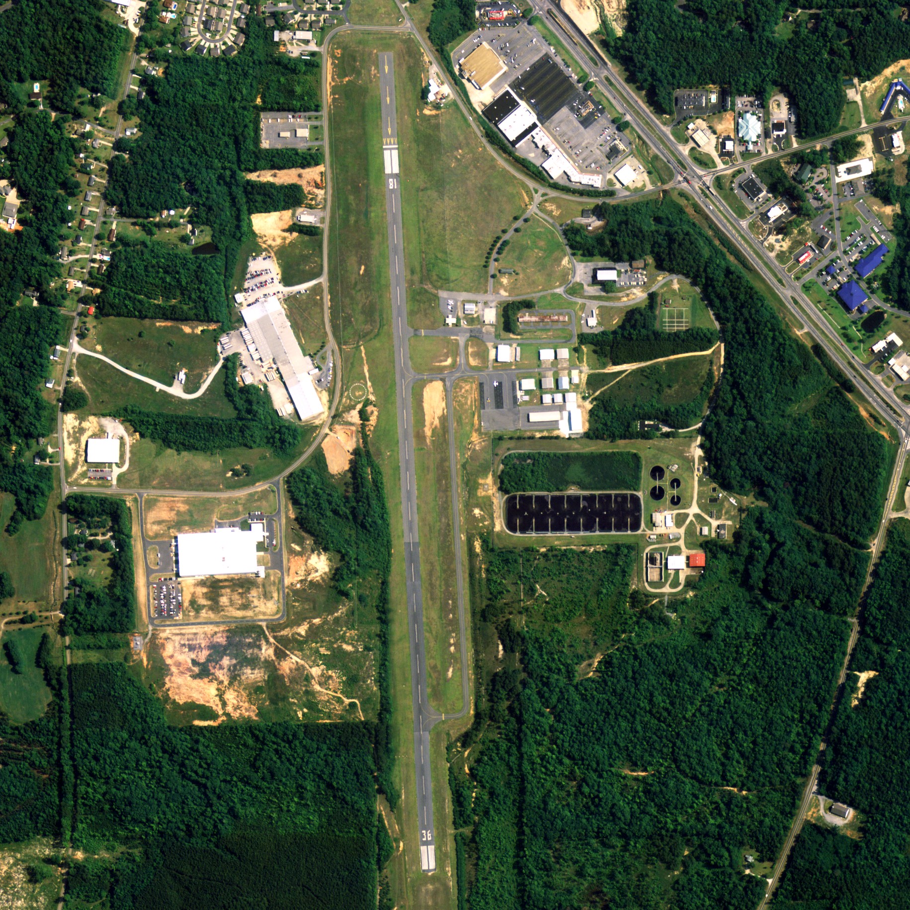
| NAIP aerial image, 30 June 2006 |
| IATA: ALX â ICAO: KALX â FAA LID: ALX |
| Summary |
| Airport type |
Public |
| Owner |
City of Alexander City |
| Serves |
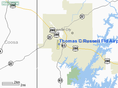
Alexander City, Alabama |
| Elevation AMSL |
686 ft / 209 m |
| Coordinates |
32°54â²53â³N 085°57â²47â³W / 32.91472°N 85.96306°W / 32.91472; -85.96306 |
| Website |
AlexanderCityOnline.com/... |
| Runways |
| Direction |
Length |
Surface |
| ft |
m |
| 18/36 |
5,425 |
1,654 |
Asphalt |
| Statistics (2006) |
| Aircraft operations |
33,312 |
| Source: Federal Aviation Administration |
Thomas C. Russell Field (IATA: ALX, ICAO: KALX, FAA LID: ALX) is a city-owned public-use airport located 2 nautical miles (4 km) southwest of the central business district of Alexander City, a city in Tallapoosa County, Alabama, United States. According to the FAA's National Plan of Integrated Airport Systems for 2009â2013, it is categorized as a general aviation facility.
Facilities and aircraft
Thomas C. Russell Field covers an area of 293 acres (0.46 sq mi; 1.19 km) which contains one runway designated 18/36 is 5,425 x 96 feet (1,654 x 29 meters) asphalt. For the 12-month period ending December 20, 2006, the airport had 33,312 general aviation aircraft operations.
The above content comes from Wikipedia and is published under free licenses – click here to read more.
Location
& QuickFacts
|
FAA Information Effective: |
2007-01-18 |
|
Airport
Identifier: |
ALX |
|
Airport
Status: |
Operational |
|
Longitude/Latitude: |
085-57-46.6400W/32-54-53.0800N
-85.962956/32.914744 (Estimated) |
|
Elevation: |
686 ft / 209.09 m (Surveyed) |
|
Land: |
293 acres |
|
From
nearest city: |
2 nautical miles SW of Alexander City, AL |
|
Location: |
Tallapoosa County, AL |
|
Magnetic Variation: |
01W (1990) |
Owner
& Manager
|
Ownership: |
Publicly owned |
|
Owner: |
City Of Alexander City |
|
Address: |
Po Box 552
Alexander City, AL 35011 |
|
Phone
number: |
256-329-6700 |
|
Manager: |
James Wallace |
|
Address: |
997 T.c. Russell Field
Alexander City, AL 35010 |
|
Phone number: |
256-329-9057
PHONE 256-329-6700 OR 256-329-3721. |
Airport
Operations and Facilities
|
Airport Use: |
Open to public |
|
Wind
indicator: |
Yes |
|
Segmented
Circle: |
Yes |
|
Control
Tower: |
No |
|
Lighting
Schedule: |
DUSK-DAWN
MIRL RY 18/36 OPERS DUSK-2200. AFTER
2200, ACTVT - CTAF |
|
Beacon
Color: |
Clear-Green (lighted land airport) |
|
Landing
fee charge: |
No |
|
Sectional
chart: |
Atlanta |
|
Region: |
ASO - Southern |
|
Boundary
ARTCC: |
ZTL - Atlanta |
|
Tie-in
FSS: |
ANB - Anniston |
|
FSS
on Airport: |
No |
|
FSS
Toll Free: |
1-800-WX-BRIEF |
|
NOTAMs
Facility: |
ANB (NOTAM-d service avaliable) |
|
Federal Agreements: |
NGY |
Airport
Communications
|
CTAF: |
122.700 |
|
Unicom: |
122.700 |
Airport
Services
|
Fuel available: |
100LLA |
|
Airframe Repair: |
MINOR |
|
Power Plant Repair: |
MAJOR |
|
Bottled
Oxygen: |
NONE |
|
Bulk
Oxygen: |
NONE |
|
Runway Information
Runway 18/36
|
Dimension: |
5425 x 96 ft / 1653.5 x 29.3 m |
|
Surface: |
ASPH, Fair Condition |
|
Weight
Limit: |
Single wheel: 30000 lbs. |
|
Edge
Lights: |
Medium |
|
|
Runway 18 |
Runway 36 |
|
Longitude: |
085-57-48.0100W |
085-57-45.2700W |
|
Latitude: |
32-55-19.8900N |
32-54-26.2600N |
|
Elevation: |
686.00
ft |
612.00
ft |
|
Alignment: |
127 |
127 |
|
Traffic
Pattern: |
Left |
Left |
|
Markings: |
Non-precision instrument, Good Condition |
Non-precision instrument, Fair Condition |
|
Crossing
Height: |
0.00 ft |
25.00
ft |
|
Displaced
threshold: |
619.00
ft |
0.00 ft |
|
VASI: |
2-light PAPI on left side |
2-light PAPI on left side |
|
Visual
Glide Angle: |
0.00° |
3.00° |
|
Runway
End Identifier: |
|
Yes |
|
Obstruction: |
49 ft trees, 582.0 ft from runway, 43 ft right
of centerline, 7:1 slope to clear
APCH RATIO 24:1 FROM DSPLCD THLD. |
70 ft trees, 2000.0 ft from runway, 25:1 slope
to clear |
|
Radio Navigation
Aids
|
ID |
Type |
Name |
Ch |
Freq |
Var |
Dist |
|
DER |
NDB |
Alexander City |
|
382.00 |
01W |
2.1 nm |
|
SCD |
NDB |
Sylacauga |
|
284.00 |
03W |
23.7 nm |
|
GGY |
NDB |
Gragg-wade |
|
338.00 |
01E |
32.9 nm |
|
PLR |
NDB |
Pell City |
|
257.00 |
01E |
41.3 nm |
|
MXF |
TACAN |
Maxwell |
097X |
|
03E |
38.2 nm |
|
TGE |
VOR/DME |
Tuskegee |
120X |
117.30 |
02E |
29.8 nm |
|
TDG |
VOR/DME |
Talladega |
025X |
108.80 |
02E |
39.9 nm |
|
LGC |
VORTAC |
Lagrange |
103X |
115.60 |
01E |
39.0 nm |
|
MGM |
VORTAC |
Montgomery |
058X |
112.10 |
03E |
45.4 nm |
Remarks
- RWY
18 HAS +136' OBSTR LGTD BLDG 3700' FROM THLD ON CNTRLN.
Based
Aircraft
|
Aircraft
based on field: |
28 |
|
Single
Engine Airplanes: |
21 |
|
Multi
Engine Airplanes: |
5 |
|
Jet Engine
Airplanes: |
1 |
|
Helicopters: |
1 |
Operational Statistics
Time Period: 1999-06-09
- 2000-06-07
|
Aircraft
Operations: |
92/Day |
|
General
Aviation Local: |
12.1% |
|
General
Aviation Itinerant: |
78.9% |
|
Military: |
9.0% |
Thomas C Russell Field Airport
Address:
Tallapoosa County, AL
Tel:
256-329-6700,
256-329-9057
Images
and information placed above are from
http://www.airport-data.com/airport/ALX/
We
thank them for the data!
| General
Info |
| Country |
United
States |
| State |
ALABAMA
|
| FAA ID |
ALX
|
| Latitude |
32-54-53.106N
|
| Longitude |
085-57-46.642W
|
| Elevation |
686 feet
|
| Near City |
ALEXANDER
CITY |
We don't guarantee the information is fresh and accurate. The data may
be wrong or outdated.
For more up-to-date information please refer to other sources.
|
|