 |
|
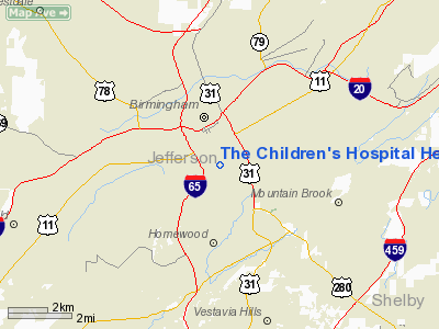
The Children's Hospital Heliport |
|
|
Location
& QuickFacts
|
FAA Information Effective: |
2007-01-18 |
|
Airport
Identifier: |
AL91 |
|
Airport
Status: |
Operational |
|
Longitude/Latitude: |
086-48-18.9630W/33-30-15.3790N
-86.805267/33.504272 (Estimated) |
|
Elevation: |
698 ft / 212.75 m (Estimated) |
|
Land: |
0
acres |
|
From
nearest city: |
0 nautical miles N of Birmingham, AL |
|
Location: |
Jefferson County, AL |
|
Magnetic Variation: |
00E (1985) |
Owner
& Manager
|
Ownership: |
Privately owned |
|
Owner: |
The Children's Hospital Of Al |
|
Address: |
1600 7th Ave South
Birmingham, AL 35233 |
|
Phone
number: |
205-939-9100 |
|
Manager: |
Michael E. Mc Devitt |
|
Address: |
1600 7th Ave South
Birmingham, AL 35233 |
|
Phone number: |
205-939-9100 |
Airport
Operations and Facilities
|
Airport Use: |
Private
MEDICAL USE. |
|
Wind
indicator: |
Yes |
|
Segmented
Circle: |
No |
|
Control
Tower: |
No |
|
Lighting
Schedule: |
PHONE REQ
FOR PERIMETER LIGHTS CALL 205-939-9100. |
|
Sectional
chart: |
Atlanta |
|
Region: |
ASO - Southern |
|
Boundary
ARTCC: |
ZTL - Atlanta |
|
Tie-in
FSS: |
ANB - Anniston |
|
FSS
on Airport: |
No |
|
FSS
Toll Free: |
1-800-WX-BRIEF |
|
Runway Information
Helipad H1
|
Dimension: |
70 x 70 ft / 21.3 x 21.3 m |
|
Surface: |
CONC, |
|
|
Runway H1 |
Runway |
|
Traffic
Pattern: |
Left |
Left |
|
Radio Navigation
Aids
|
ID |
Type |
Name |
Ch |
Freq |
Var |
Dist |
|
BH |
NDB |
Mcden |
|
224.00 |
01W |
2.1 nm |
|
BEQ |
NDB |
Bessemer |
|
368.00 |
00E |
13.0 nm |
|
PLR |
NDB |
Pell City |
|
257.00 |
01E |
28.0 nm |
|
SCD |
NDB |
Sylacauga |
|
284.00 |
03W |
31.5 nm |
|
GGY |
NDB |
Gragg-wade |
|
338.00 |
01E |
40.3 nm |
|
TDG |
VOR/DME |
Talladega |
025X |
108.80 |
02E |
38.4 nm |
|
GAD |
VOR/DME |
Gadsden |
070X |
112.30 |
02E |
45.9 nm |
|
VUZ |
VORTAC |
Vulcan |
091X |
114.40 |
02E |
11.0 nm |
|
OKW |
VORTAC |
Brookwood |
047X |
111.00 |
00E |
27.4 nm |
|
LDK |
VORTAC |
Crimson |
125X |
117.80 |
03E |
39.6 nm |
|
BHM |
VOT |
Birmingham Muni |
|
110.00 |
|
4.3 nm |
Remarks
- PRVDD
LANDING FOR PVT USE; APCH/DEP OPNS FROM 330-350 AND 150-170; AREA IS
MARKED; WIND INDICATOR IS MAINTAINED.
The Children's Hospital Heliport
Address:
Jefferson County, AL
Tel:
205-939-9100
Images
and information placed above are from
http://www.airport-data.com/airport/AL91/
We
thank them for the data!
| General
Info |
| Country |
United
States |
| State |
ALABAMA
|
| FAA ID |
AL91
|
| Latitude |
33-30-15.379N
|
| Longitude |
086-48-18.963W
|
| Elevation |
698 feet
|
| Near City |
BIRMINGHAM
|
We don't guarantee the information is fresh and accurate. The data may
be wrong or outdated.
For more up-to-date information please refer to other sources.
|
|


