 |
|
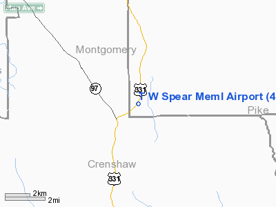
T W Spear Memorial Airport |
Location
& QuickFacts
|
FAA Information Effective: |
2007-01-18 |
|
Airport
Identifier: |
4AL9 |
|
Airport
Status: |
Operational |
|
Longitude/Latitude: |
086-17-38.0000W/31-58-29.0000N
-86.293889/31.974722 (Estimated) |
|
Elevation: |
438 ft / 133.50 m (Estimated) |
|
Land: |
115 acres |
|
From
nearest city: |
1 nautical miles N of Lapine, AL |
|
Location: |
Montgomery County, AL |
|
Magnetic Variation: |
01W (1995) |
Owner
& Manager
|
Ownership: |
Privately owned |
|
Owner: |
Art Persky |
|
Address: |
228 Merritt Hay Road
Lapine, AL 36046 |
|
Phone
number: |
334-537-9648 |
|
Manager: |
Art Persky |
|
Address: |
228 Merritt Hay Road
Lapine, AL 36046 |
|
Phone number: |
334-537-9648 |
Airport
Operations and Facilities
|
Airport Use: |
Private |
|
Wind indicator: |
Yes |
|
Segmented Circle: |
No |
|
Control Tower: |
No |
|
Landing fee charge: |
Yes |
|
Sectional chart: |
New Orleans |
|
Region: |
ASO - Southern |
|
Boundary ARTCC: |
ZTL - Atlanta |
|
Tie-in FSS: |
ANB - Anniston |
|
FSS on Airport: |
No |
|
FSS Toll Free: |
1-800-WX-BRIEF |
Airport
Services
|
Runway Information
Runway 04/22
|
Dimension: |
2909 x 30 ft / 886.7 x 9.1 m |
|
Surface: |
ASPH, Poor Condition
UNEVEN SFC WITH NUMEROUS DEPRESSIONS & STANDING WATER AFTER
RAIN. |
|
|
Runway 04 |
Runway 22 |
|
Traffic
Pattern: |
Left |
Left |
|
Displaced
threshold: |
0.00 ft |
150.00
ft |
|
Obstruction: |
80 ft trees, 1200.0 ft from runway, 5:1 slope
to clear |
76 ft trees, 352.0 ft from runway, 2:1 slope
to clear |
|
Radio Navigation
Aids
|
ID |
Type |
Name |
Ch |
Freq |
Var |
Dist |
|
TO |
NDB |
Blood |
|
365.00 |
01W |
13.0 nm |
|
PRN |
NDB |
Persimmon/dcmsnd |
|
359.00 |
00E |
18.0 nm |
|
XNE |
NDB |
Spring Hill |
|
281.00 |
00E |
23.9 nm |
|
XBR |
NDB |
Brantley |
|
410.00 |
00E |
24.8 nm |
|
SE |
NDB |
Pollk |
|
344.00 |
01W |
36.8 nm |
|
JUY |
NDB |
Judd |
|
264.00 |
02W |
40.6 nm |
|
BVG |
NDB |
Boll Weevil |
|
352.00 |
03E |
41.5 nm |
|
LOR |
NDB |
Lowe |
|
269.00 |
03W |
46.4 nm |
|
HYE |
NDB |
Hanchey |
|
221.00 |
00E |
49.2 nm |
|
MXF |
TACAN |
Maxwell |
097X |
|
03E |
24.6 nm |
|
UIA |
VOR |
Andalusia |
|
110.20 |
00E |
40.3 nm |
|
EDN |
VOR |
Enterprise |
|
116.60 |
03W |
45.4 nm |
|
HEY |
VOR |
Hanchey |
|
110.60 |
02E |
48.8 nm |
|
JYU |
VOR/DME |
Junior |
083X |
113.60 |
01W |
41.9 nm |
|
TGE |
VOR/DME |
Tuskegee |
120X |
117.30 |
02E |
44.1 nm |
|
MGM |
VORTAC |
Montgomery |
058X |
112.10 |
03E |
14.9 nm |
Remarks
- PRVDD
ALL APCH/DEPS ON RY 04/22; RYS ARE MARKED PER AC 150/5340-1; WIND INDICATOR
IS MAINTAINED; DSPLCD THLD PROPERLY MKD; AND ALL POWERLINES/PHONE LINES
ARE MKD PER AC 70/7460-1.
Based
Aircraft
|
Aircraft
based on field: |
6 |
|
Single
Engine Airplanes: |
3 |
|
Multi
Engine Airplanes: |
2 |
|
Ultralights: |
1 |
T W Spear Memorial
Airport
Address:
Montgomery County, AL
Tel:
334-537-9648
Images
and information placed above are from
http://www.airport-data.com/airport/4AL9/
We
thank them for the data!
| General
Info |
| Country |
United
States |
| State |
ALABAMA
|
| FAA ID |
4AL9
|
| Latitude |
31-58-29.000N
|
| Longitude |
086-17-38.000W
|
| Elevation |
438 feet
|
| Near City |
LAPINE
|
We don't guarantee the information is fresh and accurate. The data may
be wrong or outdated.
For more up-to-date information please refer to other sources.
|
|


