 |
|
|
|
|
|
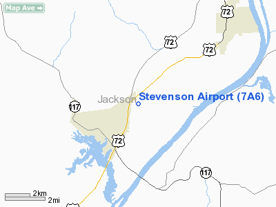
Location
& QuickFacts
|
FAA Information Effective: |
2007-01-18 |
|
Airport
Identifier: |
7A6 |
|
Airport
Status: |
Operational |
|
Longitude/Latitude: |
085-48-11.8400W/34-53-10.5950N
-85.803289/34.886276 (Estimated) |
|
Elevation: |
644 ft / 196.29 m (Estimated) |
|
Land: |
86
acres |
|
From
nearest city: |
2 nautical miles NE of Stevenson, AL |
|
Location: |
Jackson County, AL |
|
Magnetic Variation: |
01W (1985) |
Owner
& Manager
|
Ownership: |
Publicly owned |
|
Owner: |
City Of Stevenson |
|
Address: |
104 Kentucky Ave
Stevenson, AL 35772 |
|
Phone number: |
205-437-3000 |
|
Manager: |
Jerry Comeaux |
|
Address: |
614 Co Rd 283
Stevenson, AL 35772 |
|
Phone number: |
205-437-2269
OR 437-2257. |
Airport
Operations and Facilities
|
Airport Use: |
Open to public |
|
Wind
indicator: |
Yes |
|
Segmented
Circle: |
No |
|
Control
Tower: |
No |
|
Lighting
Schedule: |
DUSK-DAWN
ACTVT MIRL RY 05/23 - CTAF. |
|
Beacon
Color: |
Clear-Green (lighted land airport) |
|
Landing
fee charge: |
No |
|
Sectional
chart: |
Atlanta |
|
Region: |
ASO - Southern |
|
Boundary
ARTCC: |
ZME - Memphis |
|
Responsible
ARTCC: |
ZTL - Atlanta |
|
Tie-in
FSS: |
ANB - Anniston |
|
FSS
on Airport: |
No |
|
FSS
Toll Free: |
1-800-WX-BRIEF |
|
NOTAMs
Facility: |
ANB (NOTAM-d service avaliable) |
Airport
Communications
|
CTAF: |
122.800 |
|
Unicom: |
122.800 |
Airport
Services
|
Fuel available: |
100LL |
|
Airframe Repair: |
MAJOR |
|
Power Plant Repair: |
MAJOR |
|
Bottled
Oxygen: |
LOW |
|
Bulk
Oxygen: |
NONE |
|
Runway Information
Runway 05/23
|
Dimension: |
4103 x 80 ft / 1250.6 x 24.4 m |
|
Surface: |
ASPH, Good Condition |
|
Weight
Limit: |
Single wheel: 15000 lbs. |
|
Edge
Lights: |
Non-standard lighting system
NSTD MIRL; FIRST 50 FT RY 05 NOT LGTD. |
|
|
Runway 05 |
Runway 23 |
|
Longitude: |
085-48-30.5200W |
085-47-53.1600W |
|
Latitude: |
34-52-57.3700N |
34-53-23.8200N |
|
Elevation: |
622.00
ft |
644.00
ft |
|
Alignment: |
49 |
127 |
|
Traffic
Pattern: |
Right |
Left |
|
Markings: |
Nonstandard, Good Condition
RY 05/23 NRS LCTD ON APCH SIDE OF DSPLCD THLDS. |
Nonstandard, Good Condition |
|
Displaced
threshold: |
257.00
ft |
1048.00
ft |
|
Obstruction: |
62 ft trees, 883.0 ft from runway, 11:1 slope
to clear
RY 05 APCH RATIO 18:1 FROM DSPLCD THLD. |
94 ft trees, 838.0 ft from runway, 147 ft left
of centerline, 6:1 slope to clear
RY 23 APCH RATIO 20:1 FROM DSPLCD THLD. |
|
Radio Navigation
Aids
|
ID |
Type |
Name |
Ch |
Freq |
Var |
Dist |
|
SYI |
FAN MARKER |
Bomar |
|
|
01W |
48.5 nm |
|
APT |
NDB |
Jasper |
|
382.00 |
02W |
15.0 nm |
|
UOS |
NDB |
Sewanee |
|
275.00 |
02E |
19.6 nm |
|
BGF |
NDB |
Boiling Fork |
|
263.00 |
02W |
21.9 nm |
|
FTP |
NDB |
Fort Payne |
|
426.00 |
01W |
22.9 nm |
|
CQN |
NDB |
Daisy |
|
341.00 |
02W |
36.0 nm |
|
TNY |
NDB |
Kelso |
|
358.00 |
01W |
39.3 nm |
|
ULH |
NDB |
Burwi |
|
332.00 |
03W |
40.7 nm |
|
UWI |
NDB |
Whitfield |
|
400.00 |
03W |
42.7 nm |
|
ARF |
NDB |
Saratoga |
|
296.00 |
02W |
43.4 nm |
|
HUA |
NDB |
Redstone |
|
287.00 |
00W |
45.1 nm |
|
HDI |
NDB |
Hardwick |
|
369.00 |
01W |
47.0 nm |
|
OYD |
NDB |
Floyd |
|
388.00 |
02W |
47.4 nm |
|
CWH |
NDB |
Capshaw |
|
350.00 |
01W |
48.6 nm |
|
UXM |
VOR |
Tullahoma Regional |
|
109.65 |
03W |
36.8 nm |
|
GQO |
VORTAC |
Choo Choo |
105X |
115.80 |
01E |
32.3 nm |
|
RQZ |
VORTAC |
Rocket |
059X |
112.20 |
02E |
41.3 nm |
|
HSV |
VOT |
Huntsville |
|
111.00 |
|
48.1 nm |
Remarks
- ARPT
CLSD NIGHTS.
- VFR
USE ONLY
Based
Aircraft
|
Aircraft
based on field: |
4 |
|
Single
Engine Airplanes: |
4 |
Operational Statistics
Time Period: 1999-05-18
- 2000-05-16
|
Aircraft
Operations: |
124/Week |
|
General
Aviation Local: |
7.8% |
|
General
Aviation Itinerant: |
90.7% |
|
Military: |
1.6% |
Stevenson Airport
Address:
Jackson County, AL
Tel:
205-437-3000, 205-437-2269
Images
and information placed above are from
http://www.airport-data.com/airport/7A6/
We
thank them for the data!
| General
Info |
| Country |
United
States |
| State |
ALABAMA
|
| FAA ID |
7A6
|
| Latitude |
34-53-10.595N
|
| Longitude |
085-48-11.840W
|
| Elevation |
644 feet
|
| Near City |
STEVENSON
|
We don't guarantee the information is fresh and accurate. The data may
be wrong or outdated.
For more up-to-date information please refer to other sources.
|
|


