 |
|
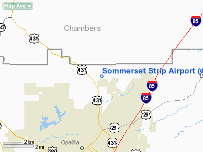
Location
& QuickFacts
|
FAA Information Effective: |
2007-01-18 |
|
Airport
Identifier: |
AL89 |
|
Airport
Status: |
Operational |
|
Longitude/Latitude: |
085-22-00.8050W/32-43-07.4730N
-85.366890/32.718742 (Estimated) |
|
Elevation: |
820 ft / 249.94 m (Estimated) |
|
Land: |
25
acres |
|
From
nearest city: |
5 nautical miles N of Opelika, AL |
|
Location: |
Lee County, AL |
|
Magnetic Variation: |
01W (1985) |
Owner
& Manager
|
Ownership: |
Privately owned |
|
Owner: |
J. B. Stokley |
|
Address: |
P.o. Box 430
Opelika, AL 36803 |
|
Phone
number: |
205-745-3532 |
|
Manager: |
J. B. Stokley |
|
Address: |
P.o. Box 430
Opelika, AL 36803 |
|
Phone number: |
205-745-3532 |
Airport
Operations and Facilities
|
Airport Use: |
Private |
|
Wind indicator: |
Yes |
|
Segmented Circle: |
No |
|
Control Tower: |
No |
|
Sectional chart: |
Atlanta |
|
Region: |
ASO - Southern |
|
Boundary ARTCC: |
ZTL - Atlanta |
|
Tie-in FSS: |
ANB - Anniston |
|
FSS on Airport: |
No |
|
FSS Toll Free: |
1-800-WX-BRIEF |
Airport
Services
|
Runway Information
Runway 07/25
|
Dimension: |
2250 x 100 ft / 685.8 x 30.5 m |
|
Surface: |
TURF, |
|
|
Runway 07 |
Runway 25 |
|
Traffic
Pattern: |
Left |
Left |
|
Displaced
threshold: |
250.00
ft |
300.00
ft |
|
Obstruction: |
, 300.0 ft from runway |
60 ft trees, 200.0 ft from runway |
|
Radio Navigation
Aids
|
ID |
Type |
Name |
Ch |
Freq |
Var |
Dist |
|
PIM |
NDB |
Pine Mountain |
|
272.00 |
03W |
26.1 nm |
|
AWS |
NDB |
Lawson |
|
335.00 |
02W |
30.9 nm |
|
DER |
NDB |
Alexander City |
|
382.00 |
01W |
31.5 nm |
|
EQQ |
NDB |
Coweta County |
|
234.00 |
03W |
46.2 nm |
|
TGE |
VOR/DME |
Tuskegee |
120X |
117.30 |
02E |
20.8 nm |
|
LSF |
VOR/DME |
Lawson |
051X |
111.40 |
02W |
30.0 nm |
|
CSG |
VORTAC |
Columbus |
118X |
117.10 |
01E |
18.7 nm |
|
LGC |
VORTAC |
Lagrange |
103X |
115.60 |
01E |
21.4 nm |
|
EUF |
VORTAC |
Eufaula |
029X |
109.20 |
02E |
47.7 nm |
Remarks
- PRVDD
USED PRIVATELY ONLY; ROAD WEST REQUIRES THR TO RY 07 300 FT FM ROAD
FOR A 20:1 CLEARANCE.
Based
Aircraft
|
Aircraft
based on field: |
2 |
|
Single
Engine Airplanes: |
2 |
Sommerset Strip Airport
Address:
Lee County, AL
Tel:
205-745-3532
Images
and information placed above are from
http://www.airport-data.com/airport/AL89/
We
thank them for the data!
| General
Info |
| Country |
United
States |
| State |
ALABAMA
|
| FAA ID |
AL89
|
| Latitude |
32-43-07.473N
|
| Longitude |
085-22-00.805W
|
| Elevation |
820 feet
|
| Near City |
OPELIKA
|
We don't guarantee the information is fresh and accurate. The data may
be wrong or outdated.
For more up-to-date information please refer to other sources.
|
|


