 |
|
|
|
|
|
Location
& QuickFacts
|
FAA
Information Effective: |
2007-01-18 |
|
Airport
Identifier: |
S26 |
|
Airport
Status: |
Operational |
|
Longitude/Latitude: |
088-22-19.0400W/30-41-00.6880N
-88.371956/30.683524 (Estimated) |
|
Elevation: |
150
ft / 45.72 m (Estimated) |
|
Land: |
15
acres |
|
From
nearest city: |
18 nautical miles W of Mobile, AL |
|
Location: |
Mobile County, AL |
|
Magnetic Variation: |
01E (1990) |
Owner
& Manager
|
Ownership: |
Privately owned |
|
Owner: |
Anthony & Barbara Williams |
|
Address: |
13721 Frank Williams Rd
Mobile, AL 36608 |
|
Phone
number: |
334-649-5033 |
|
Manager: |
Anthony & Barbara Williams |
|
Address: |
13721 Frank Williams Rd
Mobile, AL 36608 |
|
Phone number: |
334-649-5033 |
Airport
Operations and Facilities
|
Airport Use: |
Open to public |
|
Wind
indicator: |
Yes |
|
Segmented
Circle: |
No |
|
Control
Tower: |
No |
|
Lighting
Schedule: |
DUSK-0000
FOR LIRL RY 11/29 AFTER 0000 CALL 334-649-5033. |
|
Sectional
chart: |
New Orleans |
|
Region: |
ASO - Southern |
|
Boundary
ARTCC: |
ZHU - Houston |
|
Tie-in
FSS: |
ANB - Anniston |
|
FSS
on Airport: |
No |
|
FSS
Toll Free: |
1-800-WX-BRIEF |
|
NOTAMs
Facility: |
ANB (NOTAM-d service avaliable) |
Airport
Communications
|
Runway Information
Runway 11/29
|
Dimension: |
2467 x 110 ft / 751.9 x 33.5 m |
|
Surface: |
TURF, Good Condition |
|
Edge
Lights: |
Low |
|
|
Runway 11 |
Runway 29 |
|
Traffic
Pattern: |
Left |
Left |
|
Obstruction: |
29 ft pole, 681.0 ft from runway, 3 ft left
of centerline, 23:1 slope to clear |
24 ft tree, 400.0 ft from runway, 125 ft left
of centerline, 16:1 slope to clear |
|
Radio Navigation
Aids
|
ID |
Type |
Name |
Ch |
Freq |
Var |
Dist |
|
MO |
NDB |
Wisle |
|
248.00 |
02E |
5.8 nm |
|
ESU |
NDB |
Summerdale |
|
204.00 |
01E |
35.2 nm |
|
BIX |
TACAN |
Keesler |
055X |
|
01E |
33.3 nm |
|
GPT |
VOR/DME |
Gulfport |
27X |
109.00 |
02E |
40.1 nm |
|
SJI |
VORTAC |
Semmes |
100X |
115.30 |
05E |
2.6 nm |
|
BFM |
VORTAC |
Brookley |
075X |
112.80 |
04E |
16.9 nm |
|
GCV |
VORTAC |
Greene County |
104X |
115.70 |
05E |
25.6 nm |
Remarks
Based
Aircraft
|
Aircraft
based on field: |
4 |
|
Single
Engine Airplanes: |
4 |
Operational Statistics
Time Period: 1998-01-26
- 1999-01-25
|
Aircraft
Operations: |
16/Week |
|
General
Aviation Local: |
41.0% |
|
General
Aviation Itinerant: |
59.0% |
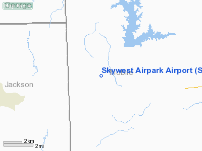
Skywest Airpark Airport
Address:
Mobile County, AL
Tel:
334-649-5033
Images
and information placed above are from
http://www.airport-data.com/airport/S26/
We
thank them for the data!
| General
Info |
| Country |
United
States |
| State |
ALABAMA
|
| FAA ID |
S26
|
| Latitude |
30-41-00.688N
|
| Longitude |
088-22-19.040W
|
| Elevation |
150 feet
|
| Near City |
MOBILE
|
We don't guarantee the information is fresh and accurate. The data may
be wrong or outdated.
For more up-to-date information please refer to other sources.
|
|


