 |
|
|
|
|
|
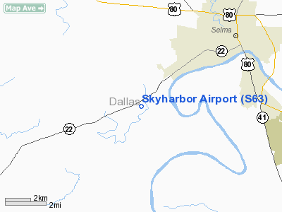
Location
& QuickFacts
|
FAA Information Effective: |
2007-01-18 |
|
Airport
Identifier: |
S63 |
|
Airport
Status: |
Operational |
|
Longitude/Latitude: |
087-06-14.9670W/32-22-00.4950N
-87.104157/32.366804 (Estimated) |
|
Elevation: |
125 ft / 38.10 m (Estimated) |
|
Land: |
70
acres |
|
From
nearest city: |
5 nautical miles SW of Selma, AL |
|
Location: |
Dallas County, AL |
|
Magnetic Variation: |
00E (1985) |
Owner
& Manager
|
Ownership: |
Privately owned |
|
Owner: |
Jacob L. Jewell |
|
Address: |
2301 W. Dallas Ave
Selma, AL 36701 |
|
Phone
number: |
334-872-0431 |
|
Manager: |
Jacob L. Jewell |
|
Address: |
5005 Al Hwy 22w
Selma, AL 36701 |
|
Phone number: |
334-872-0431 |
Airport
Operations and Facilities
|
Airport Use: |
Open to public |
|
Wind
indicator: |
Yes |
|
Segmented
Circle: |
No |
|
Control
Tower: |
No |
|
Landing
fee charge: |
No |
|
Sectional
chart: |
Atlanta |
|
Region: |
ASO - Southern |
|
Boundary
ARTCC: |
ZTL - Atlanta |
|
Tie-in
FSS: |
ANB - Anniston |
|
FSS
on Airport: |
No |
|
FSS
Toll Free: |
1-800-WX-BRIEF |
|
NOTAMs
Facility: |
ANB (NOTAM-d service avaliable) |
Airport
Communications
Airport
Services
|
Fuel available: |
100LL |
|
Airframe Repair: |
MINOR |
|
Power Plant Repair: |
MINOR |
|
Bottled
Oxygen: |
NONE |
|
Bulk
Oxygen: |
NONE |
|
Runway Information
Runway 06/24
|
Dimension: |
2500 x 170 ft / 762.0 x 51.8 m |
|
Surface: |
TURF, Good Condition |
|
Edge
Lights: |
Non-standard lighting system
NSTD LIRL; NO THLD LGTS. |
|
|
Runway 06 |
Runway 24 |
|
Traffic
Pattern: |
Left |
Left |
|
Runway
End Identifier: |
No |
No |
|
Centerline
Lights: |
No |
No |
|
Touchdown
Lights: |
No |
No |
|
Obstruction: |
75 ft tree, 1350.0 ft from runway, 18:1 slope
to clear |
70 ft tree, 570.0 ft from runway, 120 ft right
of centerline, 8:1 slope to clear |
|
Radio Navigation
Aids
|
ID |
Type |
Name |
Ch |
Freq |
Var |
Dist |
|
SE |
NDB |
Pollk |
|
344.00 |
01W |
10.7 nm |
|
EOG |
NDB |
Greensboro |
|
417.00 |
01E |
31.7 nm |
|
GGY |
NDB |
Gragg-wade |
|
338.00 |
01E |
38.4 nm |
|
PRN |
NDB |
Persimmon/dcmsnd |
|
359.00 |
00E |
39.8 nm |
|
RZO |
NDB |
Marengo |
|
391.00 |
01E |
46.3 nm |
|
MXF |
TACAN |
Maxwell |
097X |
|
03E |
37.4 nm |
|
JYU |
VOR/DME |
Junior |
083X |
113.60 |
01W |
5.9 nm |
|
MGM |
VORTAC |
Montgomery |
058X |
112.10 |
03E |
40.8 nm |
Remarks
Based Aircraft
|
Aircraft
based on field: |
14 |
|
Single
Engine Airplanes: |
13 |
|
Multi
Engine Airplanes: |
1 |
Operational Statistics
Time Period: 1995-09-21
- 1996-09-19
|
Aircraft
Operations: |
130/Week |
|
General
Aviation Local: |
15.0% |
|
General
Aviation Itinerant: |
85.0% |
Skyharbor Airport
Address:
Dallas County, AL
Tel:
334-872-0431
Images
and information placed above are from
http://www.airport-data.com/airport/S63/
We
thank them for the data!
| General
Info |
| Country |
United
States |
| State |
ALABAMA
|
| FAA ID |
S63
|
| Latitude |
32-22-00.495N
|
| Longitude |
087-06-14.967W
|
| Elevation |
125 feet
|
| Near City |
SELMA
|
We don't guarantee the information is fresh and accurate. The data may
be wrong or outdated.
For more up-to-date information please refer to other sources.
|
|


