 |
|
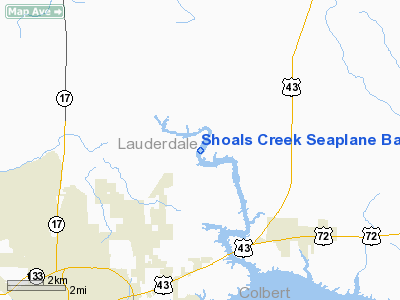
Shoals Creek Seaplane Base |
Location
& QuickFacts
|
FAA Information Effective: |
2007-01-18 |
|
Airport
Identifier: |
AL46 |
|
Airport
Status: |
Operational |
|
Longitude/Latitude: |
087-35-14.0920W/34-54-09.3060N
-87.587248/34.902585 (Estimated) |
|
Elevation: |
510 ft / 155.45 m (Estimated) |
|
Land: |
0
acres |
|
From
nearest city: |
8 nautical miles SW of Florence, AL |
|
Location: |
Lauderdale County, AL |
|
Magnetic Variation: |
00E (1985) |
Owner
& Manager
|
Ownership: |
Privately owned |
|
Owner: |
Dennis Odem |
|
Address: |
Route 1, Box 44
Florence, AL 35630 |
|
Phone number: |
205-767-0096 |
|
Manager: |
Dennis Odem |
|
Address: |
Route 1, Box 44
Florence, AL 35630 |
|
Phone number: |
205-767-0096
ADDNL PHONE 205-757-1902 |
Airport
Operations and Facilities
|
Airport Use: |
Private |
|
Wind indicator: |
Yes |
|
Segmented Circle: |
No |
|
Control Tower: |
No |
|
Landing fee charge: |
No |
|
Sectional chart: |
Atlanta |
|
Region: |
ASO - Southern |
|
Boundary ARTCC: |
ZME - Memphis |
|
Tie-in FSS: |
ANB - Anniston |
|
FSS on Airport: |
No |
|
FSS Toll Free: |
1-800-WX-BRIEF |
Airport
Services
|
Runway Information
Runway 02W/20W
|
Dimension: |
6200 x 1200 ft / 1889.8 x 365.8 m |
|
Surface: |
WATER, |
|
|
Runway 02W |
Runway 20W |
|
Traffic
Pattern: |
Left |
Left |
|
Runway 08W/26W
|
Dimension: |
6500 x 1000 ft / 1981.2 x 304.8 m |
|
Surface: |
WATER, |
|
|
Runway 08W |
Runway 26W |
|
Traffic
Pattern: |
Left |
Left |
|
Runway 17W/35W
|
Dimension: |
11000 x 1100 ft / 3352.8 x 335.3 m |
|
Surface: |
WATER, |
|
|
Runway 17W |
Runway 35W |
|
Traffic
Pattern: |
Left |
Left |
|
Radio Navigation
Aids
|
ID |
Type |
Name |
Ch |
Freq |
Var |
Dist |
|
LRT |
NDB |
Lawrenceburg |
|
269.00 |
00E |
25.7 nm |
|
GZS |
NDB |
Giles/dcmsnd |
|
375.00 |
00E |
30.0 nm |
|
JHG |
NDB |
Hohenwald |
|
257.00 |
01W |
33.7 nm |
|
HHY |
NDB |
Pinhook |
|
346.00 |
01W |
37.0 nm |
|
CWH |
NDB |
Capshaw |
|
350.00 |
01W |
40.6 nm |
|
HUA |
NDB |
Redstone |
|
287.00 |
00W |
46.0 nm |
|
PBC |
NDB |
Maury County |
|
365.00 |
01W |
48.9 nm |
|
CPP |
NDB |
Cole Spring |
|
230.00 |
01W |
49.6 nm |
|
SZY |
NDB |
Sibley |
|
386.00 |
01E |
49.9 nm |
|
DCU |
VOR/DME |
Decatur |
075X |
112.80 |
01W |
35.4 nm |
|
MSL |
VORTAC |
Muscle Shoals |
112X |
116.50 |
01E |
12.7 nm |
|
HAB |
VORTAC |
Hamilton |
041X |
110.40 |
02E |
47.5 nm |
|
RQZ |
VORTAC |
Rocket |
059X |
112.20 |
02E |
47.5 nm |
|
HSV |
VOT |
Huntsville |
|
111.00 |
|
40.4 nm |
Remarks
- USE
CAUTION; MAY BE BOATS IN THE AREA.
- VFR,
PVT USE ONLY.
Based
Aircraft
|
Aircraft
based on field: |
3 |
|
Single
Engine Airplanes: |
1 |
|
Helicopters: |
2 |
Shoals Creek Seaplane Base
Address:
Lauderdale County, AL
Tel:
205-767-0096
Images
and information placed above are from
http://www.airport-data.com/airport/AL46/
We
thank them for the data!
| General
Info |
| Country |
United
States |
| State |
ALABAMA
|
| FAA ID |
AL46
|
| Latitude |
34-54-09.306N
|
| Longitude |
087-35-14.092W
|
| Elevation |
510 feet
|
| Near City |
FLORENCE
|
We don't guarantee the information is fresh and accurate. The data may
be wrong or outdated.
For more up-to-date information please refer to other sources.
|
|


