 |
|
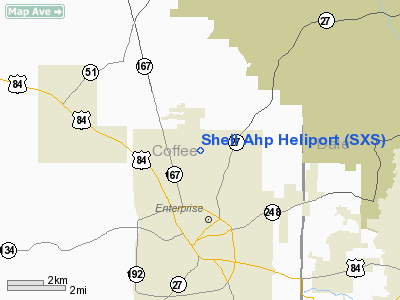
Location
& QuickFacts
|
FAA Information Effective: |
2007-01-18 |
|
Airport
Identifier: |
SXS |
|
Airport
Status: |
Operational |
|
Longitude/Latitude: |
085-50-57.7800W/31-21-45.6100N
-85.849383/31.362669 (Estimated) |
|
Elevation: |
400 ft / 121.92 m (Estimated) |
|
Land: |
0
acres |
|
From
nearest city: |
0 nautical miles N of Fort Rucker, AL |
|
Location: |
Dale County, AL |
|
Magnetic Variation: |
01W (1985) |
Owner
& Manager
|
Ownership: |
Army owned |
|
Owner: |
Us Army Atca - Aso |
|
Address: |
9325 Gunston Road
Ft Belvoir, VA 22060 |
|
Phone number: |
205-255-2314 |
|
Address: |
|
Airport
Operations and Facilities
|
Airport Use: |
Private |
|
Segmented Circle: |
No |
|
Control Tower: |
Yes |
|
Sectional chart: |
New Orleans |
|
Region: |
ASO - Southern |
|
Boundary ARTCC: |
ZJX - Jacksonville |
|
Tie-in FSS: |
OZR - Cairns Baseops |
|
FSS Phone: |
205-255-2314 |
|
NOTAMs Facility: |
OZR |
Airport
Communications
|
Runway Information
Helipad H1
|
Dimension: |
2000 x 60 ft / 609.6 x 18.3 m |
|
Surface: |
ASPH, |
|
|
Runway H1 |
Runway |
|
Traffic
Pattern: |
Left |
Left |
|
Helipad H2
|
Dimension: |
1300 x 60 ft / 396.2 x 18.3 m |
|
Surface: |
ASPH, |
|
|
Runway H2 |
Runway |
|
Traffic
Pattern: |
Left |
Left |
|
Helipad H3
|
Dimension: |
2000 x 60 ft / 609.6 x 18.3 m |
|
Surface: |
ASPH, |
|
|
Runway H3 |
Runway |
|
Traffic
Pattern: |
Left |
Left |
|
Helipad H4
|
Dimension: |
1620 x 75 ft / 493.8 x 22.9 m |
|
Surface: |
ASPH, |
|
|
Runway H4 |
Runway |
|
Traffic
Pattern: |
Left |
Left |
|
Helipad H5
|
Dimension: |
1000 x 60 ft / 304.8 x 18.3 m |
|
Surface: |
ASPH, |
|
|
Runway H5 |
Runway |
|
Traffic
Pattern: |
Left |
Left |
|
Helipad HA
|
Dimension: |
1300 x 50 ft / 396.2 x 15.2 m |
|
Surface: |
ASPH, |
|
|
Runway HA |
Runway |
|
Traffic
Pattern: |
Left |
Left |
|
Helipad HB
|
Dimension: |
1300 x 50 ft / 396.2 x 15.2 m |
|
Surface: |
ASPH, |
|
|
Runway HB |
Runway |
|
Traffic
Pattern: |
Left |
Left |
|
Helipad HC
|
Dimension: |
1300 x 50 ft / 396.2 x 15.2 m |
|
Surface: |
ASPH, |
|
|
Runway HC |
Runway |
|
Traffic
Pattern: |
Left |
Left |
|
Radio Navigation
Aids
|
ID |
Type |
Name |
Ch |
Freq |
Var |
Dist |
|
LOR |
NDB |
Lowe |
|
269.00 |
03W |
5.4 nm |
|
BVG |
NDB |
Boll Weevil |
|
352.00 |
03E |
7.0 nm |
|
OZ |
NDB |
Ruckr |
|
212.00 |
00E |
8.4 nm |
|
HYE |
NDB |
Hanchey |
|
221.00 |
00E |
10.2 nm |
|
XNE |
NDB |
Spring Hill |
|
281.00 |
00E |
20.4 nm |
|
XBR |
NDB |
Brantley |
|
410.00 |
00E |
25.7 nm |
|
JUY |
NDB |
Judd |
|
264.00 |
02W |
28.0 nm |
|
TO |
NDB |
Blood |
|
365.00 |
01W |
31.0 nm |
|
BKK |
NDB |
Tri County |
|
275.00 |
02W |
33.3 nm |
|
SMY |
NDB |
Soyya |
|
329.00 |
02W |
43.6 nm |
|
PRN |
NDB |
Persimmon/dcmsnd |
|
359.00 |
00E |
48.9 nm |
|
EDN |
VOR |
Enterprise |
|
116.60 |
03W |
4.9 nm |
|
HEY |
VOR |
Hanchey |
|
110.60 |
02E |
10.1 nm |
|
UIA |
VOR |
Andalusia |
|
110.20 |
00E |
28.0 nm |
|
FYL |
VOR |
Tri County |
|
108.40 |
08W |
33.7 nm |
|
OZR |
VOR/DME |
Cairns |
049X |
111.20 |
02E |
8.5 nm |
|
RRS |
VORTAC |
Wiregrass |
053X |
111.60 |
02E |
22.0 nm |
Remarks
- EXTENSIVE
COPTER STU TNG IN PROGRESS.
- RYS
H-A/B &1 CLSD FOR BASE ACFT PARKING.
Shell Ahp Heliport
Address:
Dale County, AL
Tel:
205-255-2314
Images
and information placed above are from
http://www.airport-data.com/airport/SXS/
We
thank them for the data!
| General
Info |
| Country |
United
States |
| State |
ALABAMA
|
| FAA ID |
SXS
|
| Latitude |
31-21-45.610N
|
| Longitude |
085-50-57.780W
|
| Elevation |
400 feet
|
| Near City |
FORT RUCKER
|
We don't guarantee the information is fresh and accurate. The data may
be wrong or outdated.
For more up-to-date information please refer to other sources.
|
|


