|
 |
|
||||
|
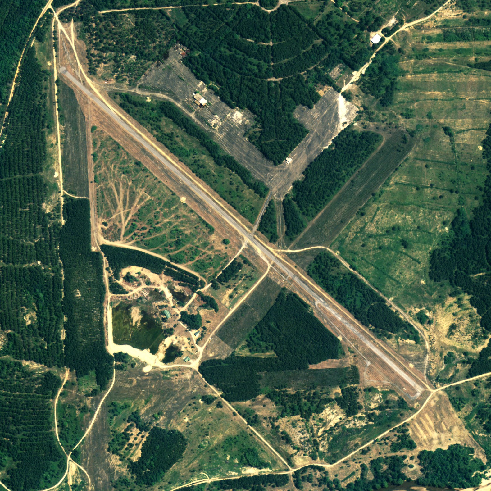
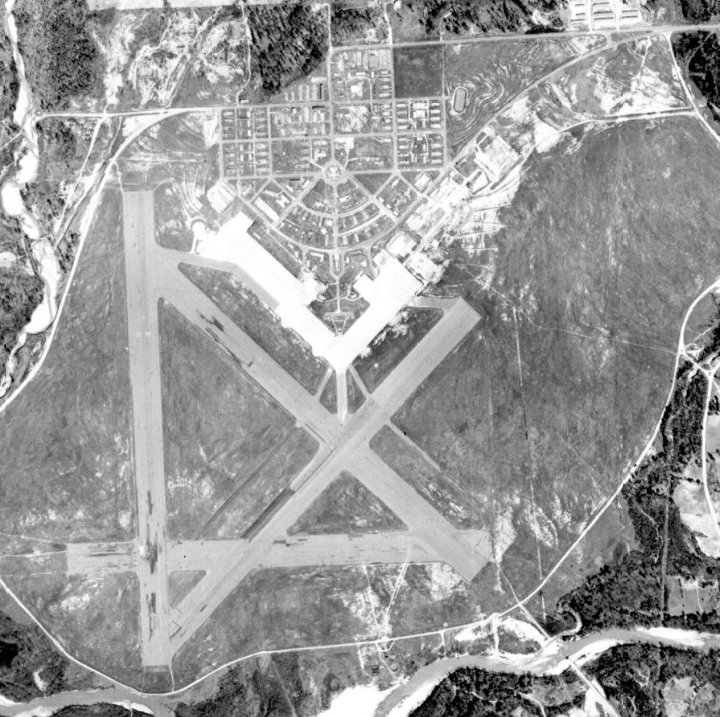
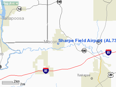
Sharpe Field (FAA LID: AL73) is a private use airport located six nautical miles (11 km) northwest of the central business district of Tuskegee, a city in Macon County, Alabama, United States. This airport is privately owned by the Bradbury Family Partnership. Formerly known as Tuskegee Army Airfield, Sharpe Field was to used train the Tuskegee Airmen during World War II. It provided advanced training for the graduates of nearby Moton Field. Most of the history of the Tuskegee Airmen was made at this site. HistoryThe Air Field was designed by the African American architect Hilyard Robinson and built in 1941. Construction began on July 12, 1941. Training flights began in November of the same year, even though construction was nowhere near completion. A graded (but not yet paved) portion of the north/south runway was used to conduct initial flight training. The earliest depiction of the Tuskegee AAF airfield which has been located was on the August 1942 14M Regional Aeronautical Chart (courtesy of Chris Kennedy). It depicted “Tuskegee” as a commercial or municipal airport. Tuskegee AAF was assigned to the Southeast Training Center of the Army Air Force Training Command. It was commanded by the 318th Army Air Force Base Unit. By the end of 1942, Tuskegee had a total of 3,414 personnel. The March 1943 14M Regional Aeronautical Chart labeled the airfield as “Tuskegee Army Flying School”, and indicated that the field had a control tower. By September 1943, Tuskegee had 4 runways & a total of 225 buildings. Aircraft used at Tuskegee during WW2 included the PT-17 biplane basic trainer, BT-13 monoplane advanced trainer, AT-6 Texan advanced trainer, and P-40 Warhawk (used for fighter transition training). Twin-engine training commenced at Tuskegee in 1943, at first using the AT-10. The 1944 US Army/Navy Directory of Airfields described Tuskegee AAF as having a 5,000' hard-surface runway As constructed during WW2, Tuskegee AAF consisted of 4 asphalt runways (the longest being 5,200'), taxiways, a ramp, and a large number of buildings north of the field During WW2, Tuskegee AAF had 2 satellite airfields: Griel Auxiliary #1, and Shorter Auxiliary #2 (still in use today as Shorter Airport). These 2 auxiliary airfield were not depicted on the November 1944 Birmingham Sectional Chart but they did appear on the April 1945 Birmingham Sectional Chart. The 1945 Birmingham Sectional Chart also depicted a "Tuskegee Institute #1" airfield, a few miles southeast of the town of Tuskegee, but no trace has been identified of this airfield on recent aerial photos. The AT-10 twin-engine trainer was replaced at Tuskegee by the TB-25 Mitchell in 1945. The last pilot class graduated at Tuskegee in 1946, bringing the total number of pilots trained at the base to 992. Tuskegee AAF was inactivated in 1946, and the property reverted back to the town of Tuskegee. Many of the base's buildings were moved into the town, and 2 of the hangars were relocated. Although the 1962 Birmingham Sectional Chart depicted Sharpe Field as having 4 paved runways (with the longest being 5,000'), the Aerodromes table included the remark "North/South only usable runway." Sharpe Field was reopened as a civilian airport at some point between 1945–62, as that is how it was listed in the 1962 AOPA Airport Directory. Sharpe Field was described as having a single 5,000' asphalt Runway 18/36, and the operator was listed as Sharpe Aviation Service The Tuskegee airfield was evidently closed once again at some point between 1965–71, as it was not listed among active airfields in the 1971 Flight Guide. In 1976, an attempt was made to reuse the abandoned base as an oil refinery, but this did not work out. It was depicted as an abandoned airfield on the 1998 World Aeronautical Chart. The site of Tuskegee AAF was purchased by the Bradbury Family Partnership in the year 2000 time frame. It is strictly a private development, however, in 2003 that Sharpe Field was once again listed as an active private airfield. Only one runway was listed as being active, the 5,300' asphalt Runway 14/32. The owner was listed as the Bradbury Family Partnership, of Woodstock, GA. The purpose of the airfield having been reactivated is unknown, although the old ramp area was used as an asphalt plant for a number of years. Some of the equipment can still be seen on the ramp area. FacilitiesSharpe Field covers an area of 2,600 acres (1,052 ha) at an elevation of 253 feet (77 m) above mean sea level. It has one asphalt paved runway designated 14/32 which measures 5,300 by 46 feet (1,615 x 14 m). The above content comes from Wikipedia and is published under free licenses – click here to read more.
Runway InformationRunway 14/32
Radio Navigation Aids
Remarks
Sharpe Field Airport Address: Macon County, AL Tel: 770-928-0092 Images
and information placed above are from We thank them for the data!
We don't guarantee the information is fresh and accurate. The data may
be wrong or outdated.
|
||||||||||||||||||||||||||||||||||||||||||||||||||||||||||||||||||||||||||||||||||||||||||||||||||||||||||||||||||||||||||||||||||||||||||||||||||||||||||||||||||||||||||||||||||||||||||||||||||||||||||||||||||||||||||||||||||||||||||||||||||||||||||||||||||||||||||||||||

 |
|
Copyright 2004-2026 © by Airports-Worldwide.com, Vyshenskoho st. 36, Lviv 79010, Ukraine Legal Disclaimer |