 |
|
|
|
|
|
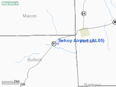
Location
& QuickFacts
|
FAA Information Effective: |
2007-01-18 |
|
Airport
Identifier: |
AL05 |
|
Airport
Status: |
Operational |
|
Longitude/Latitude: |
085-28-04.8010W/32-13-12.5340N
-85.468000/32.220148 (Estimated) |
|
Elevation: |
331 ft / 100.89 m (Estimated) |
|
Land: |
0
acres |
|
From
nearest city: |
3 nautical miles SW of Hurtsboro, AL |
|
Location: |
Bullock County, AL |
|
Magnetic Variation: |
01W (1985) |
Owner
& Manager
|
Ownership: |
Privately owned |
|
Owner: |
Mary Ann Williams |
|
Address: |
6475 Old West Point Road
La Grange, GA 30240 |
|
Phone
number: |
706-884-6398 |
|
Manager: |
Cam Lanier Iv |
|
Address: |
1442 St Mark Church Rd
Hurtsboro, AL 36860 |
|
Phone number: |
334-253-2100 |
Airport
Operations and Facilities
|
Airport Use: |
Private |
|
Wind
indicator: |
Yes |
|
Segmented
Circle: |
Yes |
|
Control
Tower: |
No |
|
Lighting
Schedule: |
PHONE REQ
FOR RWY LGTS & ROTG BCN MON-FRI FROM 0730 TO 1530 CALL
334-253-2100.
AFTER HRS AND WEEKENDS CALL 706-773-3167. |
|
Beacon
Color: |
Clear-Green (lighted land airport) |
|
Sectional chart: |
Atlanta |
|
Region: |
ASO - Southern |
|
Boundary ARTCC: |
ZTL - Atlanta |
|
Tie-in FSS: |
ANB - Anniston |
|
FSS on Airport: |
No |
|
FSS Toll Free: |
1-800-WX-BRIEF |
|
Runway Information
Runway 04/22
|
Dimension: |
5000 x 75 ft / 1524.0 x 22.9 m |
|
Surface: |
ASPH, Good Condition |
|
Edge
Lights: |
Medium |
|
|
Runway 04 |
Runway 22 |
|
Traffic
Pattern: |
Left |
Left |
|
Markings: |
Basic, Good Condition |
Basic, Good Condition |
|
VASI: |
2-box on left side |
2-box on left side |
|
Obstruction: |
52 ft trees, 800.0 ft from runway, 300 ft left
of centerline, 11:1 slope to clear |
57 ft trees, 750.0 ft from runway, 275 ft left
of centerline, 9:1 slope to clear |
|
Radio Navigation
Aids
|
ID |
Type |
Name |
Ch |
Freq |
Var |
Dist |
|
AWS |
NDB |
Lawson |
|
335.00 |
02W |
23.0 nm |
|
TO |
NDB |
Blood |
|
365.00 |
01W |
40.1 nm |
|
XNE |
NDB |
Spring Hill |
|
281.00 |
00E |
41.3 nm |
|
DER |
NDB |
Alexander City |
|
382.00 |
01W |
46.8 nm |
|
PIM |
NDB |
Pine Mountain |
|
272.00 |
03W |
48.1 nm |
|
MXF |
TACAN |
Maxwell |
097X |
|
03E |
46.7 nm |
|
TGE |
VOR/DME |
Tuskegee |
120X |
117.30 |
02E |
18.9 nm |
|
LSF |
VOR/DME |
Lawson |
051X |
111.40 |
02W |
25.1 nm |
|
EUF |
VORTAC |
Eufaula |
029X |
109.20 |
02E |
23.6 nm |
|
CSG |
VORTAC |
Columbus |
118X |
117.10 |
01E |
33.0 nm |
|
MGM |
VORTAC |
Montgomery |
058X |
112.10 |
03E |
43.3 nm |
Remarks
Based
Aircraft
|
Aircraft
based on field: |
1 |
|
Single
Engine Airplanes: |
1 |
Operational Statistics
Time Period: 1989-02-08
- 1990-02-07
|
Aircraft
Operations: |
22/Month |
|
General
Aviation Local: |
92.3% |
|
General
Aviation Itinerant: |
7.7% |
Sehoy Airport
Address:
Bullock County, AL
Tel:
706-884-6398,
334-253-2100
Images
and information placed above are from
http://www.airport-data.com/airport/AL05/
We
thank them for the data!
| General
Info |
| Country |
United
States |
| State |
ALABAMA
|
| FAA ID |
AL05
|
| Latitude |
32-13-12.534N
|
| Longitude |
085-28-04.801W
|
| Elevation |
331 feet
|
| Near City |
HURTSBORO
|
We don't guarantee the information is fresh and accurate. The data may
be wrong or outdated.
For more up-to-date information please refer to other sources.
|
|


