|
|
Russellville Municipal Airport |
| Russellville Municipal Airport |
 |
| IATA: none â ICAO: none â FAA LID: M22 |
| Summary |
| Airport type |
Public |
| Owner |
Russellville, Alabama |
| Serves |
Russellville, Alabama |
| Elevation AMSL |
723 ft / 220 m |
| Coordinates |
34°26â²43â³N 087°42â²41â³W / 34.44528°N 87.71139°W / 34.44528; -87.71139 |
| Website |
RussellvilleGov.com/... |
| Runways |
| Direction |
Length |
Surface |
| ft |
m |
| 1/19 |
5,500 |
1,676 |
Asphalt |
| Statistics (2006) |
| Aircraft operations |
20,125 |
| Source: Federal Aviation Administration |
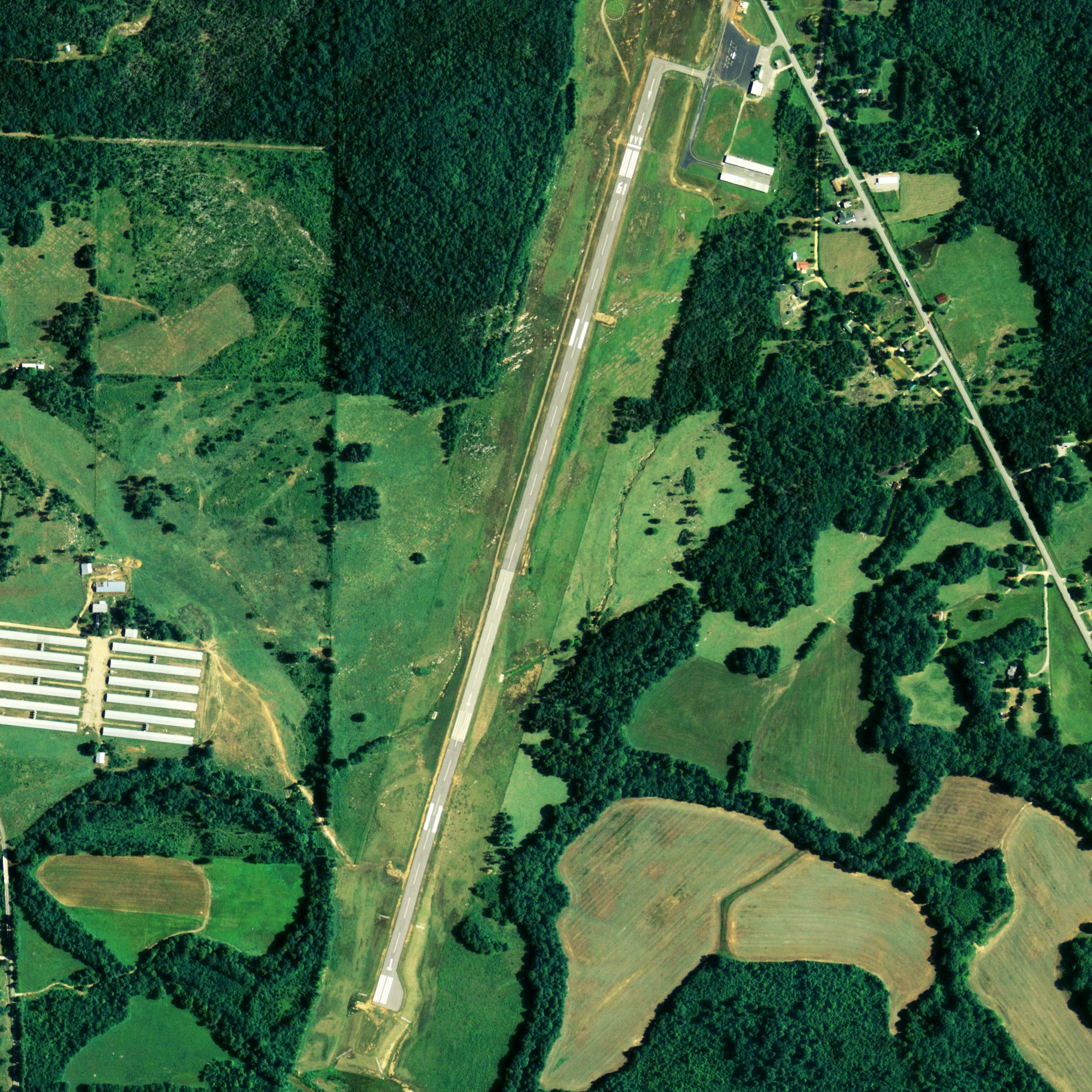
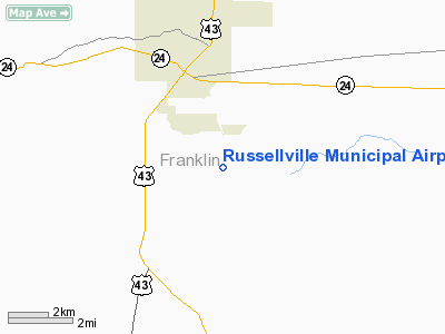
Russellville Municipal Airport (FAA LID: M22) is a city-owned public-use airport located 3 miles (4.8 km) southeast of the central business district of Russellville, a city in Franklin County, Alabama, United States.
Facilities and aircraft
Russellville Municipal Airport covers an area of 177 acres (0.277 sq mi; 0.716 km), and contains one runway designated 1/19 that is 5,500 x 75 feet (1,676 x 23 meters) with asphalt pavement. For the 12-month period ending June 15, 2006, the airport had 20,125 general aviation aircraft operations.
The above content comes from Wikipedia and is published under free licenses – click here to read more.
Location
& QuickFacts
|
FAA Information Effective: |
2007-01-18 |
|
Airport
Identifier: |
M22 |
|
Airport
Status: |
Operational |
|
Longitude/Latitude: |
087-42-40.6610W/34-26-43.2530N
-87.711295/34.445348 (Estimated) |
|
Elevation: |
723 ft / 220.37 m (Estimated) |
|
Land: |
177 acres |
|
From
nearest city: |
3 nautical miles SE of Russellville, AL |
|
Location: |
Franklin County, AL |
|
Magnetic Variation: |
01E (1985) |
Owner
& Manager
|
Ownership: |
Publicly owned |
|
Owner: |
City Of Russellville |
|
Address: |
Po Box 1148
Russellville, AL 35653 |
|
Phone
number: |
256-332-6060 |
|
Manager: |
Harry Mattox |
|
Address: |
Russellville Muni Airport, 13365 Hwy 243
Russellville, AL 35654 |
|
Phone number: |
256-331-9000 |
Airport
Operations and Facilities
|
Airport Use: |
Open to public |
|
Wind
indicator: |
Yes |
|
Segmented
Circle: |
Yes |
|
Control
Tower: |
No |
|
Lighting
Schedule: |
DUSK-DAWN
ACTVT MIRL RY 01/19 - CTAF. |
|
Beacon
Color: |
Clear-Green (lighted land airport) |
|
Landing
fee charge: |
No |
|
Sectional
chart: |
Atlanta |
|
Region: |
ASO - Southern |
|
Boundary
ARTCC: |
ZME - Memphis |
|
Tie-in
FSS: |
ANB - Anniston |
|
FSS
on Airport: |
No |
|
FSS
Toll Free: |
1-800-WX-BRIEF |
|
NOTAMs
Facility: |
ANB (NOTAM-d service avaliable) |
|
Federal Agreements: |
NGY |
Airport
Communications
|
CTAF: |
122.800 |
|
Unicom: |
122.800 |
Airport
Services
|
Fuel available: |
100LL |
|
Airframe Repair: |
MINOR |
|
Power Plant Repair: |
MINOR |
|
Bottled
Oxygen: |
NONE |
|
Bulk
Oxygen: |
NONE |
|
Runway Information
Runway 01/19
|
Dimension: |
5500 x 75 ft / 1676.4 x 22.9 m |
|
Surface: |
ASPH, Good Condition |
|
Weight
Limit: |
Single wheel: 30000 lbs. |
|
Edge
Lights: |
Medium |
|
|
Runway 01 |
Runway 19 |
|
Longitude: |
087-42-51.0100W |
087-42-32.6800W |
|
Latitude: |
34-26-16.1600N |
34-27-08.4000N |
|
Elevation: |
688.00
ft |
719.00
ft |
|
Alignment: |
16 |
127 |
|
Traffic
Pattern: |
Left |
Left |
|
Markings: |
Non-precision instrument, Good Condition |
Non-precision instrument, Good Condition |
|
Crossing
Height: |
40.00
ft |
40.00
ft |
|
Displaced
threshold: |
0.00 ft |
500.00
ft |
|
VASI: |
4-light PAPI on left side |
4-light PAPI on left side |
|
Visual
Glide Angle: |
3.00° |
3.00° |
|
Runway
End Identifier: |
Yes |
Yes |
|
Obstruction: |
68 ft trees, 1229.0 ft from runway, 51 ft right
of centerline, 15:1 slope to clear |
70 ft trees, 1093.0 ft from runway, 199 ft
left of centerline, 12:1 slope to clear
APCH RATIO 22:1 TO DSPLCD THR. |
|
Decleard
distances: |
Take off run available 5000.00 ft
Take off distance available 5500.00 ft
Actual stop distance available 5500.00 ft
Landing distance available 5500.00 ft |
Take off run available 5500.00 ft
Take off distance available 5500.00 ft
Actual stop distance available 5500.00 ft
Landing distance available 5000.00 ft |
|
Radio Navigation
Aids
|
ID |
Type |
Name |
Ch |
Freq |
Var |
Dist |
|
FDF |
NDB |
Fayette |
|
204.00 |
00E |
44.2 nm |
|
CPP |
NDB |
Cole Spring |
|
230.00 |
01W |
44.3 nm |
|
DCU |
VOR/DME |
Decatur |
075X |
112.80 |
01W |
40.1 nm |
|
MSL |
VORTAC |
Muscle Shoals |
112X |
116.50 |
01E |
19.1 nm |
|
HAB |
VORTAC |
Hamilton |
041X |
110.40 |
02E |
21.2 nm |
Remarks
- BIRDS
INVOF WEST SIDE AER 01.
- AFTER
HOURS CALL 256-766-1312 OR 256-710-4739.
- VFR
OPERATIONS ONLY.
Based
Aircraft
|
Aircraft
based on field: |
21 |
|
Single
Engine Airplanes: |
18 |
|
Multi
Engine Airplanes: |
3 |
Operational Statistics
Time Period: 2005-06-16
- 2006-06-15
|
Aircraft
Operations: |
56/Day |
|
General
Aviation Local: |
13.0% |
|
General
Aviation Itinerant: |
87.0% |
Russellville Municipal Airport
Address:
Franklin County, AL
Tel:
256-332-6060,
256-331-9000
Images
and information placed above are from
http://www.airport-data.com/airport/M22/
We
thank them for the data!
| General
Info |
| Country |
United
States |
| State |
ALABAMA
|
| FAA ID |
M22
|
| Latitude |
34-26-58.343N
|
| Longitude |
087-42-37.110W
|
| Elevation |
723 feet
|
| Near City |
RUSSELLVILLE
|
We don't guarantee the information is fresh and accurate. The data may
be wrong or outdated.
For more up-to-date information please refer to other sources.
|
|