 |
|
|
|
|
|
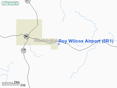
Location
& QuickFacts
|
FAA Information Effective: |
2007-01-18 |
|
Airport
Identifier: |
5R1 |
|
Airport
Status: |
Operational |
|
Longitude/Latitude: |
088-11-40.0310W/31-27-06.5960N
-88.194453/31.451832 (Estimated) |
|
Elevation: |
165 ft / 50.29 m (Estimated) |
|
Land: |
40
acres |
|
From
nearest city: |
3 nautical miles E of Chatom, AL |
|
Location: |
Washington County, AL |
|
Magnetic Variation: |
01E (1985) |
Owner
& Manager
|
Ownership: |
Publicly owned |
|
Owner: |
City Of Chatom |
|
Address: |
Po Box 817
Chatom, AL 36518 |
|
Phone number: |
251-847-2580 |
|
Manager: |
Joe Hearn |
|
Address: |
Po Box 530
Chatom, AL 36518 |
|
Phone number: |
251-847-2723 |
Airport
Operations and Facilities
|
Airport Use: |
Open to public |
|
Wind
indicator: |
Yes |
|
Segmented
Circle: |
No |
|
Control
Tower: |
No |
|
Lighting
Schedule: |
DUSK-DAWN |
|
Beacon
Color: |
Clear-Green (lighted land airport) |
|
Landing
fee charge: |
No |
|
Sectional
chart: |
New Orleans |
|
Region: |
ASO - Southern |
|
Boundary
ARTCC: |
ZHU - Houston |
|
Tie-in
FSS: |
ANB - Anniston |
|
FSS
on Airport: |
No |
|
FSS
Toll Free: |
1-800-WX-BRIEF |
|
NOTAMs
Facility: |
ANB (NOTAM-d service avaliable) |
Airport
Communications
|
CTAF: |
122.800 |
|
Unicom: |
122.800 |
Airport
Services
|
Fuel available: |
100LL
FOR FUEL CALL AMGR 334-847-2723. |
|
Runway Information
Runway 12/30
|
Dimension: |
4000 x 80 ft / 1219.2 x 24.4 m |
|
Surface: |
ASPH, Good Condition |
|
Weight
Limit: |
Single wheel: 15000 lbs. |
|
Edge
Lights: |
Medium |
|
|
Runway 12 |
Runway 30 |
|
Traffic
Pattern: |
Left |
Left |
|
Markings: |
Basic, Good Condition |
Basic, Good Condition |
|
Displaced
threshold: |
200.00
ft |
0.00 ft |
|
Touchdown
Lights: |
No |
No |
|
Obstruction: |
20 ft road, 450.0 ft from runway, 12:1 slope
to clear
APCH RATIO 32:1 FM DSPLCD THR. |
30 ft trees, 530.0 ft from runway, 27 ft right
of centerline, 11:1 slope to clear |
|
Radio Navigation
Aids
|
ID |
Type |
Name |
Ch |
Freq |
Var |
Dist |
|
BCZ |
NDB |
Choctaw |
|
228.00 |
01E |
40.0 nm |
|
MO |
NDB |
Wisle |
|
248.00 |
02E |
41.9 nm |
|
GCV |
VORTAC |
Greene County |
104X |
115.70 |
05E |
26.0 nm |
|
MVC |
VORTAC |
Monroeville |
115X |
116.80 |
04E |
43.2 nm |
|
SJI |
VORTAC |
Semmes |
100X |
115.30 |
05E |
44.4 nm |
Remarks
- DEER
ON & INVOF RY.
- BEFORE
FAA ACT.
Based
Aircraft
|
Aircraft
based on field: |
7 |
|
Single
Engine Airplanes: |
6 |
|
Multi
Engine Airplanes: |
1 |
Operational Statistics
Time Period: 1999-09-13
- 2000-09-11
|
Aircraft
Operations: |
72/Week |
|
General
Aviation Local: |
34.7% |
|
General
Aviation Itinerant: |
65.3% |
Roy Wilcox Airport
Address:
Washington County, AL
Tel:
251-847-2580, 251-847-2723
Images
and information placed above are from
http://www.airport-data.com/airport/5R1/
We
thank them for the data!
| General
Info |
| Country |
United
States |
| State |
ALABAMA
|
| FAA ID |
5R1
|
| Latitude |
31-27-06.596N
|
| Longitude |
088-11-40.031W
|
| Elevation |
165 feet
|
| Near City |
CHATOM
|
We don't guarantee the information is fresh and accurate. The data may
be wrong or outdated.
For more up-to-date information please refer to other sources.
|
|


