 |
|
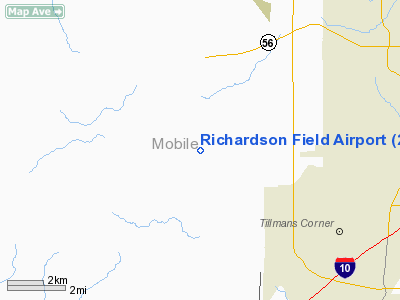
Location
& QuickFacts
|
FAA Information Effective: |
2007-01-18 |
|
Airport
Identifier: |
26AL |
|
Airport
Status: |
Operational |
|
Longitude/Latitude: |
088-16-43.0000W/30-37-27.0000N
-88.278611/30.624167 (Estimated) |
|
Elevation: |
180 ft / 54.86 m (Estimated) |
|
Land: |
52
acres |
|
From
nearest city: |
10 nautical miles SW of Mobile, AL |
|
Location: |
Mobile County, AL |
|
Magnetic Variation: |
00W (2000) |
Owner
& Manager
|
Ownership: |
Privately owned |
|
Owner: |
John D Richardson |
|
Address: |
9951 Jeff Hamilton Rd
Mobile, AL 36695 |
|
Phone
number: |
251-633-5618 |
|
Manager: |
John D Richardson |
|
Address: |
9951 Jeff Hamilton Rd
Mobile, AL 36695 |
|
Phone number: |
251-633-5618 |
Airport
Operations and Facilities
|
Airport Use: |
Private |
|
Wind
indicator: |
Yes |
|
Segmented
Circle: |
No |
|
Control
Tower: |
No |
|
Sectional
chart: |
New Orleans |
|
Region: |
ASO - Southern |
|
Boundary
ARTCC: |
ZHU - Houston |
|
Tie-in
FSS: |
ANB - Anniston |
|
FSS
Toll Free: |
1-800-WX-BRIEF |
|
Runway Information
Runway 09/27
|
Dimension: |
2700 x 200 ft / 823.0 x 61.0 m |
|
Surface: |
TURF, |
|
|
Runway 09 |
Runway 27 |
|
Traffic
Pattern: |
Left |
Left |
|
Radio Navigation
Aids
|
ID |
Type |
Name |
Ch |
Freq |
Var |
Dist |
|
MO |
NDB |
Wisle |
|
248.00 |
02E |
8.3 nm |
|
ESU |
NDB |
Summerdale |
|
204.00 |
01E |
29.6 nm |
|
BIX |
TACAN |
Keesler |
055X |
|
01E |
36.2 nm |
|
NUN |
VOR |
Saufley |
|
108.80 |
01E |
49.7 nm |
|
GPT |
VOR/DME |
Gulfport |
27X |
109.00 |
02E |
43.3 nm |
|
SJI |
VORTAC |
Semmes |
100X |
115.30 |
05E |
7.4 nm |
|
BFM |
VORTAC |
Brookley |
075X |
112.80 |
04E |
11.6 nm |
|
GCV |
VORTAC |
Greene County |
104X |
115.70 |
05E |
30.4 nm |
Remarks
- OWNER
DESIRES CHARTING.
- PROVIDED
VFR/PVT USE.
Based
Aircraft
|
Aircraft
based on field: |
2 |
|
Single
Engine Airplanes: |
1 |
|
Multi
Engine Airplanes: |
1 |
Richardson Field Airport
Address:
Mobile County, AL
Tel:
251-633-5618
Images
and information placed above are from
http://www.airport-data.com/airport/26AL/
We
thank them for the data!
| General
Info |
| Country |
United
States |
| State |
ALABAMA
|
| FAA ID |
26AL
|
| Latitude |
30-37-27.000N
|
| Longitude |
088-16-43.000W
|
| Elevation |
180 feet
|
| Near City |
MOBILE
|
We don't guarantee the information is fresh and accurate. The data may
be wrong or outdated.
For more up-to-date information please refer to other sources.
|
|


