 |
|
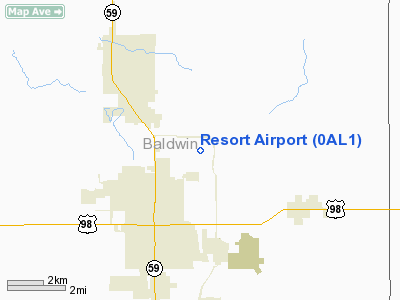
Location
& QuickFacts
|
FAA Information Effective: |
2007-01-18 |
|
Airport
Identifier: |
0AL1 |
|
Airport
Status: |
Operational |
|
Longitude/Latitude: |
087-39-25.0000W/30-26-38.0000N
-87.656944/30.443889 (Estimated) |
|
Elevation: |
97
ft / 29.57 m (Estimated) |
|
Land: |
0
acres |
|
From
nearest city: |
4 nautical miles NE of Foley, AL |
|
Location: |
Baldwin County, AL |
|
Magnetic Variation: |
01E (1990) |
Owner
& Manager
|
Ownership: |
Privately owned |
|
Owner: |
Jack D. Teague |
|
Address: |
P.o. Box 456
Foley, AL 36536 |
|
Phone
number: |
205-943-2367 |
|
Manager: |
Jack D. Teague |
|
Address: |
P.o. Box 456
Foley, AL 36536 |
|
Phone number: |
205-943-2367 |
Airport
Operations and Facilities
|
Airport Use: |
Private |
|
Segmented
Circle: |
No |
|
Control
Tower: |
No |
|
Sectional
chart: |
New Orleans |
|
Region: |
ASO - Southern |
|
Boundary
ARTCC: |
ZJX - Jacksonville |
|
Tie-in
FSS: |
ANB - Anniston |
|
FSS
on Airport: |
No |
|
FSS
Toll Free: |
1-800-WX-BRIEF |
|
Runway Information
Runway 17/35
|
Dimension: |
2640 x 70 ft / 804.7 x 21.3 m |
|
Surface: |
TURF, |
|
|
Runway 17 |
Runway 35 |
|
Traffic
Pattern: |
Left |
Left |
|
Obstruction: |
|
30 ft pline, 500.0 ft from runway |
|
Radio Navigation
Aids
|
ID |
Type |
Name |
Ch |
Freq |
Var |
Dist |
|
ESU |
NDB |
Summerdale |
|
204.00 |
01E |
4.9 nm |
|
PKZ |
NDB |
Pickens |
|
326.00 |
01E |
24.8 nm |
|
MO |
NDB |
Wisle |
|
248.00 |
02E |
38.5 nm |
|
NPA |
TACAN |
Pensacola |
119X |
|
01E |
18.4 nm |
|
NSE |
TACAN |
Whiting |
070X |
|
01E |
37.1 nm |
|
NGS |
TACAN |
Santa Rosa |
063X |
|
01E |
38.6 nm |
|
NUN |
VOR |
Saufley |
|
108.80 |
01E |
16.7 nm |
|
BFM |
VORTAC |
Brookley |
075X |
112.80 |
04E |
23.0 nm |
|
SJI |
VORTAC |
Semmes |
100X |
115.30 |
05E |
40.1 nm |
Remarks
- PRVDD
VFR/PR USE; AND ALL TRAFFIC PATTERNS TO EAST OF ARPT.
Based
Aircraft
|
Aircraft
based on field: |
1 |
|
Single
Engine Airplanes: |
1 |
Resort Airport
Address:
Baldwin County, AL
Tel:
205-943-2367
Images
and information placed above are from
http://www.airport-data.com/airport/0AL1/
We
thank them for the data!
| General
Info |
| Country |
United
States |
| State |
ALABAMA
|
| FAA ID |
0AL1
|
| Latitude |
30-26-38.000N
|
| Longitude |
087-39-25.000W
|
| Elevation |
97 feet
|
| Near City |
FOLEY
|
We don't guarantee the information is fresh and accurate. The data may
be wrong or outdated.
For more up-to-date information please refer to other sources.
|
|


