 |
|
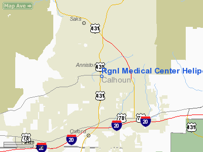
Regional Medical Center Heliport |
Location
& QuickFacts
|
FAA Information Effective: |
2007-01-18 |
|
Airport
Identifier: |
AL42 |
|
Airport
Status: |
Operational |
|
Longitude/Latitude: |
085-49-26.8730W/33-39-22.3730N
-85.824131/33.656215 (Estimated) |
|
Elevation: |
844 ft / 257.25 m (Estimated) |
|
Land: |
0
acres |
|
From
nearest city: |
0 nautical miles N of Anniston, AL |
|
Location: |
Calhoun County, AL |
|
Magnetic Variation: |
01W (1985) |
Owner
& Manager
|
Ownership: |
Privately owned |
|
Owner: |
Ne Alabama Regional Med Ctr |
|
Address: |
P O Box 2208
Anniston, AL 36202 |
|
Phone
number: |
205-235-5050 |
|
Manager: |
William J Tutwiler Jr |
|
Address: |
P O Box 2208
Anniston, AL 36202 |
|
Phone number: |
205-235-5050 |
Airport
Operations and Facilities
|
Airport Use: |
Private
MEDICAL USE. |
|
Wind
indicator: |
Yes |
|
Segmented
Circle: |
No |
|
Control
Tower: |
No |
|
Lighting
Schedule: |
PHONE REQ
FOR LGTS CALL 205-235-5295. |
|
Sectional
chart: |
Atlanta |
|
Region: |
ASO - Southern |
|
Boundary
ARTCC: |
ZTL - Atlanta |
|
Tie-in
FSS: |
ANB - Anniston |
|
FSS
Toll Free: |
1-800-WX-BRIEF |
|
Runway Information
Helipad H1
|
Dimension: |
50 x 50 ft / 15.2 x 15.2 m |
|
Surface: |
CONC, |
|
|
Runway H1 |
Runway |
|
Traffic
Pattern: |
Left |
Left |
|
Radio Navigation
Aids
|
ID |
Type |
Name |
Ch |
Freq |
Var |
Dist |
|
PLR |
NDB |
Pell City |
|
257.00 |
01E |
22.1 nm |
|
GPQ |
NDB |
Carrollton |
|
278.00 |
02W |
35.1 nm |
|
SCD |
NDB |
Sylacauga |
|
284.00 |
03W |
38.1 nm |
|
ARF |
NDB |
Saratoga |
|
296.00 |
02W |
41.0 nm |
|
DER |
NDB |
Alexander City |
|
382.00 |
01W |
47.2 nm |
|
TDG |
VOR/DME |
Talladega |
025X |
108.80 |
02E |
12.0 nm |
|
GAD |
VOR/DME |
Gadsden |
070X |
112.30 |
02E |
23.2 nm |
|
RMG |
VORTAC |
Rome |
101X |
115.40 |
01E |
46.5 nm |
|
LGC |
VORTAC |
Lagrange |
103X |
115.60 |
01E |
47.9 nm |
|
BHM |
VOT |
Birmingham Muni |
|
110.00 |
|
47.0 nm |
Remarks
- PRVDD
LNDG AREA LIMITED TO PVT USE; ALL OPNS CONDUCTED FM 090-250 DEGREES;
ALL DEP OPNS CONDUCTED FM 270-080 DEGREES; TKOF LNDG AREA IS MKD; NON-OBSTRUCTING
WIND INDICATOR IS MAINTAINED.
Regional Medical Center Heliport
Address:
Calhoun County, AL
Tel:
205-235-5050
Images
and information placed above are from
http://www.airport-data.com/airport/AL42/
We
thank them for the data!
| General
Info |
| Country |
United
States |
| State |
ALABAMA
|
| FAA ID |
AL42
|
| Latitude |
33-39-22.373N
|
| Longitude |
085-49-26.873W
|
| Elevation |
844 feet
|
| Near City |
ANNISTON
|
We don't guarantee the information is fresh and accurate. The data may
be wrong or outdated.
For more up-to-date information please refer to other sources.
|
|


