 |
|
|
|
|
|
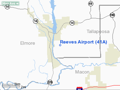
Location
& QuickFacts
|
FAA Information Effective: |
2007-01-18 |
|
Airport
Identifier: |
41A |
|
Airport
Status: |
Operational |
|
Longitude/Latitude: |
085-52-33.5000W/32-30-53.0000N
-85.875972/32.514722 (Estimated) |
|
Elevation: |
326 ft / 99.36 m (Surveyed) |
|
Land: |
425 acres |
|
From
nearest city: |
2 nautical miles SE of Tallassee, AL |
|
Location: |
Tallapoosa County, AL |
|
Magnetic Variation: |
02W (1995) |
Owner
& Manager
|
Ownership: |
Publicly owned |
|
Owner: |
City Of Tallassee |
|
Address: |
3 Freeman Avenue
Tallassee, AL 36078 |
|
Phone number: |
334-283-6571 |
|
Manager: |
Jim Cook |
|
Address: |
245 Airport Drive
Tallassee, AL 36078 |
|
Phone number: |
334-252-1033 |
Airport
Operations and Facilities
|
Airport Use: |
Open to public |
|
Wind
indicator: |
Yes |
|
Segmented
Circle: |
No |
|
Control
Tower: |
No |
|
Lighting
Schedule: |
DUSK-DAWN |
|
Beacon
Color: |
Clear-Green (lighted land airport) |
|
Sectional
chart: |
Atlanta |
|
Region: |
ASO - Southern |
|
Boundary
ARTCC: |
ZTL - Atlanta |
|
Tie-in
FSS: |
ANB - Anniston |
|
FSS
on Airport: |
No |
|
FSS
Toll Free: |
1-800-WX-BRIEF |
|
NOTAMs
Facility: |
ANB (NOTAM-d service avaliable) |
|
Federal Agreements: |
GY |
Airport
Communications
Airport
Services
|
Fuel available: |
100LL |
|
Airframe Repair: |
MAJOR |
|
Power Plant Repair: |
MAJOR |
|
Bottled
Oxygen: |
LOW |
|
Runway Information
Runway 13/31
|
Dimension: |
3207 x 75 ft / 977.5 x 22.9 m |
|
Surface: |
ASPH, Fair Condition |
|
Edge
Lights: |
Medium |
|
|
Runway 13 |
Runway 31 |
|
Longitude: |
085-52-47.0000W |
085-52-20.0000W |
|
Latitude: |
32-31-04.0000N |
32-30-42.0000N |
|
Alignment: |
127 |
127 |
|
Traffic
Pattern: |
Left |
Left |
|
Markings: |
Basic, Fair Condition |
Basic, Fair Condition |
|
Obstruction: |
35 ft trees, 1300.0 ft from runway, 180 ft
left of centerline, 31:1 slope to clear |
46 ft trees, 1272.0 ft from runway, 56 ft left
of centerline, 23:1 slope to clear |
|
Radio Navigation
Aids
|
ID |
Type |
Name |
Ch |
Freq |
Var |
Dist |
|
DER |
NDB |
Alexander City |
|
382.00 |
01W |
22.3 nm |
|
GGY |
NDB |
Gragg-wade |
|
338.00 |
01E |
42.4 nm |
|
TO |
NDB |
Blood |
|
365.00 |
01W |
42.8 nm |
|
AWS |
NDB |
Lawson |
|
335.00 |
02W |
45.3 nm |
|
SCD |
NDB |
Sylacauga |
|
284.00 |
03W |
45.5 nm |
|
MXF |
TACAN |
Maxwell |
097X |
|
03E |
26.3 nm |
|
TGE |
VOR/DME |
Tuskegee |
120X |
117.30 |
02E |
10.6 nm |
|
LSF |
VOR/DME |
Lawson |
051X |
111.40 |
02W |
46.1 nm |
|
MGM |
VORTAC |
Montgomery |
058X |
112.10 |
03E |
28.6 nm |
|
CSG |
VORTAC |
Columbus |
118X |
117.10 |
01E |
43.9 nm |
|
LGC |
VORTAC |
Lagrange |
103X |
115.60 |
01E |
46.7 nm |
Remarks
Based Aircraft
|
Aircraft
based on field: |
15 |
|
Single
Engine Airplanes: |
12 |
|
Multi
Engine Airplanes: |
3 |
Operational Statistics
Time Period: 1997-09-12
- 1998-09-11
|
Aircraft
Operations: |
89/Week |
|
General
Aviation Local: |
23.6% |
|
General
Aviation Itinerant: |
76.4% |
Reeves Airport
Address:
Tallapoosa County, AL
Tel:
334-283-6571, 334-252-1033
Images
and information placed above are from
http://www.airport-data.com/airport/41A/
We
thank them for the data!
| General
Info |
| Country |
United
States |
| State |
ALABAMA
|
| FAA ID |
41A
|
| Latitude |
32-30-53.000N
|
| Longitude |
085-52-33.500W
|
| Elevation |
326 feet
|
| Near City |
TALLASSEE
|
We don't guarantee the information is fresh and accurate. The data may
be wrong or outdated.
For more up-to-date information please refer to other sources.
|
|


