 |
|
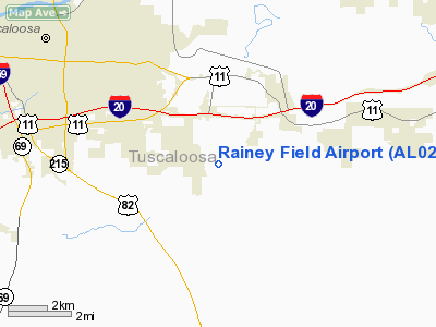
Location
& QuickFacts
|
FAA Information Effective: |
2007-01-18 |
|
Airport
Identifier: |
AL02 |
|
Airport
Status: |
Operational |
|
Longitude/Latitude: |
087-26-30.0110W/33-09-00.4300N
-87.441670/33.150119 (Estimated) |
|
Elevation: |
300 ft / 91.44 m (Estimated) |
|
Land: |
0
acres |
|
From
nearest city: |
3 nautical miles SE of Cottondale, AL |
|
Location: |
Tuscaloosa County, AL |
|
Magnetic Variation: |
01E (1985) |
Owner
& Manager
|
Ownership: |
Privately owned |
|
Owner: |
Maurice D Rainey |
|
Address: |
7211 Buttermilk Rd
Cottondale, AL 35453 |
|
Phone number: |
205-553-3644 |
|
Manager: |
7211 Buttermilk Road |
|
Address: |
Buttermilk Rd
Cottondale, AL 35453 |
|
Phone number: |
205-556-4206 |
Airport
Operations and Facilities
|
Airport Use: |
Private |
|
Wind
indicator: |
Yes |
|
Segmented
Circle: |
No |
|
Control
Tower: |
No |
|
Landing
fee charge: |
No |
|
Sectional
chart: |
Atlanta |
|
Region: |
ASO - Southern |
|
Boundary
ARTCC: |
ZTL - Atlanta |
|
Tie-in
FSS: |
ANB - Anniston |
|
FSS
on Airport: |
No |
|
FSS
Toll Free: |
1-800-WX-BRIEF
TOLL FREE NUMBER TO FSS 1-800-292-6218. |
|
Runway Information
Runway 08/26
|
Dimension: |
2000 x 100 ft / 609.6 x 30.5 m |
|
Surface: |
TURF, |
|
|
Runway 08 |
Runway 26 |
|
Traffic
Pattern: |
Left |
Left |
|
Radio Navigation
Aids
|
ID |
Type |
Name |
Ch |
Freq |
Var |
Dist |
|
BEQ |
NDB |
Bessemer |
|
368.00 |
00E |
27.8 nm |
|
EOG |
NDB |
Greensboro |
|
417.00 |
01E |
34.8 nm |
|
BH |
NDB |
Mcden |
|
224.00 |
01W |
37.0 nm |
|
AIV |
NDB |
Aliceville |
|
254.00 |
|
37.5 nm |
|
FDF |
NDB |
Fayette |
|
204.00 |
00E |
38.7 nm |
|
GGY |
NDB |
Gragg-wade |
|
338.00 |
01E |
45.5 nm |
|
LDK |
VORTAC |
Crimson |
125X |
117.80 |
03E |
8.1 nm |
|
OKW |
VORTAC |
Brookwood |
047X |
111.00 |
00E |
11.0 nm |
|
VUZ |
VORTAC |
Vulcan |
091X |
114.40 |
02E |
41.4 nm |
|
BHM |
VOT |
Birmingham Muni |
|
110.00 |
|
42.5 nm |
Remarks
- 500'
STOPWAY EAST END RWY 08.
- PRIVATE
USE; VFR WEATHER ONLY.
Based Aircraft
|
Aircraft
based on field: |
8 |
|
Single
Engine Airplanes: |
8 |
Rainey Field Airport
Address:
Tuscaloosa County, AL
Tel:
205-553-3644, 205-556-4206
Images
and information placed above are from
http://www.airport-data.com/airport/AL02/
We
thank them for the data!
| General
Info |
| Country |
United
States |
| State |
ALABAMA
|
| FAA ID |
AL02
|
| Latitude |
33-09-00.430N
|
| Longitude |
087-26-30.011W
|
| Elevation |
300 feet
|
| Near City |
COTTONDALE
|
We don't guarantee the information is fresh and accurate. The data may
be wrong or outdated.
For more up-to-date information please refer to other sources.
|
|


