|
|
Pryor Field Regional Airport |
Coordinates: 34°39′15″N 086°56′43″W / 34.65417°N 86.94528°W / 34.65417; -86.94528
| Pryor Field Regional Airport |
 |
| IATA: DCU – ICAO: KDCU – FAA LID: DCU |
| Summary |
| Airport type |
Public |
| Owner |
Decatur/Athens Airport Authority |
| Serves |
Decatur, Alabama |
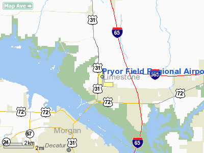
| Location |
Limestone County, Alabama |
| Elevation AMSL |
592 ft / 180 m |
| Runways |
| Direction |
Length |
Surface |
| ft |
m |
| 18/36 |
6,107 |
1,861 |
Asphalt |
| Statistics (2007) |
| Aircraft operations |
167,701 |
| Based aircraft |
144 |
| Source: Federal Aviation Administration |
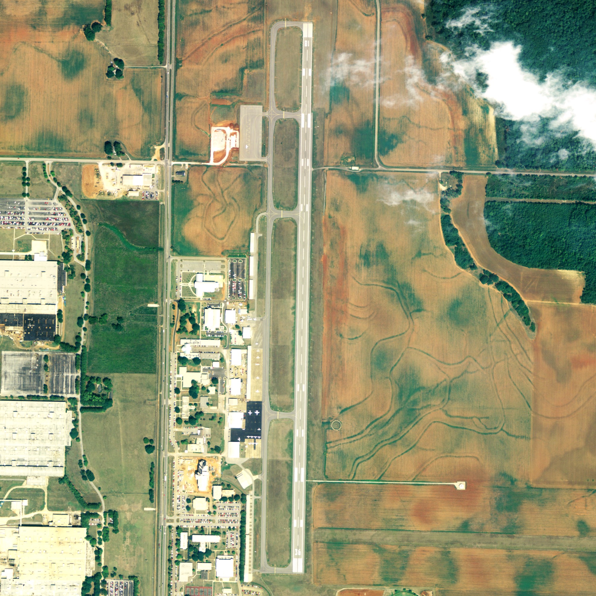
Pryor Field Regional Airport (IATA: DCU, ICAO: KDCU, FAA LID: DCU) is a public airport located three miles (5 km) northeast of the central business district of Decatur and south of Athens, in Limestone County, Alabama, United States. It is owned by Decatur/Athens Airport Authority.
Situated next to Calhoun Community College, the airport serves the western portion of the Huntsville-Decatur Combined Statistical Area and most of the Decatur Metropolitan Area. Pryor Field is currently the busiest regional airport in Alabama. Facilities and aircraft
Pryor Field Regional Airport covers an area of 200 acres (81 ha) which contains one asphalt paved runway (18/36) measuring 6,107 x 100 ft (1,861 x 30 m).
For the 12-month period ending May 3, 2006, the airport had 167,701 aircraft operations, an average of 459 per day: 91% general aviation, 7% military and 2% air taxi. There are 144 aircraft based at this airport: 79% single engine, 14% multi-engine, 3% jet aircraft, 3% helicopters and 1% gliders.
History
Opened in October 1941 with 4,600' x 4'600 square all-direction turf runway. Began training United States Army Air Corps flying cadets under contract to Southern Airways, Inc. & Southern Aviation Training School, Inc. Assigned to Gulf Coast Training Center (later Central FLying Training Command) as a primary (level 1) pilot training airfield. had five local auxiliary airfields for emergency and overflow landings. Flying training was performed with Fairchild PT-19s as the primary trainer. Also had several PT-17 Stearmans and a few P-40 Warhawks assigned.
Inactivated on 28 December 1944 with the drawdown of AAFTC's pilot training program. Declared surplus and turned over to the Army Corps of Engineers on 30 September 1945. Eventually discharged to the War Assets Administration (WAA) and became a civil airport.
The above content comes from Wikipedia and is published under free licenses – click here to read more.
Location
& QuickFacts
|
FAA Information Effective: |
2007-01-18 |
|
Airport
Identifier: |
DCU |
|
Airport
Status: |
Operational |
|
Longitude/Latitude: |
086-56-43.3000W/34-39-14.6000N
-86.945361/34.654056 (Estimated) |
|
Elevation: |
592 ft / 180.44 m (Surveyed) |
|
Land: |
200 acres |
|
From
nearest city: |
3 nautical miles NE of Decatur, AL |
|
Location: |
Limestone County, AL |
|
Magnetic Variation: |
01W (1990) |
Owner
& Manager
|
Ownership: |
Publicly owned |
|
Owner: |
Decatur/athens Airport Authority |
|
Address: |
6113 Spring Lake Dr
Huntsville, AL 35811 |
|
Phone
number: |
256-306-9070 |
|
Manager: |
Stan Smith |
|
Address: |
Decatur/athens Airport Authority, 6113 Spring
Lake Dr
Huntsville, AL 35811 |
|
Phone number: |
256-306-9070 |
Airport
Operations and Facilities
|
Airport Use: |
Open to public |
|
Wind
indicator: |
Yes |
|
Segmented
Circle: |
Yes |
|
Control
Tower: |
No |
|
Lighting
Schedule: |
DUSK-DAWN
ACTVT HIRL RY 18/36, REIL RYS 18 & 36 AND VASI RY 18
& PAPI RY 36 - CTAF. |
|
Beacon
Color: |
Clear-Green (lighted land airport) |
|
Landing
fee charge: |
No |
|
Sectional
chart: |
Atlanta |
|
Region: |
ASO - Southern |
|
Boundary
ARTCC: |
ZME - Memphis |
|
Tie-in
FSS: |
ANB - Anniston |
|
FSS
on Airport: |
No |
|
FSS
Toll Free: |
1-800-WX-BRIEF |
|
NOTAMs
Facility: |
DCU (NOTAM-d service avaliable) |
|
Federal Agreements: |
NGPY |
Airport
Communications
|
CTAF: |
123.075 |
|
Unicom: |
123.075 |
Airport
Services
|
Fuel available: |
100LLA1+ |
|
Airframe Repair: |
MAJOR |
|
Power Plant Repair: |
MAJOR |
|
Bottled
Oxygen: |
NONE |
|
Bulk
Oxygen: |
NONE |
|
Runway Information
Runway 18/36
|
Dimension: |
6107
x 100 ft / 1861.4 x 30.5 m
25 FT PAVED SHOULDERS WITH GRASS. |
|
Surface: |
ASPH, Good Condition |
|
Weight
Limit: |
Single wheel: 35000 lbs.
Dual wheel: 55000 lbs.
Dual
tandem wheel: 95000 lbs. |
|
Edge
Lights: |
High |
|
|
Runway 18 |
Runway 36 |
|
Longitude: |
086-56-42.5900W |
086-56-44.0200W |
|
Latitude: |
34-39-44.7800N |
34-38-44.3900N |
|
Elevation: |
588.00
ft |
583.00
ft |
|
Alignment: |
127 |
1 |
|
Traffic
Pattern: |
Left |
Left |
|
Markings: |
Precision instrument, Good Condition |
Precision instrument, Good Condition |
|
VASI: |
4-box on left side |
2-light PAPI on left side |
|
Runway
End Identifier: |
Yes |
Yes |
|
Radio Navigation
Aids
|
ID |
Type |
Name |
Ch |
Freq |
Var |
Dist |
|
CWH |
NDB |
Capshaw |
|
350.00 |
01W |
10.9 nm |
|
HUA |
NDB |
Redstone |
|
287.00 |
00W |
13.0 nm |
|
CPP |
NDB |
Cole Spring |
|
230.00 |
01W |
18.2 nm |
|
GZS |
NDB |
Giles/dcmsnd |
|
375.00 |
00E |
30.4 nm |
|
TNY |
NDB |
Kelso |
|
358.00 |
01W |
35.0 nm |
|
LRT |
NDB |
Lawrenceburg |
|
269.00 |
00E |
38.2 nm |
|
ARF |
NDB |
Saratoga |
|
296.00 |
02W |
43.1 nm |
|
DCU |
VOR/DME |
Decatur |
075X |
112.80 |
01W |
0.4 nm |
|
RQZ |
VORTAC |
Rocket |
059X |
112.20 |
02E |
17.6 nm |
|
MSL |
VORTAC |
Muscle Shoals |
112X |
116.50 |
01E |
27.2 nm |
|
HSV |
VOT |
Huntsville |
|
111.00 |
|
21.5 nm |
Remarks
- FLAGGED
& LGTD 150 FT CRANE LCTD 1750 FT WEST OF RY 18/36 & 1250 FT
SOUTH OF AER 18.
Based
Aircraft
|
Aircraft
based on field: |
144 |
|
Single
Engine Airplanes: |
114 |
|
Multi
Engine Airplanes: |
20 |
|
Jet Engine
Airplanes: |
5 |
|
Helicopters: |
4 |
|
Gliders: |
1 |
Operational Statistics
Time Period: 2005-05-04
- 2006-05-03
|
Aircraft
Operations: |
460/Day |
|
Air Taxi: |
2.3% |
|
General
Aviation Local: |
24.0% |
|
General
Aviation Itinerant: |
66.6% |
|
Military: |
7.2% |
Pryor Field Regional Airport
Address:
Limestone County, AL
Tel:
256-306-9070
Images
and information placed above are from
http://www.airport-data.com/airport/DCU/
We
thank them for the data!
| General
Info |
| Country |
United
States |
| State |
ALABAMA
|
| FAA ID |
DCU
|
| Latitude |
34-39-09.528N
|
| Longitude |
086-56-43.324W
|
| Elevation |
592 feet
|
| Near City |
DECATUR
|
We don't guarantee the information is fresh and accurate. The data may
be wrong or outdated.
For more up-to-date information please refer to other sources.
|
|