 |
|
Pine Hill Municipal Airport |
|
|
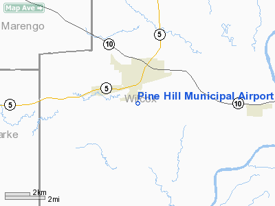
Location
& QuickFacts
|
FAA Information Effective: |
2007-01-18 |
|
Airport
Identifier: |
71A |
|
Airport
Status: |
Operational |
|
Longitude/Latitude: |
087-34-59.9990W/31-58-00.5400N
-87.583333/31.966817 (Estimated) |
|
Elevation: |
123 ft / 37.49 m (Surveyed) |
|
Land: |
80
acres |
|
From
nearest city: |
1 nautical miles S of Pine Hill, AL |
|
Location: |
Wilcox County, AL |
|
Magnetic Variation: |
01E (1985) |
Owner
& Manager
|
Ownership: |
Publicly owned |
|
Owner: |
Town Of Pine Hill |
|
Address: |
Po Box Drawer 397
Pine Hill, AL 36769 |
|
Phone
number: |
334-963-4351 |
|
Manager: |
Andy Hyman, City Mgr |
|
Address: |
Po Box 368
Pine Hill, AL 36769 |
|
Phone number: |
334-963-4351 |
Airport
Operations and Facilities
|
Airport Use: |
Open to public |
|
Wind
indicator: |
Yes |
|
Segmented
Circle: |
No |
|
Control
Tower: |
No |
|
Landing
fee charge: |
No |
|
Sectional
chart: |
New Orleans |
|
Region: |
ASO - Southern |
|
Boundary
ARTCC: |
ZTL - Atlanta |
|
Tie-in
FSS: |
ANB - Anniston |
|
FSS
on Airport: |
No |
|
FSS
Toll Free: |
1-800-WX-BRIEF |
|
NOTAMs
Facility: |
ANB (NOTAM-d service avaliable) |
Airport
Communications
Airport
Services
|
Airframe Repair: |
NONE |
|
Power Plant Repair: |
NONE |
|
Bottled
Oxygen: |
NONE |
|
Bulk
Oxygen: |
NONE |
|
Runway Information
Runway 09/27
|
Dimension: |
4462 x 80 ft / 1360.0 x 24.4 m |
|
Surface: |
ASPH, Fair Condition |
|
|
Runway 09 |
Runway 27 |
|
Traffic
Pattern: |
Left |
Left |
|
Markings: |
Basic, Fair Condition |
Basic, Fair Condition |
|
Obstruction: |
112 ft trees, 1470.0 ft from runway, 11:1 slope
to clear |
50 ft trees, 250.0 ft from runway, 100 ft left
of centerline, 1:1 slope to clear |
|
Radio Navigation
Aids
|
ID |
Type |
Name |
Ch |
Freq |
Var |
Dist |
|
BCZ |
NDB |
Choctaw |
|
228.00 |
01E |
28.8 nm |
|
RZO |
NDB |
Marengo |
|
391.00 |
01E |
34.7 nm |
|
SE |
NDB |
Pollk |
|
344.00 |
01W |
38.0 nm |
|
EOG |
NDB |
Greensboro |
|
417.00 |
01E |
38.4 nm |
|
PRN |
NDB |
Persimmon/dcmsnd |
|
359.00 |
00E |
49.9 nm |
|
JYU |
VOR/DME |
Junior |
083X |
113.60 |
01W |
37.7 nm |
|
MVC |
VORTAC |
Monroeville |
115X |
116.80 |
04E |
32.6 nm |
Remarks
- RY
27 +4' FENCE 249' FM RY END.
- VFR
OPERNS ONLY
Operational Statistics
Time Period: 1998-11-02
- 1999-11-01
|
Aircraft
Operations: |
25/Month |
|
General
Aviation Itinerant: |
100.0% |
Pine Hill Municipal Airport
Address:
Wilcox County, AL
Tel:
334-963-4351
Images
and information placed above are from
http://www.airport-data.com/airport/71A/
We
thank them for the data!
| General
Info |
| Country |
United
States |
| State |
ALABAMA
|
| FAA ID |
71A
|
| Latitude |
31-58-00.540N
|
| Longitude |
087-34-59.999W
|
| Elevation |
123 feet
|
| Near City |
PINE HILL
|
We don't guarantee the information is fresh and accurate. The data may
be wrong or outdated.
For more up-to-date information please refer to other sources.
|
|


