 |
|
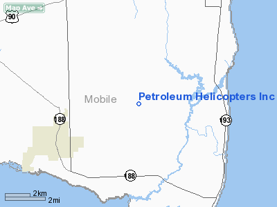
Petroleum Helicopters Incorporated Heliport |
Location
& QuickFacts
|
FAA Information Effective: |
2007-01-18 |
|
Airport
Identifier: |
2AL4 |
|
Airport
Status: |
Operational |
|
Longitude/Latitude: |
088-10-45.0000W/30-25-52.0000N
-88.179167/30.431111 (Estimated) |
|
Elevation: |
34
ft / 10.36 m (Estimated) |
|
Land: |
0
acres |
|
From
nearest city: |
4 nautical miles SW of Bayou Labatre, AL |
|
Location: |
Mobile County, AL |
|
Magnetic Variation: |
01E (1990) |
Owner
& Manager
|
Ownership: |
Privately owned |
|
Owner: |
Exxon Usa
HELIPAD LEASED TO PETROLEUM HELICOPTERS INC.
SEE
HELIPORT MANAGER'S ADDRESS. |
|
Address: |
Po Box 61707
New Orleans, LA 70161-1707 |
|
Phone number: |
504-561-4314 |
|
Manager: |
Carlin Craig |
|
Address: |
Po Box 578
Metairie, LA 70004-0578 |
|
Phone number: |
504-733-7673 |
Airport
Operations and Facilities
|
Airport Use: |
Private |
|
Wind
indicator: |
Yes |
|
Segmented
Circle: |
No |
|
Control
Tower: |
No |
|
Sectional
chart: |
New Orleans |
|
Region: |
ASO - Southern |
|
Boundary
ARTCC: |
ZHU - Houston |
|
Tie-in
FSS: |
ANB - Anniston |
|
FSS
on Airport: |
No |
|
FSS
Toll Free: |
1-800-WX-BRIEF |
|
Runway Information
Helipad H1
|
Dimension: |
90 x 50 ft / 27.4 x 15.2 m |
|
Surface: |
CONC, |
|
|
Runway H1 |
Runway |
|
Traffic
Pattern: |
Left |
Left |
|
Radio Navigation
Aids
|
ID |
Type |
Name |
Ch |
Freq |
Var |
Dist |
|
MO |
NDB |
Wisle |
|
248.00 |
02E |
20.8 nm |
|
ESU |
NDB |
Summerdale |
|
204.00 |
01E |
23.8 nm |
|
BIX |
TACAN |
Keesler |
055X |
|
01E |
38.9 nm |
|
NPA |
TACAN |
Pensacola |
119X |
|
01E |
44.9 nm |
|
NUN |
VOR |
Saufley |
|
108.80 |
01E |
43.8 nm |
|
GPT |
VOR/DME |
Gulfport |
27X |
109.00 |
02E |
46.5 nm |
|
BFM |
VORTAC |
Brookley |
075X |
112.80 |
04E |
12.7 nm |
|
SJI |
VORTAC |
Semmes |
100X |
115.30 |
05E |
20.0 nm |
|
GCV |
VORTAC |
Greene County |
104X |
115.70 |
05E |
43.1 nm |
Remarks
- PRIVATE
USE; OPNS CONDUCTED FROM 360 DEG TO 180 DEG; AREA IS MARKED; WIND INDICATOR
IS MAINTAINED.
Based Aircraft
|
Aircraft
based on field: |
1 |
|
Helicopters: |
1 |
Petroleum Helicopters Incorporated
Heliport
Address:
Mobile County, AL
Tel:
504-561-4314, 504-733-7673
Images
and information placed above are from
http://www.airport-data.com/airport/2AL4/
We
thank them for the data!
| General
Info |
| Country |
United
States |
| State |
ALABAMA
|
| FAA ID |
2AL4
|
| Latitude |
30-25-52.000N
|
| Longitude |
088-10-45.000W
|
| Elevation |
34 feet
|
| Near City |
BAYOU
LABATRE |
We don't guarantee the information is fresh and accurate. The data may
be wrong or outdated.
For more up-to-date information please refer to other sources.
|
|


