 |
|
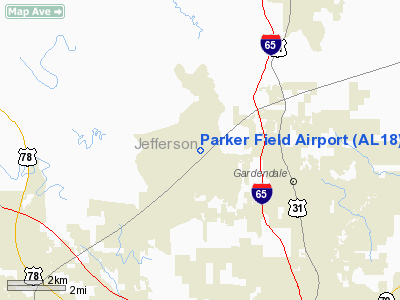
Location
& QuickFacts
|
FAA Information Effective: |
2007-01-18 |
|
Airport
Identifier: |
AL18 |
|
Airport
Status: |
Operational |
|
Longitude/Latitude: |
086-52-02.9780W/33-40-34.3730N
-86.867494/33.676215 (Estimated) |
|
Elevation: |
590 ft / 179.83 m (Surveyed) |
|
Land: |
0
acres |
|
From
nearest city: |
3 nautical miles NW of Gardendale, AL |
|
Location: |
Jefferson County, AL |
|
Magnetic Variation: |
00E (1985) |
Owner
& Manager
|
Ownership: |
Privately owned |
|
Owner: |
R. E. Parker |
|
Address: |
Rt 1, Po Box 130
Mt Olive, AL 35117 |
|
Phone
number: |
205-608-0808 |
|
Manager: |
R. E. Parker |
|
Address: |
Rt 1, Po Box 130
Mt Olive, AL 35117 |
|
Phone number: |
205-631-4455 |
Airport
Operations and Facilities
|
Airport Use: |
Private |
|
Wind
indicator: |
Yes |
|
Segmented
Circle: |
No |
|
Control
Tower: |
No |
|
Landing
fee charge: |
No |
|
Sectional
chart: |
Atlanta |
|
Region: |
ASO - Southern |
|
Boundary
ARTCC: |
ZTL - Atlanta |
|
Tie-in
FSS: |
ANB - Anniston |
|
FSS on Airport: |
No |
|
FSS Toll Free: |
1-800-WX-BRIEF |
Airport
Services
|
Runway Information
Runway 13/31
|
Dimension: |
1550 x 100 ft / 472.4 x 30.5 m |
|
Surface: |
TURF, |
|
|
Runway 13 |
Runway 31 |
|
Traffic
Pattern: |
Left |
Left |
|
Radio Navigation
Aids
|
ID |
Type |
Name |
Ch |
Freq |
Var |
Dist |
|
BH |
NDB |
Mcden |
|
224.00 |
01W |
10.0 nm |
|
BEQ |
NDB |
Bessemer |
|
368.00 |
00E |
22.1 nm |
|
PLR |
NDB |
Pell City |
|
257.00 |
01E |
31.7 nm |
|
SCD |
NDB |
Sylacauga |
|
284.00 |
03W |
40.9 nm |
|
CPP |
NDB |
Cole Spring |
|
230.00 |
01W |
41.6 nm |
|
ARF |
NDB |
Saratoga |
|
296.00 |
02W |
47.2 nm |
|
FDF |
NDB |
Fayette |
|
204.00 |
00E |
47.3 nm |
|
TDG |
VOR/DME |
Talladega |
025X |
108.80 |
02E |
41.7 nm |
|
GAD |
VOR/DME |
Gadsden |
070X |
112.30 |
02E |
43.1 nm |
|
VUZ |
VORTAC |
Vulcan |
091X |
114.40 |
02E |
1.7 nm |
|
OKW |
VORTAC |
Brookwood |
047X |
111.00 |
00E |
32.5 nm |
|
LDK |
VORTAC |
Crimson |
125X |
117.80 |
03E |
41.9 nm |
|
BHM |
VOT |
Birmingham Muni |
|
110.00 |
|
8.8 nm |
Remarks
- VFR
OPERATIONS/PRIVATE USE.
Based
Aircraft
|
Aircraft
based on field: |
4 |
|
Helicopters: |
4 |
Parker Field Airport
Address:
Jefferson County, AL
Tel:
205-608-0808,
205-631-4455
Images
and information placed above are from
http://www.airport-data.com/airport/AL18/
We
thank them for the data!
| General
Info |
| Country |
United
States |
| State |
ALABAMA
|
| FAA ID |
AL18
|
| Latitude |
33-40-34.373N
|
| Longitude |
086-52-02.978W
|
| Elevation |
590 feet
|
| Near City |
GARDENDALE
|
We don't guarantee the information is fresh and accurate. The data may
be wrong or outdated.
For more up-to-date information please refer to other sources.
|
|


