 |
|
Northwest Alabama Regional Airport |
Coordinates: 34°44â²43â³N 087°36â²37â³W / 34.74528°N 87.61028°W / 34.74528; -87.61028
| Northwest Alabama Regional Airport |
 |
 |
| IATA: MSL â ICAO: KMSL â FAA LID: MSL |
| Summary |
| Airport type |
Public |
| Owner |
Colbert & Lauderdale Counties |
| Location |
Muscle Shoals, Alabama |
| Elevation AMSL |
550 ft / 168 m |
| Website |
www.FlyTheShoals.com |
| Runways |
| Direction |
Length |
Surface |
| ft |
m |
| 11/29 |
6,693 |
2,040 |
Asphalt |
| 18/36 |
4,000 |
1,219 |
Asphalt |
| Statistics (2009) |
| Aircraft operations |
44,490 |
| Based aircraft |
52 |
| Source: Federal Aviation Administration |
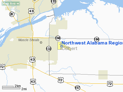
Northwest Alabama Regional Airport (IATA: MSL, ICAO: KMSL, FAA LID: MSL) is a public airport located one mile (1.6 km) east of the central business district of Muscle Shoals, a city in Colbert County, Alabama, United States. The airport is operated by the counties of Colbert and Lauderdale. It is mostly used for general aviation, but is also served by one commercial airline. Service is subsidized by the Essential Air Service program.
As per Federal Aviation Administration records, the airport had 5,166 commercial passenger boardings (enplanements) in calendar year 2004 and 6,157 enplanements in 2005. According to the FAA's National Plan of Integrated Airport Systems for 2007â2011, Northwest Alabama Regional is classified as commercial service - non-primary because it has between 2,500 and 10,000 passenger boardings per year. Facilities and aircraft
Northwest Alabama Regional Airport covers an area of 615 acres (249 ha) which contains two asphalt paved runways: 11/29 measuring 6,693 x 150 ft (2,040 x 46 m) and 18/36 measuring 4,000 x 100 ft (1,219 x 30 m).
For the 12-month period ending October 31, 2006, the airport had 44,860 aircraft operations, an average of 122 per day: 94% general aviation, 3% military, 2% scheduled commercial and 1% air taxi. There are 74 aircraft based at this airport: 58% single engine, 20% multi-engine, 8% jet aircraft and 14% helicopters.
The airport is also notorious for late flights and lost baggage. It also is one of the few airports that does not deliver lost baggage to the passenger's door when finally found. Passengers frequently find that they must divert to Huntsville, or rearrange their flight plans completely, incurring extra expenses. One corporate executive from Silicon Valley was quoted as saying he could not justify locating a server farm in the area due to lack of flight reliability.
Airline and destinations
| Airlines |
Destinations |
| Delta Connection operated by Mesaba Airlines |
Atlanta |
History
The airport was opened in February 1940, however in 1942 it was taken over by the United States Army Air Forces as a World War II pilot training military airfield. It was assigned to the AAF Flying Training Command, Southeast Training Center (later Eastern Flying Training Command) as a basic (stage 2) pilot training airfield.
Instruction at the school consisted of teaching the cadets to fly in formation, fly by instruments or by aerial navigation, fly at night, and fly for long distances. Aviation Cadets who washed out of pilot training were usually sent to navigator or bombardier school. The initial aircraft complement numbered 24 Vultee BT-13 Valiant and BT-15 aircraft. The ten-week course consisted of 70 hours of flight training and 150 hours of ground training.
Pilot training at the airfield apparently ended on 30 May 1944, with the drawdown of AAFTC's pilot training program. The airfield was returned to civil control at the end of the war.
Prior to Summer 2009, Muscle Shoals was served from Northwest Airlines' hub in Memphis. After Northwest was acquired by Delta, service was transferred to the company's larger hub in Atlanta. This has seen increased passenger numbers and less market leakage to nearby Huntsville Airport.
The above content comes from Wikipedia and is published under free licenses – click here to read more.
Location
& QuickFacts
|
FAA Information Effective: |
2007-01-18 |
|
Airport
Identifier: |
MSL |
|
Airport
Status: |
Operational |
|
Longitude/Latitude: |
087-36-36.8360W/34-44-43.1530N
-87.610232/34.745320 (Estimated) |
|
Elevation: |
550 ft / 167.64 m (Surveyed) |
|
Land: |
615 acres |
|
From
nearest city: |
1 nautical miles E of Muscle Shoals, AL |
|
Location: |
Colbert County, AL |
|
Magnetic Variation: |
00E (1985) |
Owner
& Manager
|
Ownership: |
Publicly owned |
|
Owner: |
Colbert & Lauderdale Counties |
|
Address: |
1729 T Ed Campbell Dr Suite A
Muscle Shoals, AL 35661-2016 |
|
Phone
number: |
256-381-2869 |
|
Manager: |
John Lehrter |
|
Address: |
1729 T Ed Campbell Dr Suite A
Muscle Shoals, AL 35661-2016 |
|
Phone number: |
256-381-2869
EXT. 101. |
Airport
Operations and Facilities
|
Airport Use: |
Open to public |
|
Wind
indicator: |
Yes |
|
Segmented
Circle: |
Yes |
|
Control
Tower: |
No |
|
Lighting
Schedule: |
DUSK-DAWN
ACTVT HIRL RY 11/29, MIRL RY 08/36, PAPI RYS 18 & 36,
VASI RY 11, REIL RY 11 & MALSR RY 29 - CTAF. |
|
Beacon
Color: |
Clear-Green (lighted land airport) |
|
Landing
fee charge: |
No |
|
Sectional
chart: |
Atlanta |
|
Region: |
ASO - Southern |
|
Boundary
ARTCC: |
ZME - Memphis |
|
Tie-in
FSS: |
ANB - Anniston |
|
FSS
Toll Free: |
1-800-WX-BRIEF |
|
NOTAMs
Facility: |
MSL (NOTAM-d service avaliable) |
|
Certification
type/date: |
I A S 04/2005
PPR FOR UNSKED ACR & CHARTER OPNS WITH MORE THAN 30
PSGR SEATS; CALL AMGR (256) 381-2869, EXT 101 OR FAX (256)
381-2915. |
|
Federal Agreements: |
NGSY3 |
Airport
Communications
|
CTAF: |
123.050 |
|
Unicom: |
123.050 |
Airport
Services
|
Fuel available: |
100LLA
FUEL AVBL NIGHTS CALL 256-383-2270. |
|
Airframe Repair: |
MINOR |
|
Power Plant Repair: |
MINOR |
|
Bottled
Oxygen: |
NONE |
|
Bulk
Oxygen: |
NONE |
|
Runway Information
Runway 11/29
|
Dimension: |
6693 x 150 ft / 2040.0 x 45.7 m |
|
Surface: |
ASPH, Fair Condition
WIDESPREAD CRACKING AND POOR PATCHES WITH FOD |
|
Surface
Treatment: |
Saw-cut or plastic Grooved |
|
Weight
Limit: |
Single wheel: 59000 lbs.
Dual wheel: 98000 lbs.
Dual
tandem wheel: 160000 lbs. |
|
Edge
Lights: |
High |
|
|
Runway 11 |
Runway 29 |
|
Longitude: |
087-37-01.2650W |
087-35-48.0660W |
|
Latitude: |
34-44-56.4570N |
34-44-29.4030N |
|
Elevation: |
542.00
ft |
550.00
ft |
|
Alignment: |
114 |
127 |
|
ILS
Type: |
|
ILS |
|
Traffic
Pattern: |
Left |
Left |
|
Markings: |
Non-precision instrument, Good Condition |
Precision instrument, Good Condition |
|
Crossing
Height: |
51.00
ft |
0.00 ft |
|
VASI: |
4-box on right side |
|
|
Visual
Glide Angle: |
3.00° |
0.00° |
|
Approach
lights: |
|
MALSR |
|
Runway
End Identifier: |
Yes |
No |
|
Centerline
Lights: |
|
No |
|
Touchdown
Lights: |
|
No |
|
Obstruction: |
, 50:1 slope to clear |
108 ft tower, 5350.0 ft from runway, 1200 ft
right of centerline, 47:1 slope to clear |
|
Runway 18/36
|
Dimension: |
4000 x 100 ft / 1219.2 x 30.5 m |
|
Surface: |
ASPH, Poor Condition
WIDESPREAD CRACKING AND POOR PATCHES WITH FOD |
|
Weight
Limit: |
Single wheel: 30000 lbs.
Dual wheel: 50000 lbs. |
|
Edge
Lights: |
Medium |
|
|
Runway 18 |
Runway 36 |
|
Longitude: |
087-36-56.6360W |
087-36-57.7790W |
|
Latitude: |
34-45-03.2980N |
34-44-23.7500N |
|
Elevation: |
539.00
ft |
541.00
ft |
|
Alignment: |
127 |
1 |
|
Traffic
Pattern: |
Left |
Left |
|
Markings: |
Basic, Fair Condition |
Basic, Fair Condition |
|
Crossing
Height: |
40.00
ft |
40.00
ft |
|
VASI: |
4-light PAPI on left side |
4-light PAPI on left side |
|
Visual
Glide Angle: |
3.00° |
3.00° |
|
Radio Navigation
Aids
|
ID |
Type |
Name |
Ch |
Freq |
Var |
Dist |
|
LRT |
NDB |
Lawrenceburg |
|
269.00 |
00E |
34.1 nm |
|
GZS |
NDB |
Giles/dcmsnd |
|
375.00 |
00E |
36.6 nm |
|
CWH |
NDB |
Capshaw |
|
350.00 |
01W |
41.1 nm |
|
HHY |
NDB |
Pinhook |
|
346.00 |
01W |
42.3 nm |
|
JHG |
NDB |
Hohenwald |
|
257.00 |
01W |
43.1 nm |
|
CPP |
NDB |
Cole Spring |
|
230.00 |
01W |
45.1 nm |
|
HUA |
NDB |
Redstone |
|
287.00 |
00W |
45.6 nm |
|
DCU |
VOR/DME |
Decatur |
075X |
112.80 |
01W |
33.7 nm |
|
MSL |
VORTAC |
Muscle Shoals |
112X |
116.50 |
01E |
6.3 nm |
|
HAB |
VORTAC |
Hamilton |
041X |
110.40 |
02E |
38.6 nm |
|
RQZ |
VORTAC |
Rocket |
059X |
112.20 |
02E |
48.3 nm |
|
HSV |
VOT |
Huntsville |
|
111.00 |
|
43.7 nm |
Remarks
- DURG
CALM WINDS PREFERRED RWY IS 29.
- NO
GA PARKING ON ACR RAMP.
- LANDING
FEE & PASSENGER FACILITY CHARGE FOR UNSKED ACR & CHARTER OPNS.
- TWY
'A' IS THE PREFERRED TWY FOR ACR & CHARTER OPNS USING THE ACR RAMP.
- LANDING
FEE FOR ACR OVER 12,500 LBS.
Based Aircraft
|
Aircraft
based on field: |
74 |
|
Single
Engine Airplanes: |
43 |
|
Multi
Engine Airplanes: |
15 |
|
Jet Engine
Airplanes: |
6 |
|
Helicopters: |
10 |
Operational Statistics
Time Period: 2005-11-01
- 2006-10-31
|
Aircraft
Operations: |
123/Day |
|
Commerical: |
2.5% |
|
Air Taxi: |
0.6% |
|
General
Aviation Local: |
53.5% |
|
General
Aviation Itinerant: |
40.1% |
|
Military: |
3.3% |
Northwest Alabama Regional Airport
Address:
Colbert County, AL
Tel:
256-381-2869
Images
and information placed above are from
http://www.airport-data.com/airport/MSL/
We
thank them for the data!
| General
Info |
| Country |
United
States |
| State |
ALABAMA
|
| FAA ID |
MSL
|
| Latitude |
34-44-43.153N
|
| Longitude |
087-36-36.836W
|
| Elevation |
550 feet
|
| Near City |
MUSCLE
SHOALS |
We don't guarantee the information is fresh and accurate. The data may
be wrong or outdated.
For more up-to-date information please refer to other sources.
|
|


