 |
|
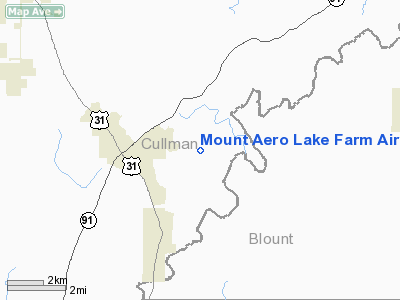
Mount Aero Lake Farm Airport |
Location
& QuickFacts
|
FAA Information Effective: |
2007-01-18 |
|
Airport
Identifier: |
2AL7 |
|
Airport
Status: |
Operational |
|
Longitude/Latitude: |
086-43-23.0000W/34-03-46.0000N
-86.723056/34.062778 (Estimated) |
|
Elevation: |
625 ft / 190.50 m (Surveyed) |
|
Land: |
90
acres |
|
From
nearest city: |
2 nautical miles E of Hanceville, AL |
|
Location: |
Cullman County, AL |
|
Magnetic Variation: |
01W (1990) |
Owner
& Manager
|
Ownership: |
Privately owned |
|
Owner: |
Earnie H Haynes |
|
Address: |
Po Drawer 879
Hanceville, AL 35077 |
|
Phone number: |
205-352-2577 |
|
Manager: |
Earnie H Haynes |
|
Address: |
Po Drawer 879
Hanceville, AL 35077 |
|
Phone number: |
205-352-2577 |
Airport
Operations and Facilities
|
Airport Use: |
Private |
|
Wind
indicator: |
Yes |
|
Segmented
Circle: |
No |
|
Control
Tower: |
No |
|
Sectional
chart: |
Atlanta |
|
Region: |
ASO - Southern |
|
Boundary
ARTCC: |
ZTL - Atlanta |
|
Tie-in
FSS: |
ANB - Anniston |
|
FSS
on Airport: |
No |
|
FSS
Toll Free: |
1-800-WX-BRIEF |
|
Runway Information
Runway 18/36
|
Dimension: |
2600 x 90 ft / 792.5 x 27.4 m |
|
Surface: |
TURF, Good Condition |
|
Edge
Lights: |
Low |
|
|
Runway 18 |
Runway 36 |
|
Traffic
Pattern: |
Left |
Left |
|
Displaced
threshold: |
0.00 ft |
250.00
ft |
|
Radio Navigation
Aids
|
ID |
Type |
Name |
Ch |
Freq |
Var |
Dist |
|
CPP |
NDB |
Cole Spring |
|
230.00 |
01W |
19.0 nm |
|
ARF |
NDB |
Saratoga |
|
296.00 |
02W |
27.3 nm |
|
BH |
NDB |
Mcden |
|
224.00 |
01W |
33.7 nm |
|
HUA |
NDB |
Redstone |
|
287.00 |
00W |
38.3 nm |
|
PLR |
NDB |
Pell City |
|
257.00 |
01E |
38.4 nm |
|
CWH |
NDB |
Capshaw |
|
350.00 |
01W |
42.8 nm |
|
BEQ |
NDB |
Bessemer |
|
368.00 |
00E |
46.2 nm |
|
GAD |
VOR/DME |
Gadsden |
070X |
112.30 |
02E |
32.3 nm |
|
DCU |
VOR/DME |
Decatur |
075X |
112.80 |
01W |
36.8 nm |
|
TDG |
VOR/DME |
Talladega |
025X |
108.80 |
02E |
44.9 nm |
|
VUZ |
VORTAC |
Vulcan |
091X |
114.40 |
02E |
25.2 nm |
|
RQZ |
VORTAC |
Rocket |
059X |
112.20 |
02E |
44.4 nm |
|
BHM |
VOT |
Birmingham Muni |
|
110.00 |
|
30.1 nm |
Remarks
Based
Aircraft
|
Aircraft
based on field: |
2 |
|
Single
Engine Airplanes: |
2 |
Mount Aero Lake Farm Airport
Address:
Cullman County, AL
Tel:
205-352-2577
Images
and information placed above are from
http://www.airport-data.com/airport/2AL7/
We
thank them for the data!
| General
Info |
| Country |
United
States |
| State |
ALABAMA
|
| FAA ID |
2AL7
|
| Latitude |
34-03-46.000N
|
| Longitude |
086-43-23.000W
|
| Elevation |
625 feet
|
| Near City |
HANCEVILLE
|
We don't guarantee the information is fresh and accurate. The data may
be wrong or outdated.
For more up-to-date information please refer to other sources.
|
|


