|
|
| Monroe County Airport |
 |
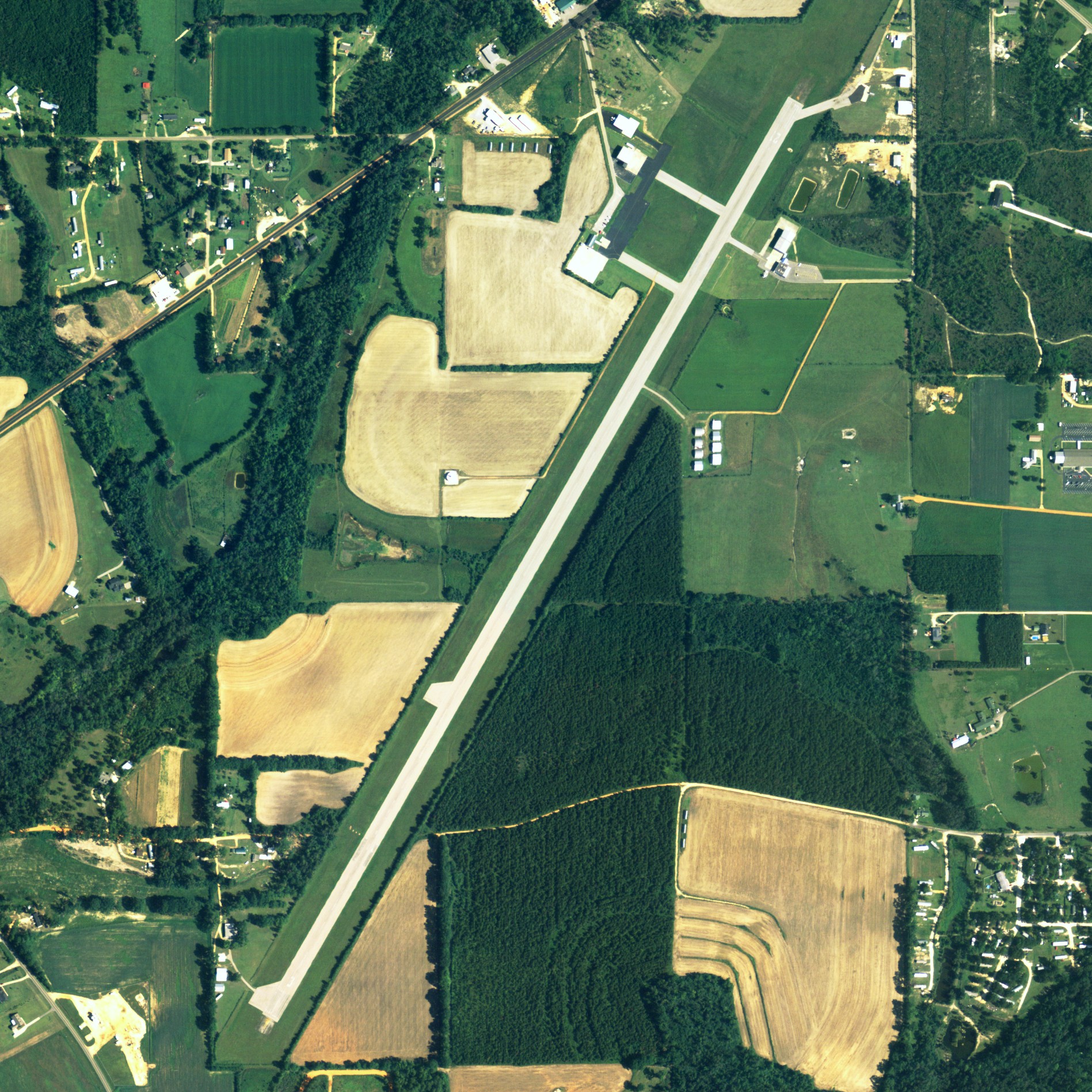
| NAIP aerial image, 2006 |
| IATA: MVC â ICAO: KMVC â FAA LID: MVC |
| Summary |
| Airport type |
Public |
| Owner |
Monroe County |
| Serves |
Monroeville, Alabama |
| Elevation AMSL |
419 ft / 128 m |
| Coordinates |
31°27â²29â³N 087°21â²04â³W / 31.45806°N 87.35111°W / 31.45806; -87.35111 |
| Runways |
| Direction |
Length |
Surface |
| ft |
m |
| 3/21 |
6,028 |
1,837 |
Asphalt |
| Statistics (2009) |
| Aircraft operations |
20,100 |
| Based aircraft |
16 |
| Source: Federal Aviation Administration |
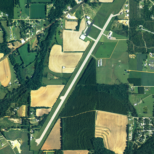
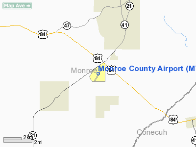
Monroe County Airport (IATA: MVC, ICAO: KMVC, FAA LID: MVC) is a county-owned public-use airport located three nautical miles (6 km) south of the central business district of Monroeville, in Monroe County, Alabama, United States. According to the FAA's National Plan of Integrated Airport Systems for 2009â2013, it is categorized as a general aviation facility.
Facilities and aircraft
Monroe County Airport covers an area of 56 acres (23 ha) at an elevation of 419 feet (128 m) above mean sea level. It has one runway designated 3/21 with an asphalt surface measuring 6,028 by 100 feet (1,837 x 30 m).
For the 12-month period ending July 14, 2009, the airport had 20,100 aircraft operations, an average of 55 per day: 95% general aviation and 5% military. At that time there were 16 aircraft based at this airport: 75% single-engine, 13% multi-engine, 6% jet and 6% helicopter.
The above content comes from Wikipedia and is published under free licenses – click here to read more.
Location
& QuickFacts
|
FAA Information Effective: |
2007-01-18 |
|
Airport
Identifier: |
MVC |
|
Airport
Status: |
Operational |
|
Longitude/Latitude: |
087-21-03.7700W/31-27-28.9100N
-87.351047/31.458031 (Estimated) |
|
Elevation: |
419 ft / 127.71 m (Surveyed) |
|
Land: |
56
acres |
|
From
nearest city: |
3 nautical miles S of Monroeville, AL |
|
Location: |
Monroe County, AL |
|
Magnetic Variation: |
01E (1985) |
Owner
& Manager
|
Ownership: |
Publicly owned |
|
Owner: |
Monroe County |
|
Address: |
Po Box 8
Monroeville, AL 36461 |
|
Phone
number: |
251-575-2081 |
|
Manager: |
Andy Harhai
ADDL CTC FBO TIM TIREY, MONROEVILLE AVIATION. |
|
Address: |
Po Box 191
Monroeville, AL 36461 |
|
Phone number: |
251-575-4235 |
Airport
Operations and Facilities
|
Airport Use: |
Open to public |
|
Wind
indicator: |
Yes |
|
Segmented
Circle: |
No |
|
Control
Tower: |
No |
|
Lighting
Schedule: |
DUSK-DAWN
ACTVT PAPI RY 03, VASI RY 21 AND REIL RYS 03 & 21 -
CTAF. |
|
Beacon
Color: |
Clear-Green (lighted land airport) |
|
Landing
fee charge: |
No |
|
Sectional
chart: |
New Orleans |
|
Region: |
ASO - Southern |
|
Boundary
ARTCC: |
ZTL - Atlanta |
|
Tie-in
FSS: |
ANB - Anniston |
|
FSS
on Airport: |
No |
|
FSS
Toll Free: |
1-800-WX-BRIEF |
|
NOTAMs
Facility: |
ANB (NOTAM-d service avaliable) |
|
Federal Agreements: |
N |
Airport
Communications
|
CTAF: |
123.000 |
|
Unicom: |
123.000 |
Airport
Services
|
Fuel available: |
100LLA
A+ FUEL AVBL 0800-2000 MON-FRI, 0900-1700 SAT-SUN; FOR FUEL
& OTHER SVCS AFTER HRS ONLY CALL 251-743-2024.
SVCS
DURG ARPT HRS CALL 251-575-4235. |
|
Airframe Repair: |
MINOR |
|
Bottled
Oxygen: |
NONE |
|
Bulk
Oxygen: |
NONE |
|
Runway Information
Runway 03/21
|
Dimension: |
6016 x 100 ft / 1833.7 x 30.5 m |
|
Surface: |
ASPH, Fair Condition |
|
Weight
Limit: |
Single wheel: 70000 lbs. |
|
Edge
Lights: |
Medium |
|
|
Runway 03 |
Runway 21 |
|
Longitude: |
087-21-20.9500W |
087-20-46.5800W |
|
Latitude: |
31-27-03.4000N |
31-27-54.7800N |
|
Elevation: |
413.00
ft |
419.00
ft |
|
Alignment: |
30 |
127 |
|
Traffic
Pattern: |
Left |
Left |
|
Markings: |
Non-precision instrument, Fair Condition |
Non-precision instrument, Fair Condition |
|
Crossing
Height: |
59.00
ft |
31.00
ft |
|
VASI: |
4-light PAPI on left side |
4-box on left side |
|
Visual
Glide Angle: |
3.00° |
3.00° |
|
Runway
End Identifier: |
Yes |
Yes |
|
Obstruction: |
56 ft tree, 220.0 ft from runway, 225 ft right
of centerline
+4 FT FENCE 200 FT LEFT & RIGHT OF THLD. |
75 ft trees, 488.0 ft from runway, 292 ft left
of centerline, 3:1 slope to clear
+10 FT FENCE 200 FT LEFT OF THLD. |
|
Radio Navigation
Aids
|
ID |
Type |
Name |
Ch |
Freq |
Var |
Dist |
|
PRN |
NDB |
Persimmon/dcmsnd |
|
359.00 |
00E |
44.5 nm |
|
NSE |
TACAN |
Whiting |
070X |
|
01E |
47.3 nm |
|
MVC |
VORTAC |
Monroeville |
115X |
116.80 |
04E |
0.2 nm |
Based
Aircraft
|
Aircraft
based on field: |
16 |
|
Single
Engine Airplanes: |
10 |
|
Multi
Engine Airplanes: |
5 |
|
Jet Engine
Airplanes: |
1 |
Operational Statistics
Time Period: 1999-09-13
- 2000-09-11
|
Aircraft
Operations: |
56/Day |
|
General
Aviation Local: |
12.4% |
|
General
Aviation Itinerant: |
82.6% |
|
Military: |
5.0% |
Monroe County Airport
Address:
Monroe County, AL
Tel:
251-575-2081,
251-575-4235
Images
and information placed above are from
http://www.airport-data.com/airport/MVC/
We
thank them for the data!
| General
Info |
| Country |
United
States |
| State |
ALABAMA
|
| FAA ID |
MVC
|
| Latitude |
31-27-28.991N
|
| Longitude |
087-21-03.745W
|
| Elevation |
419 feet
|
| Near City |
MONROEVILLE
|
We don't guarantee the information is fresh and accurate. The data may
be wrong or outdated.
For more up-to-date information please refer to other sources.
|
|