 |
|
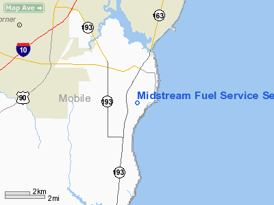
Midstream Fuel Service Seaplane Base |
Location
& QuickFacts
|
FAA Information Effective: |
2007-01-18 |
|
Airport
Identifier: |
5AL2 |
|
Airport
Status: |
Operational |
|
Longitude/Latitude: |
088-05-55.9960W/30-31-35.6990N
-88.098888/30.526583 (Estimated) |
|
Elevation: |
0
ft / 0.00 m (Estimated) |
|
Land: |
0
acres |
|
From
nearest city: |
4 nautical miles SE of Theodore, AL |
|
Location: |
Mobile County, AL |
|
Magnetic Variation: |
02E (1985) |
Owner
& Manager
|
Ownership: |
Privately owned |
|
Owner: |
Midstream Fuel Service, Inc. |
|
Address: |
P.o. Box 2826
Mobile, AL 36652 |
|
Phone
number: |
205-433-4972 |
|
Manager: |
John S. Mcclelland, Jr. |
|
Address: |
P.o. Box 2826
Mobile, AL 36652 |
Airport
Operations and Facilities
|
Airport Use: |
Private |
|
Wind
indicator: |
Yes |
|
Segmented
Circle: |
No |
|
Control
Tower: |
No |
|
Sectional
chart: |
New Orleans |
|
Region: |
ASO - Southern |
|
Boundary
ARTCC: |
ZHU - Houston |
|
Tie-in
FSS: |
ANB - Anniston |
|
FSS
on Airport: |
No |
|
FSS
Toll Free: |
1-800-WX-BRIEF |
|
Runway Information
Runway 13/31
|
Dimension: |
5000 x 150 ft / 1524.0 x 45.7 m |
|
Surface: |
WATER, |
|
|
Runway 13 |
Runway 31 |
|
Traffic
Pattern: |
Left |
Left |
|
Helipad H1
|
Dimension: |
50 x 30 ft / 15.2 x 9.1 m |
|
Surface: |
CONC, |
|
|
Runway H1 |
Runway |
|
Traffic
Pattern: |
Left |
Left |
|
Radio Navigation
Aids
|
ID |
Type |
Name |
Ch |
Freq |
Var |
Dist |
|
MO |
NDB |
Wisle |
|
248.00 |
02E |
17.6 nm |
|
ESU |
NDB |
Summerdale |
|
204.00 |
01E |
19.4 nm |
|
PKZ |
NDB |
Pickens |
|
326.00 |
01E |
48.0 nm |
|
NPA |
TACAN |
Pensacola |
119X |
|
01E |
41.8 nm |
|
BIX |
TACAN |
Keesler |
055X |
|
01E |
43.6 nm |
|
NUN |
VOR |
Saufley |
|
108.80 |
01E |
39.7 nm |
|
BFM |
VORTAC |
Brookley |
075X |
112.80 |
04E |
5.6 nm |
|
SJI |
VORTAC |
Semmes |
100X |
115.30 |
05E |
18.0 nm |
|
GCV |
VORTAC |
Greene County |
104X |
115.70 |
05E |
39.7 nm |
Remarks
- PROVIDED
ALL OPS VFR/PVT USE.
Midstream Fuel Service Seaplane Base
Address:
Mobile County, AL
Tel:
205-433-4972
Images
and information placed above are from
http://www.airport-data.com/airport/5AL2/
We
thank them for the data!
| General
Info |
| Country |
United
States |
| State |
ALABAMA
|
| FAA ID |
5AL2
|
| Latitude |
30-31-35.699N
|
| Longitude |
088-05-55.996W
|
| Elevation |
0 feet
|
| Near City |
THEODORE
|
We don't guarantee the information is fresh and accurate. The data may
be wrong or outdated.
For more up-to-date information please refer to other sources.
|
|


