 |
|
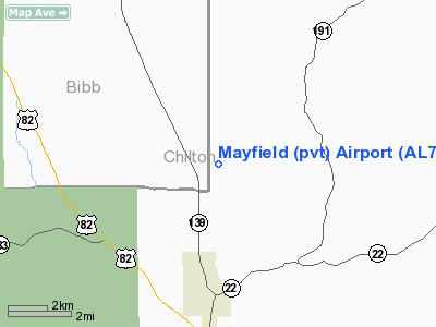
Mayfield (private) Airport |
Location
& QuickFacts
|
FAA Information Effective: |
2007-01-18 |
|
Airport
Identifier: |
AL76 |
|
Airport
Status: |
Operational |
|
Longitude/Latitude: |
086-52-11.9580W/32-50-55.4530N
-86.869988/32.848737 (Estimated) |
|
Elevation: |
495 ft / 150.88 m (Estimated) |
|
Land: |
0
acres |
|
From
nearest city: |
5 nautical miles N of Maplesville, AL |
|
Location: |
Chilton County, AL |
|
Magnetic Variation: |
00E (1985) |
Owner
& Manager
|
Ownership: |
Privately owned |
|
Owner: |
Argle Mayfield |
|
Address: |
Rt 1 Box 208
Maplesville, AL 36750 |
|
Phone number: |
205-366-2368 |
|
Manager: |
Argle Mayfield |
|
Address: |
Rt 1 Box 208
Maplesville, AL 36750 |
|
Phone number: |
205-366-2368 |
Airport
Operations and Facilities
|
Airport Use: |
Private |
|
Wind
indicator: |
Yes |
|
Segmented
Circle: |
No |
|
Control
Tower: |
No |
|
Sectional
chart: |
Atlanta |
|
Region: |
ASO - Southern |
|
Boundary
ARTCC: |
ZTL - Atlanta |
|
Tie-in
FSS: |
ANB - Anniston |
|
FSS
Toll Free: |
1-800-WX-BRIEF |
|
Runway Information
Runway 02/20
|
Dimension: |
3200 x 100 ft / 975.4 x 30.5 m |
|
Surface: |
TURF, |
|
|
Runway 02 |
Runway 20 |
|
Traffic
Pattern: |
Left |
Left |
|
Displaced
threshold: |
200.00
ft |
0.00 ft |
|
Obstruction: |
, 200.0 ft from runway |
50 ft trees, 4000.0 ft from runway |
|
Radio Navigation
Aids
|
ID |
Type |
Name |
Ch |
Freq |
Var |
Dist |
|
GGY |
NDB |
Gragg-wade |
|
338.00 |
01E |
13.1 nm |
|
BEQ |
NDB |
Bessemer |
|
368.00 |
00E |
28.0 nm |
|
SCD |
NDB |
Sylacauga |
|
284.00 |
03W |
34.0 nm |
|
SE |
NDB |
Pollk |
|
344.00 |
01W |
34.9 nm |
|
BH |
NDB |
Mcden |
|
224.00 |
01W |
39.8 nm |
|
EOG |
NDB |
Greensboro |
|
417.00 |
01E |
42.8 nm |
|
DER |
NDB |
Alexander City |
|
382.00 |
01W |
45.9 nm |
|
MXF |
TACAN |
Maxwell |
097X |
|
03E |
38.0 nm |
|
JYU |
VOR/DME |
Junior |
083X |
113.60 |
01W |
30.9 nm |
|
OKW |
VORTAC |
Brookwood |
047X |
111.00 |
00E |
30.3 nm |
|
LDK |
VORTAC |
Crimson |
125X |
117.80 |
03E |
41.7 nm |
|
MGM |
VORTAC |
Montgomery |
058X |
112.10 |
03E |
46.9 nm |
|
VUZ |
VORTAC |
Vulcan |
091X |
114.40 |
02E |
49.4 nm |
|
BHM |
VOT |
Birmingham Muni |
|
110.00 |
|
43.3 nm |
Remarks
Based
Aircraft
|
Aircraft
based on field: |
4 |
|
Single
Engine Airplanes: |
4 |
Mayfield (private) Airport
Address:
Chilton County, AL
Tel:
205-366-2368
Images
and information placed above are from
http://www.airport-data.com/airport/AL76/
We
thank them for the data!
| General
Info |
| Country |
United
States |
| State |
ALABAMA
|
| FAA ID |
AL76
|
| Latitude |
32-50-55.453N
|
| Longitude |
086-52-11.958W
|
| Elevation |
495 feet
|
| Near City |
MAPLESVILLE
|
We don't guarantee the information is fresh and accurate. The data may
be wrong or outdated.
For more up-to-date information please refer to other sources.
|
|


