 |
|
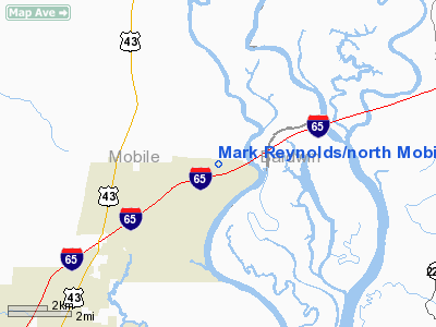
Mark Reynolds/north Mobile County Airport |
|
|
Location
& QuickFacts
|
FAA Information Effective: |
2007-01-18 |
|
Airport
Identifier: |
15A |
|
Airport
Status: |
Operational |
|
Longitude/Latitude: |
087-58-49.9900W/30-54-47.6600N
-87.980553/30.913239 (Estimated) |
|
Elevation: |
60
ft / 18.29 m (Estimated) |
|
Land: |
40
acres |
|
From
nearest city: |
3 nautical miles NE of Creola, AL |
|
Location: |
Mobile County, AL |
|
Magnetic Variation: |
01E (1985) |
Owner
& Manager
|
Ownership: |
Privately owned |
|
Owner: |
Louis G. Buffkin |
|
Address: |
1931 Deadlake Marina
Creola, AL 36525 |
|
Phone
number: |
334-341-6450 |
|
Manager: |
Louis G. Buffkin |
|
Address: |
1931 Deadlake Marina Rd.
Creola, AL 36525 |
|
Phone number: |
251-341-6450
ADDL PHONE 251-341-6457 OR 251-680-9063. |
Airport
Operations and Facilities
|
Airport Use: |
Open to public |
|
Wind
indicator: |
Yes |
|
Segmented
Circle: |
No |
|
Control
Tower: |
No |
|
Lighting
Schedule: |
DUSK-DAWN
ACTVT LIRL RY 03/21 - CTAF. |
|
Beacon
Color: |
Clear-Green (lighted land airport) |
|
Landing
fee charge: |
No |
|
Sectional
chart: |
New Orleans |
|
Region: |
ASO - Southern |
|
Boundary
ARTCC: |
ZHU - Houston |
|
Tie-in
FSS: |
ANB - Anniston |
|
FSS
on Airport: |
No |
|
FSS
Toll Free: |
1-800-WX-BRIEF |
|
NOTAMs
Facility: |
ANB (NOTAM-d service avaliable) |
Airport
Communications
|
CTAF: |
122.800 |
|
Unicom: |
122.800 |
|
Runway Information
Runway 03/21
|
Dimension: |
2000 x 180 ft / 609.6 x 54.9 m |
|
Surface: |
TURF, Fair Condition |
|
Edge
Lights: |
Non-standard lighting system
RY 03/21 NSTD LIRL; NO THLD LGTS. |
|
|
Runway 03 |
Runway 21 |
|
Traffic
Pattern: |
Left |
Left |
|
Obstruction: |
26 ft trees, 352.0 ft from runway, 120 ft left
of centerline, 13:1 slope to clear |
55 ft trees, 451.0 ft from runway, 170 ft right
of centerline, 8:1 slope to clear |
|
Radio Navigation
Aids
|
ID |
Type |
Name |
Ch |
Freq |
Var |
Dist |
|
MO |
NDB |
Wisle |
|
248.00 |
02E |
19.0 nm |
|
ESU |
NDB |
Summerdale |
|
204.00 |
01E |
28.1 nm |
|
NPA |
TACAN |
Pensacola |
119X |
|
01E |
47.9 nm |
|
NUN |
VOR |
Saufley |
|
108.80 |
01E |
42.6 nm |
|
BFM |
VORTAC |
Brookley |
075X |
112.80 |
04E |
18.5 nm |
|
SJI |
VORTAC |
Semmes |
100X |
115.30 |
05E |
22.6 nm |
|
GCV |
VORTAC |
Greene County |
104X |
115.70 |
05E |
28.3 nm |
|
MVC |
VORTAC |
Monroeville |
115X |
116.80 |
04E |
46.1 nm |
Remarks
Based
Aircraft
|
Aircraft
based on field: |
10 |
|
Single
Engine Airplanes: |
10 |
Operational Statistics
Time Period: 1999-03-30
- 2000-03-28
|
Aircraft
Operations: |
165/Week |
|
General
Aviation Local: |
8.4% |
|
General
Aviation Itinerant: |
77.6% |
|
Military: |
14.0% |
Mark Reynolds/north Mobile County Airport
Address:
Mobile County, AL
Tel:
334-341-6450
Images
and information placed above are from
http://www.airport-data.com/airport/15A/
We
thank them for the data!
| General
Info |
| Country |
United
States |
| State |
ALABAMA
|
| FAA ID |
15A
|
| Latitude |
30-54-47.660N
|
| Longitude |
087-58-49.990W
|
| Elevation |
60 feet
|
| Near City |
CREOLA
|
We don't guarantee the information is fresh and accurate. The data may
be wrong or outdated.
For more up-to-date information please refer to other sources.
|
|


