|
|
Marion County - Rankin Fite Airport |
Coordinates: 34°07′03″N 087°59′54″W / 34.1175°N 87.99833°W / 34.1175; -87.99833
| Marion County - Rankin Fite Airport |
 |
| IATA: HAB – ICAO: KHAB – FAA LID: HAB |
| Summary |
| Airport type |
Public |
| Owner |
Marion County |
| Serves |
Hamilton, Alabama |
| Elevation AMSL |
442 ft / 135 m |
| Runways |
| Direction |
Length |
Surface |
| ft |
m |
| 18/36 |
5,500 |
1,676 |
Asphalt |
| Statistics (2006) |
| Aircraft operations |
21,800 |
| Source: Federal Aviation Administration |
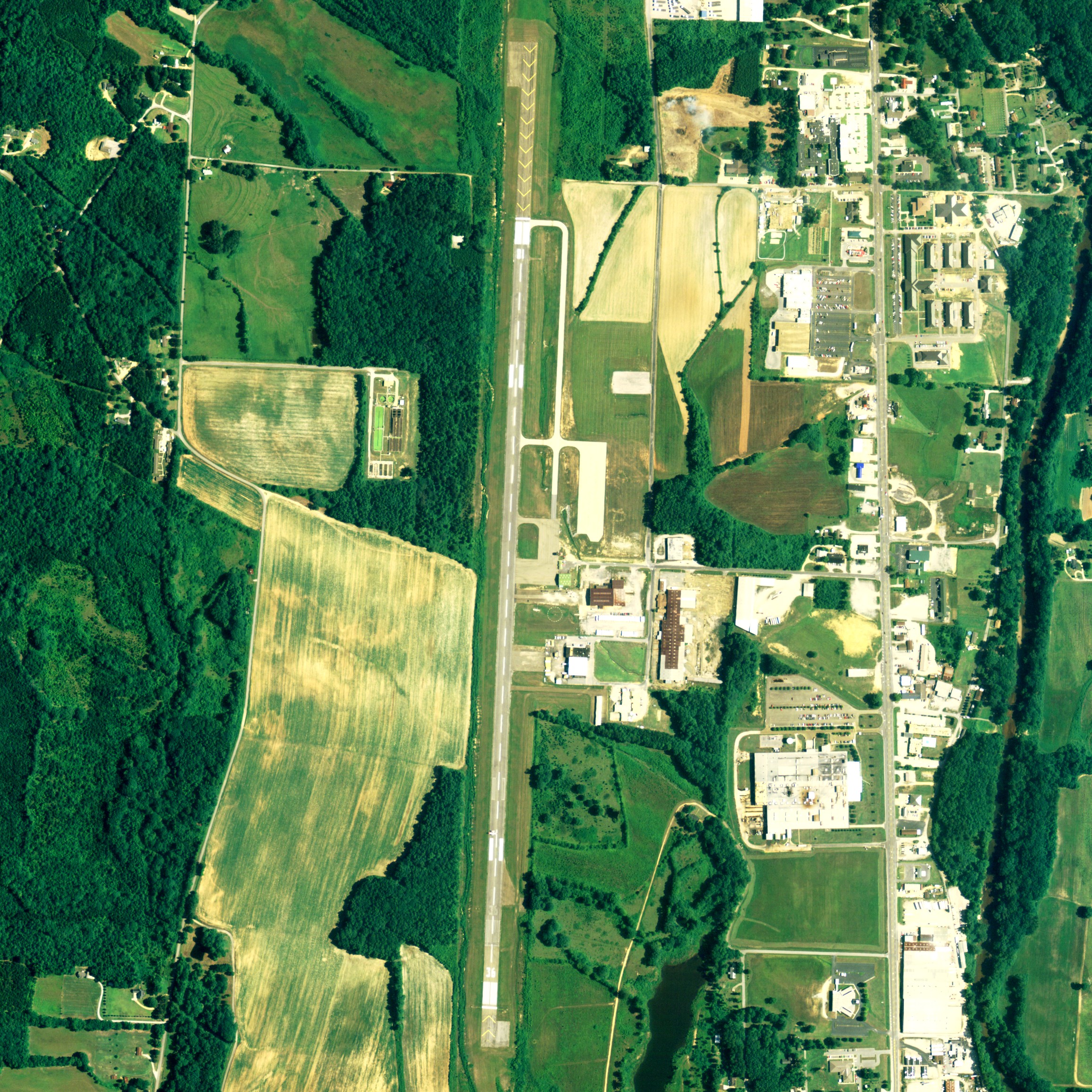
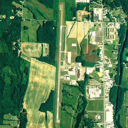
Marion County - Rankin Fite Airport (IATA: HAB, ICAO: KHAB, FAA LID: HAB) is a public airport located one mile (2 km) south of the central business district of Hamilton, a city in Marion County, Alabama, United States. It is owned by Marion County.
Facilities and aircraft
Marion County - Rankin Fite Airport covers an area of 173 acres (70 ha) which contains one asphalt paved runway (18/36) measuring 5,500 x 100 ft (1,676 x 30 m). For the 12-month period ending August 23, 2006, the airport had 21,800 aircraft operations, 100% of which were general aviation.
The above content comes from Wikipedia and is published under free licenses – click here to read more.
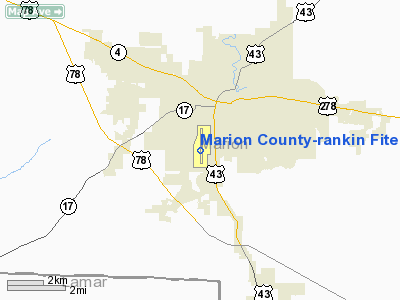
Location
& QuickFacts
|
FAA Information Effective: |
2007-01-18 |
|
Airport
Identifier: |
HAB |
|
Airport
Status: |
Operational |
|
Longitude/Latitude: |
087-59-53.5050W/34-07-03.2600N
-87.998196/34.117572 (Estimated) |
|
Elevation: |
442 ft / 134.72 m (Surveyed) |
|
Land: |
173 acres |
|
From
nearest city: |
1 nautical miles S of Hamilton, AL |
|
Location: |
Marion County, AL |
|
Magnetic Variation: |
01E (1985) |
Owner
& Manager
|
Ownership: |
Publicly owned |
|
Owner: |
Marion County |
|
Address: |
Box 460
Hamilton, AL 35570 |
|
Phone
number: |
205-921-3172 |
|
Manager: |
Steve Shotts
FLYING SERVICES, INC. |
|
Address: |
520 Airport Road
Hamilton, AL 35570 |
|
Phone number: |
205-921-9585
AFT HRS CALL (205) 412-2484. |
Airport
Operations and Facilities
|
Airport Use: |
Open to public |
|
Wind
indicator: |
Yes |
|
Segmented
Circle: |
Yes |
|
Control
Tower: |
No |
|
Lighting
Schedule: |
DUSK-DAWN
ACTVT MIRL RY 18/36, PAPI RYS 18 & 36, REIL RYS 18 &
36 - CTAF. |
|
Beacon
Color: |
Clear-Green (lighted land airport) |
|
Landing
fee charge: |
No |
|
Sectional
chart: |
Atlanta |
|
Region: |
ASO - Southern |
|
Boundary
ARTCC: |
ZME - Memphis |
|
Tie-in
FSS: |
ANB - Anniston |
|
FSS
on Airport: |
No |
|
FSS
Toll Free: |
1-800-WX-BRIEF |
|
NOTAMs
Facility: |
ANB (NOTAM-d service avaliable) |
|
Federal Agreements: |
NGY |
Airport
Communications
|
CTAF: |
122.800 |
|
Unicom: |
122.800 |
Airport
Services
|
Fuel available: |
100LLA |
|
Airframe Repair: |
MINOR |
|
Power Plant Repair: |
MINOR |
|
Bottled
Oxygen: |
NONE |
|
Bulk
Oxygen: |
NONE |
|
Runway Information
Runway 18/36
|
Dimension: |
5500 x 100 ft / 1676.4 x 30.5 m |
|
Surface: |
ASPH, Good Condition |
|
Weight
Limit: |
Single wheel: 15000 lbs. |
|
Edge
Lights: |
Medium |
|
|
Runway 18 |
Runway 36 |
|
Longitude: |
087-59-52.4600W |
087-59-54.5900W |
|
Latitude: |
34-07-28.1900N |
34-06-33.8100N |
|
Elevation: |
440.00
ft |
408.00
ft |
|
Alignment: |
127 |
2 |
|
Traffic
Pattern: |
Left |
Left |
|
Markings: |
Non-precision instrument, Good Condition |
Non-precision instrument, Good Condition |
|
VASI: |
4-light PAPI on left side |
4-light PAPI on left side |
|
Runway
End Identifier: |
Yes |
Yes |
|
Obstruction: |
37 ft trees, 998.0 ft from runway, 179 ft left
of centerline, 21:1 slope to clear |
62 ft trees, 940.0 ft from runway, 291 ft right
of centerline, 11:1 slope to clear |
|
Radio Navigation
Aids
|
ID |
Type |
Name |
Ch |
Freq |
Var |
Dist |
|
FDF |
NDB |
Fayette |
|
204.00 |
00E |
25.9 nm |
|
OTB |
VOR/DME |
Tupelo |
035X |
109.80 |
04E |
40.3 nm |
|
HAB |
VORTAC |
Hamilton |
041X |
110.40 |
02E |
4.7 nm |
|
CBM |
VORTAC |
Caledonia |
099X |
115.20 |
00E |
36.1 nm |
|
MSL |
VORTAC |
Muscle Shoals |
112X |
116.50 |
01E |
43.4 nm |
|
IGB |
VORTAC |
Bigbee |
109X |
116.20 |
04E |
45.9 nm |
Remarks
Based
Aircraft
|
Aircraft
based on field: |
17 |
|
Single
Engine Airplanes: |
15 |
|
Multi
Engine Airplanes: |
2 |
Operational Statistics
Time Period: 2005-08-24
- 2006-08-23
|
Aircraft
Operations: |
60/Day |
|
General
Aviation Local: |
16.1% |
|
General
Aviation Itinerant: |
83.9% |
Marion County-rankin Fite Airport
Address:
Marion County, AL
Tel:
205-921-3172,
205-921-9585
Images
and information placed above are from
http://www.airport-data.com/airport/HAB/
We
thank them for the data!
| General
Info |
| Country |
United
States |
| State |
ALABAMA
|
| FAA ID |
HAB
|
| Latitude |
34-07-03.260N
|
| Longitude |
087-59-53.505W
|
| Elevation |
442 feet
|
| Near City |
HAMILTON
|
We don't guarantee the information is fresh and accurate. The data may
be wrong or outdated.
For more up-to-date information please refer to other sources.
|
|