 |
|
|
|
|
|
Location
& QuickFacts
|
FAA Information Effective: |
2007-01-18 |
|
Airport
Identifier: |
23A |
|
Airport
Status: |
Closed Indefinitely |
|
Longitude/Latitude: |
088-16-05.1020W/32-29-42.4950N
-88.268084/32.495137 (Estimated) |
|
Elevation: |
185 ft / 56.39 m (Surveyed) |
|
Land: |
45
acres |
|
From
nearest city: |
1 nautical miles E of York, AL |
|
Location: |
Sumter County, AL |
|
Magnetic Variation: |
01E (1985) |
Owner
& Manager
|
Ownership: |
Publicly owned |
|
Owner: |
City Of York |
|
Address: |
Po Box 37
York, AL 36925 |
|
Phone number: |
205-392-5231 |
|
Manager: |
Robert Holycross |
|
Address: |
Po Box 490
Livingston, AL 35470 |
|
Phone number: |
205-652-3400 |
Airport
Operations and Facilities
|
Airport Use: |
Open to public |
|
Wind
indicator: |
Yes |
|
Segmented
Circle: |
No |
|
Control
Tower: |
No |
|
Lighting
Schedule: |
DUSK-DAWN |
|
Landing
fee charge: |
No |
|
Sectional
chart: |
Memphis |
|
Region: |
ASO - Southern |
|
Boundary
ARTCC: |
ZME - Memphis |
|
Tie-in
FSS: |
ANB - Anniston |
|
FSS
on Airport: |
No |
|
FSS
Toll Free: |
1-800-WX-BRIEF |
|
NOTAMs
Facility: |
ANB (NOTAM-d service avaliable) |
Airport
Communications
Airport
Services
|
Airframe Repair: |
NONE |
|
Power Plant Repair: |
NONE |
|
Bottled
Oxygen: |
NONE |
|
Bulk
Oxygen: |
NONE |
|
Runway Information
Runway 07/25
|
Dimension: |
3221 x 80 ft / 981.8 x 24.4 m |
|
Surface: |
ASPH, Poor Condition
AREAS OF LOOSE PAVEMENT |
|
Weight
Limit: |
Single wheel: 20000 lbs. |
|
Edge
Lights: |
Medium |
|
|
Runway 07 |
Runway 25 |
|
Traffic
Pattern: |
Left |
Left |
|
Markings: |
Nonstandard, Fair Condition
/25 CNTRLN ONLY. |
Nonstandard, Fair Condition |
|
Obstruction: |
20 ft trees, 200.0 ft from runway, 100 ft right
of centerline
+15 FT TREES 190 FT FM THLD & 100 FT RIGHT. |
25 ft trees, 200.0 ft from runway, 40 ft left
of centerline
+25 FT TREES 180-200 FT FM THLD & 97 FT LEFT. |
|
Radio Navigation
Aids
|
ID |
Type |
Name |
Ch |
Freq |
Var |
Dist |
|
RZO |
NDB |
Marengo |
|
391.00 |
01E |
13.7 nm |
|
BCZ |
NDB |
Choctaw |
|
228.00 |
01E |
24.1 nm |
|
ME |
NDB |
Savoy |
|
356.00 |
01E |
29.6 nm |
|
EOG |
NDB |
Greensboro |
|
417.00 |
01E |
31.3 nm |
|
AIV |
NDB |
Aliceville |
|
254.00 |
|
37.4 nm |
|
MPE |
NDB |
Philadelphia |
|
219.00 |
01E |
47.0 nm |
|
NMM |
TACAN |
Meridian |
056X |
|
01E |
14.9 nm |
|
NJW |
TACAN |
Joe Williams |
61Y |
|
01E |
33.9 nm |
|
EWA |
VORTAC |
Kewanee |
085X |
113.80 |
04E |
12.4 nm |
|
MEI |
VORTAC |
Meridian |
117X |
117.00 |
05E |
28.1 nm |
Remarks
- PUBLIC
TELEPHONE AVBL; 205-392-9227.
- (ARPT
STATUS) ARPT CLSD INDEFLY.
Based
Aircraft
|
Aircraft
based on field: |
3 |
|
Single
Engine Airplanes: |
3 |
Operational Statistics
Time Period: 1997-08-14
- 1998-08-13
|
Aircraft
Operations: |
10/Week |
|
General
Aviation Local: |
42.6% |
|
General
Aviation Itinerant: |
57.4% |
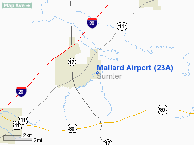
Mallard Airport
Address:
Sumter County, AL
Tel:
205-392-5231, 205-652-3400
Images
and information placed above are from
http://www.airport-data.com/airport/23A/
We
thank them for the data!
| General
Info |
| Country |
United
States |
| State |
ALABAMA
|
| FAA ID |
23A
|
| Latitude |
32-29-42.495N
|
| Longitude |
088-16-05.102W
|
| Elevation |
185 feet
|
| Near City |
YORK
|
We don't guarantee the information is fresh and accurate. The data may
be wrong or outdated.
For more up-to-date information please refer to other sources.
|
|


