 |
|
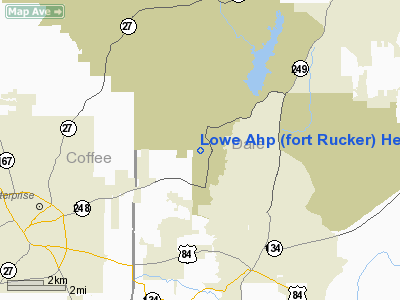
Lowe Ahp (fort Rucker) Heliport |
Location
& QuickFacts
|
FAA Information Effective: |
2007-01-18 |
|
Airport
Identifier: |
LOR |
|
Airport
Status: |
Operational |
|
Longitude/Latitude: |
085-45-04.2000W/31-21-21.0000N
-85.751167/31.355833 (Estimated) |
|
Elevation: |
244 ft / 74.37 m (Estimated) |
|
Land: |
0
acres |
|
From
nearest city: |
3 nautical miles W of Fort Rucker Ozark,
AL |
|
Location: |
Dale County, AL |
|
Magnetic Variation: |
03W (2005) |
Owner
& Manager
|
Ownership: |
Army owned |
|
Owner: |
Us Army Lowe Army Helipad |
|
Address: |
9325 Gunston Road
Ft Belvoir, VA 22060 |
|
Address: |
|
|
Phone number: |
205-255-2086 |
Airport
Operations and Facilities
|
Airport Use: |
Private |
|
Segmented
Circle: |
No |
|
Control
Tower: |
Yes |
|
Beacon
Color: |
Clear (unlighted land airport) |
|
Sectional
chart: |
New Orleans |
|
Region: |
ASO - Southern |
|
Traffic
Pattern Alt: |
800 ft |
|
Boundary
ARTCC: |
ZJX - Jacksonville |
|
Tie-in
FSS: |
OZR - Cairns Baseops |
|
FSS
on Airport: |
No |
|
FSS
Phone: |
205-255-2314 |
|
NOTAMs
Facility: |
OZR (NOTAM-d service avaliable) |
|
Runway
Information
Runway 06L/24R
|
Dimension: |
2000 x 75 ft / 609.6 x 22.9 m |
|
Surface: |
ASPH, |
|
Pavement
Class: |
7 /R/C/W/T |
|
Edge
Lights: |
Low |
|
|
Runway 06L |
Runway 24R |
|
Traffic
Pattern: |
Left |
Left |
|
Runway 06R/24L
|
Dimension: |
2000 x 75 ft / 609.6 x 22.9 m |
|
Surface: |
ASPH, |
|
Pavement
Class: |
9 /R/C/W/T |
|
Edge
Lights: |
Low |
|
|
Runway 06R |
Runway 24L |
|
Traffic
Pattern: |
Left |
Left |
|
Runway 18L/36R
|
Dimension: |
2000 x 75 ft / 609.6 x 22.9 m |
|
Surface: |
ASPH, |
|
Pavement
Class: |
5 /F/B/W/T |
|
Edge
Lights: |
Low |
|
|
Runway 18L |
Runway 36R |
|
Traffic
Pattern: |
Left |
Left |
|
Runway 18R/36L
|
Dimension: |
2000 x 75 ft / 609.6 x 22.9 m |
|
Surface: |
ASPH, |
|
Pavement
Class: |
7 /F/B/W/T |
|
Edge
Lights: |
Low |
|
|
Runway 18R |
Runway 36L |
|
Traffic
Pattern: |
Left |
Left |
|
Radio Navigation
Aids
|
ID |
Type |
Name |
Ch |
Freq |
Var |
Dist |
|
LOR |
NDB |
Lowe |
|
269.00 |
03W |
0.5 nm |
|
HYE |
NDB |
Hanchey |
|
221.00 |
00E |
5.2 nm |
|
OZ |
NDB |
Ruckr |
|
212.00 |
00E |
8.5 nm |
|
BVG |
NDB |
Boll Weevil |
|
352.00 |
03E |
12.0 nm |
|
XNE |
NDB |
Spring Hill |
|
281.00 |
00E |
22.8 nm |
|
XBR |
NDB |
Brantley |
|
410.00 |
00E |
30.4 nm |
|
BKK |
NDB |
Tri County |
|
275.00 |
02W |
31.3 nm |
|
JUY |
NDB |
Judd |
|
264.00 |
02W |
33.0 nm |
|
TO |
NDB |
Blood |
|
365.00 |
01W |
33.8 nm |
|
SMY |
NDB |
Soyya |
|
329.00 |
02W |
39.8 nm |
|
IWJ |
NDB |
Blaak |
|
344.00 |
03W |
48.2 nm |
|
HEY |
VOR |
Hanchey |
|
110.60 |
02E |
5.2 nm |
|
EDN |
VOR |
Enterprise |
|
116.60 |
03W |
8.6 nm |
|
FYL |
VOR |
Tri County |
|
108.40 |
08W |
31.8 nm |
|
UIA |
VOR |
Andalusia |
|
110.20 |
00E |
33.0 nm |
|
OZR |
VOR/DME |
Cairns |
049X |
111.20 |
02E |
5.4 nm |
|
RRS |
VORTAC |
Wiregrass |
053X |
111.60 |
02E |
17.0 nm |
|
MAI |
VORTAC |
Marianna |
087X |
114.00 |
00E |
47.0 nm |
|
EUF |
VORTAC |
Eufaula |
029X |
109.20 |
02E |
47.8 nm |
Remarks
- HELIPADS
LOCATED ON ENDS OF RWYS.
- FUEL:
J8
- SEE
FLIP AP/1, FLT HAZ, FORT RUCKER.
- RSTD
- NO TRAN ACFT. NO USABLE RWY ON LOWE AHP AT THIS TIME.
- CAUTION:
INTS STU TRNG.
Lowe Ahp (fort Rucker) Heliport
Address:
Dale County, AL
Tel:
205-255-2086
Images
and information placed above are from
http://www.airport-data.com/airport/LOR/
We
thank them for the data!
| General
Info |
| Country |
United
States |
| State |
ALABAMA
|
| FAA ID |
LOR
|
| Latitude |
31-21-00.615N
|
| Longitude |
085-44-59.769W
|
| Elevation |
244 feet
|
| Near City |
FORT RUCKER
OZARK |
We don't guarantee the information is fresh and accurate. The data may
be wrong or outdated.
For more up-to-date information please refer to other sources.
|
|


