 |
|
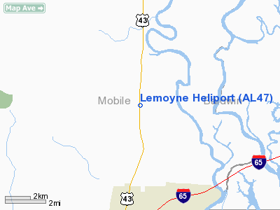
Location
& QuickFacts
|
FAA Information Effective: |
2007-01-18 |
|
Airport
Identifier: |
AL47 |
|
Airport
Status: |
Operational |
|
Longitude/Latitude: |
088-01-34.9960W/30-58-18.6540N
-88.026388/30.971848 (Estimated) |
|
Elevation: |
40
ft / 12.19 m (Estimated) |
|
Land: |
0
acres |
|
From
nearest city: |
2 nautical miles N of Axis, AL |
|
Location: |
Mobile County, AL |
|
Magnetic Variation: |
01E (1990) |
Owner
& Manager
|
Ownership: |
Privately owned |
|
Owner: |
Lemoyne Industrial Park |
|
Address: |
P.o. Box 525
Axis, AL 36505 |
|
Phone
number: |
205-679-5215 |
|
Manager: |
W. O. Green |
|
Address: |
P.o. Box 525, U.s. Hwy 43
Axis, AL 36505 |
|
Phone number: |
205-679-5215 |
Airport
Operations and Facilities
|
Airport Use: |
Private |
|
Wind
indicator: |
Yes |
|
Segmented
Circle: |
No |
|
Control
Tower: |
No |
|
Sectional
chart: |
New Orleans |
|
Region: |
ASO - Southern |
|
Boundary
ARTCC: |
ZHU - Houston |
|
Tie-in
FSS: |
ANB - Anniston |
|
FSS
on Airport: |
No |
|
FSS
Toll Free: |
1-800-WX-BRIEF |
|
Runway Information
Helipad H1
|
Dimension: |
30
x 30 ft / 9.1 x 9.1 m |
|
Surface: |
CONC, |
|
|
Runway H1 |
Runway |
|
Traffic
Pattern: |
Left |
Left |
|
Radio Navigation
Aids
|
ID |
Type |
Name |
Ch |
Freq |
Var |
Dist |
|
MO |
NDB |
Wisle |
|
248.00 |
02E |
19.1 nm |
|
ESU |
NDB |
Summerdale |
|
204.00 |
01E |
32.4 nm |
|
NUN |
VOR |
Saufley |
|
108.80 |
01E |
46.6 nm |
|
BFM |
VORTAC |
Brookley |
075X |
112.80 |
04E |
21.6 nm |
|
SJI |
VORTAC |
Semmes |
100X |
115.30 |
05E |
22.7 nm |
|
GCV |
VORTAC |
Greene County |
104X |
115.70 |
05E |
24.9 nm |
|
MVC |
VORTAC |
Monroeville |
115X |
116.80 |
04E |
45.4 nm |
Remarks
- PRVDD
VFR/PR USE; AREA IS MARKED; WIND INDICATOR MNTND; APCH/DEP ROUTE ARE
210-330 DEG.
Lemoyne Heliport
Address:
Mobile County, AL
Tel:
205-679-5215
Images
and information placed above are from
http://www.airport-data.com/airport/AL47/
We
thank them for the data!
| General
Info |
| Country |
United
States |
| State |
ALABAMA
|
| FAA ID |
AL47
|
| Latitude |
30-58-18.654N
|
| Longitude |
088-01-34.996W
|
| Elevation |
40 feet
|
| Near City |
AXIS
|
We don't guarantee the information is fresh and accurate. The data may
be wrong or outdated.
For more up-to-date information please refer to other sources.
|
|


