 |
|
Lawrence County Hospital Heliport |
|
|
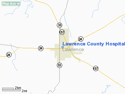
Location
& QuickFacts
|
FAA Information Effective: |
2007-01-18 |
|
Airport
Identifier: |
AL86 |
|
Airport
Status: |
Operational |
|
Longitude/Latitude: |
087-17-11.0710W/34-29-02.3420N
-87.286409/34.483984 (Estimated) |
|
Elevation: |
650 ft / 198.12 m (Estimated) |
|
Land: |
1
acres |
|
From
nearest city: |
0 nautical miles NE of Moulton, AL |
|
Location: |
Lawrence County, AL |
|
Magnetic Variation: |
00E (1985) |
Owner
& Manager
|
Ownership: |
Privately owned |
|
Owner: |
Lawrence County Hospital |
|
Address: |
Po Box 39
Moulton, AL 35650 |
|
Phone number: |
256-974-2200 |
|
Manager: |
Lawrence County Hospital |
|
Address: |
Po Box 39
Moulton, AL 35650 |
|
Phone number: |
256-974-2200 |
Airport
Operations and Facilities
|
Airport Use: |
Private
MEDICAL USE ONLY. |
|
Wind
indicator: |
Yes |
|
Segmented
Circle: |
No |
|
Control
Tower: |
No |
|
Lighting
Schedule: |
PHONE REQ
FOR PERIMETER LIGHTS CALL 205-974-2200. |
|
Beacon
Color: |
Clear-Green-Yellow (heliport) |
|
Sectional
chart: |
Atlanta |
|
Region: |
ASO - Southern |
|
Boundary
ARTCC: |
ZME - Memphis |
|
Tie-in
FSS: |
ANB - Anniston |
|
FSS
on Airport: |
No |
|
FSS
Toll Free: |
1-800-WX-BRIEF |
|
Runway Information
Helipad H1
|
Dimension: |
30
x 30 ft / 9.1 x 9.1 m |
|
Surface: |
CONC, |
|
|
Runway H1 |
Runway |
|
Traffic
Pattern: |
Left |
Left |
|
Markings: |
Basic, |
, |
|
Radio Navigation
Aids
|
ID |
Type |
Name |
Ch |
Freq |
Var |
Dist |
|
CPP |
NDB |
Cole Spring |
|
230.00 |
01W |
24.0 nm |
|
CWH |
NDB |
Capshaw |
|
350.00 |
01W |
30.5 nm |
|
HUA |
NDB |
Redstone |
|
287.00 |
00W |
32.3 nm |
|
GZS |
NDB |
Giles/dcmsnd |
|
375.00 |
00E |
41.7 nm |
|
LRT |
NDB |
Lawrenceburg |
|
269.00 |
00E |
45.2 nm |
|
DCU |
VOR/DME |
Decatur |
075X |
112.80 |
01W |
19.8 nm |
|
MSL |
VORTAC |
Muscle Shoals |
112X |
116.50 |
01E |
16.8 nm |
|
RQZ |
VORTAC |
Rocket |
059X |
112.20 |
02E |
37.4 nm |
|
HAB |
VORTAC |
Hamilton |
041X |
110.40 |
02E |
40.0 nm |
|
HSV |
VOT |
Huntsville |
|
111.00 |
|
39.3 nm |
Remarks
- ALL
APPROACHES AND DEPARTURES ARE TO BE CONDUCTED FROM 230-360 DEG CLKWS
USING TOUCHDOWN PAD AS CENTER OF COMPASS ROSE.
- OPNS
ARE CONDUCTED FROM 230-360 DEG, AREA IS MARKED AND WIND INDICATOR IS
MAINTAINED.
Lawrence County Hospital Heliport
Address:
Lawrence County, AL
Tel:
256-974-2200
Images
and information placed above are from
http://www.airport-data.com/airport/AL86/
We
thank them for the data!
| General
Info |
| Country |
United
States |
| State |
ALABAMA
|
| FAA ID |
AL86
|
| Latitude |
34-29-02.342N
|
| Longitude |
087-17-11.071W
|
| Elevation |
650 feet
|
| Near City |
MOULTON
|
We don't guarantee the information is fresh and accurate. The data may
be wrong or outdated.
For more up-to-date information please refer to other sources.
|
|


