|
|
Lawrence County Airport
Courtland Industrial Airpark |
 |
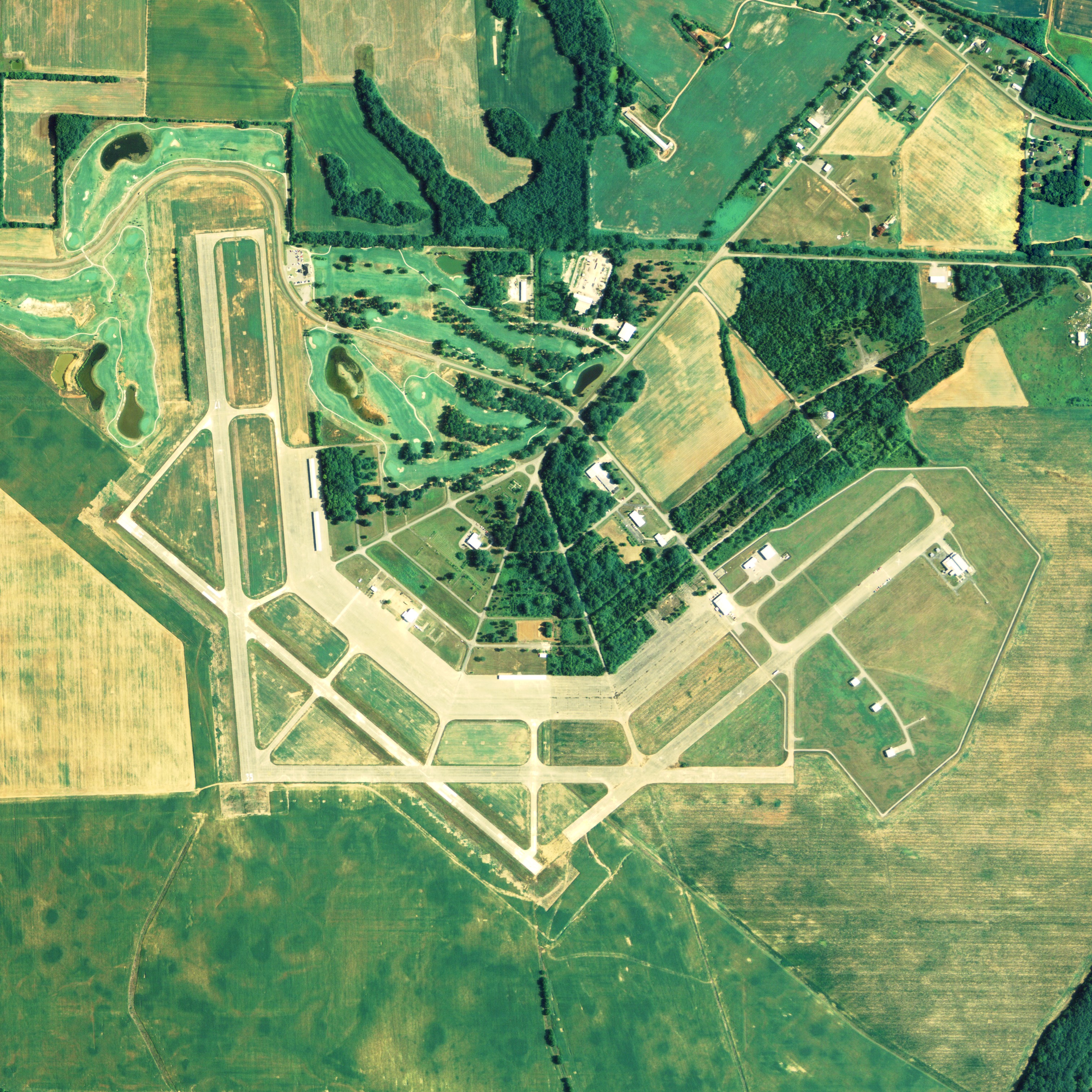
| NAIP aerial image, 29 June 2006 |
 |
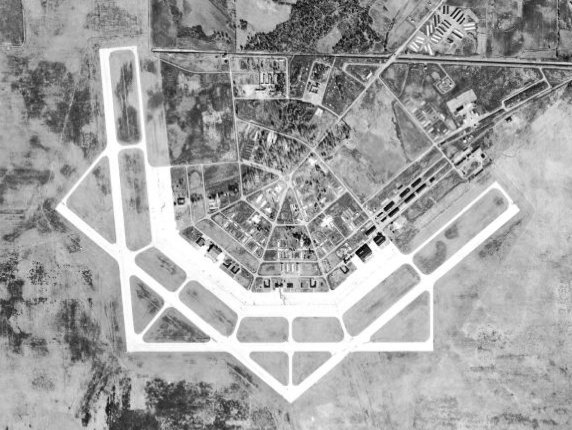
| Courtland Army Airfield, 28 December 1949 |
| IATA: none – ICAO: none – FAA LID: 9A4 |
| Summary |
| Airport type |
Public |
| Owner |
Lawrence County Commission |
| Serves |
Lawrence County, Alabama |
| Location |
Courtland, Alabama |
| Elevation AMSL |
588 ft / 179 m |
| Coordinates |
34°39′34″N 087°20′56″W / 34.65944°N 87.34889°W / 34.65944; -87.34889 |
| Runways |
| Direction |
Length |
Surface |
| ft |
m |
| 13/31 |
5,000 |
1,524 |
Concrete |
| 17/35 |
5,000 |
1,524 |
Concrete |
| Statistics (2008) |
| Aircraft operations |
11,900 |
| Based aircraft |
24 |
| Source: Federal Aviation Administration |
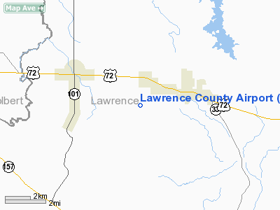
Lawrence County Airport (FAA LID: 9A4) is a public use airport in Lawrence County, Alabama, United States. It is located two nautical miles (3.7 km) northeast of the central business district of Courtland, Alabama. The airport is owned by the Lawrence County Commission. According to the FAA's National Plan of Integrated Airport Systems for 2009–2013, it is categorized as a general aviation facility. History
The area was acquired starting in 1942 and the airport was opened in 1944 as Courtland Army Airfield and was used by the United States Army Air Forces as a training base during World War II. Courtland was assiged to the Southeast Training Center of the Army Air Force Training Command. It was commanded by the 446th Army Air Force Base Unit.
Courtland AAF was the home of a Basic Flying School which utilized Vultee BT-13s for the Air Cadets as well as a specialized 4-Engine flying school that flew B-24s, and a school for transition from B-24s to B-29s school opened up in early 1945. Personnel were required to fire pistols or carbines for marksmanship training and practice gas attack drills. The chemical agents used during training were tear gas, mustard agent, chlorine gas, incendiary and smoke munitions.
At the end of the war the airfield was determined to be excess by the War Department in 1946 and was excessed. The site was returned to the State of Alabama by Quitclaim Deed in 1948.
Today, most everything but the runway, and several concrete slabs with 3 or 4 wide concrete steps are gone now. A golf course hugs the northeast to west perimeter.
Facilities and aircraft
Lawrence County Airport covers an area of 350 acres (142 ha) at an elevation of 588 feet (179 m) above mean sea level. It has two concrete paved runways designated 13/31 and 17/35, each measuring 5,000 by 150 feet (1,524 x 46 m).
For the 12-month period ending May 15, 2008, the airport had 11,900 aircraft operations, an average of 32 per day: 92% general aviation and 8% military. At that time there were 24 aircraft based at this airport: 92% single-engine and 8% multi-engine.
The above content comes from Wikipedia and is published under free licenses – click here to read more.
Location
& QuickFacts
|
FAA Information Effective: |
2007-01-18 |
|
Airport
Identifier: |
9A4 |
|
Airport
Status: |
Operational |
|
Longitude/Latitude: |
087-20-55.8000W/34-39-33.8000N
-87.348833/34.659389 (Estimated) |
|
Elevation: |
588 ft / 179.22 m (Estimated) |
|
Land: |
350 acres |
|
From
nearest city: |
2 nautical miles NE of Courtland, AL |
|
Location: |
Lawrence County, AL |
|
Magnetic Variation: |
00E (1980) |
Owner
& Manager
|
Ownership: |
Publicly owned |
|
Owner: |
Lawrence County Commission |
|
Address: |
P. O. Box 307
Moulton, AL 35650 |
|
Phone number: |
256-974-0663 |
|
Manager: |
Robert Mcclung |
|
Address: |
1390 Sanderson Lane
Courtland, AL 35618 |
|
Phone number: |
256-637-6000 |
Airport
Operations and Facilities
|
Airport Use: |
Open to public |
|
Wind
indicator: |
Yes |
|
Segmented
Circle: |
No |
|
Control
Tower: |
No |
|
Lighting
Schedule: |
DUSK-DAWN |
|
Beacon
Color: |
Clear-Green (lighted land airport) |
|
Sectional
chart: |
Atlanta |
|
Region: |
ASO - Southern |
|
Boundary
ARTCC: |
ZME - Memphis |
|
Tie-in
FSS: |
ANB - Anniston |
|
FSS
Toll Free: |
1-800-WX-BRIEF |
|
NOTAMs
Facility: |
ANB (NOTAM-d service avaliable) |
|
Federal Agreements: |
NGY |
Airport
Communications
|
CTAF: |
122.700 |
|
Unicom: |
122.700 |
Airport
Services
|
Fuel available: |
100LLA
FUEL CREDIT CARD DISPENSER. |
|
Power Plant Repair: |
MAJOR |
|
Runway Information
Runway 13/31
|
Dimension: |
5000 x 150 ft / 1524.0 x 45.7 m |
|
Surface: |
CONC, Good Condition
GRASS IN PAVEMENT JOINTS. |
|
Edge
Lights: |
Medium |
|
|
Runway 13 |
Runway 31 |
|
Longitude: |
087-21-12.9700W |
087-20-27.1900W |
|
Latitude: |
34-39-41.2500N |
34-39-09.4100N |
|
Elevation: |
580.00
ft |
571.00
ft |
|
Alignment: |
127 |
127 |
|
Traffic
Pattern: |
Left |
Left |
|
Markings: |
Non-precision instrument, Good Condition |
Non-precision instrument, Good Condition |
|
Runway 17/35
|
Dimension: |
5000 x 150 ft / 1524.0 x 45.7 m |
|
Surface: |
CONC, Good Condition
GRASS IN PAVEMENT JOINTS. |
|
|
Runway 17 |
Runway 35 |
|
Longitude: |
087-21-04.0059W |
087-20-59.0770W |
|
Latitude: |
34-40-06.6143N |
34-39-17.3260N |
|
Elevation: |
584.00
ft |
580.00
ft |
|
Alignment: |
127 |
127 |
|
Traffic
Pattern: |
Left |
Left |
|
Markings: |
Basic, Good Condition |
Basic, Good Condition |
|
Radio Navigation
Aids
|
ID |
Type |
Name |
Ch |
Freq |
Var |
Dist |
|
CWH |
NDB |
Capshaw |
|
350.00 |
01W |
29.0 nm |
|
CPP |
NDB |
Cole Spring |
|
230.00 |
01W |
31.4 nm |
|
HUA |
NDB |
Redstone |
|
287.00 |
00W |
32.7 nm |
|
GZS |
NDB |
Giles/dcmsnd |
|
375.00 |
00E |
32.9 nm |
|
LRT |
NDB |
Lawrenceburg |
|
269.00 |
00E |
34.9 nm |
|
TNY |
NDB |
Kelso |
|
358.00 |
01W |
49.0 nm |
|
DCU |
VOR/DME |
Decatur |
075X |
112.80 |
01W |
20.2 nm |
|
MSL |
VORTAC |
Muscle Shoals |
112X |
116.50 |
01E |
7.6 nm |
|
RQZ |
VORTAC |
Rocket |
059X |
112.20 |
02E |
36.3 nm |
|
HAB |
VORTAC |
Hamilton |
041X |
110.40 |
02E |
43.1 nm |
|
HSV |
VOT |
Huntsville |
|
111.00 |
|
34.4 nm |
Remarks
- RQ
ACFT AVOID 200 ACRE ORDNANCE PLANT LCTD 1 NM EAST OF THE INTERSECTION
OF RYS 17/35 AND 13/31.
- PRVDD
VFR USE ONLY.
Based
Aircraft
|
Aircraft
based on field: |
16 |
|
Single
Engine Airplanes: |
14 |
|
Multi
Engine Airplanes: |
2 |
Operational Statistics
Time Period: 2005-06-16
- 2006-06-15
|
Aircraft
Operations: |
229/Week |
|
General
Aviation Local: |
8.4% |
|
General
Aviation Itinerant: |
83.2% |
|
Military: |
8.4% |
Lawrence County Airport
Address:
Lawrence County, AL
Tel:
256-974-0663, 256-637-6000
Images
and information placed above are from
http://www.airport-data.com/airport/9A4/
We
thank them for the data!
| General
Info |
| Country |
United
States |
| State |
ALABAMA
|
| FAA ID |
9A4
|
| Latitude |
34-39-33.800N
|
| Longitude |
087-20-55.800W
|
| Elevation |
588 feet
|
| Near City |
COURTLAND
|
We don't guarantee the information is fresh and accurate. The data may
be wrong or outdated.
For more up-to-date information please refer to other sources.
|
|