 |
|
|
|
|
|
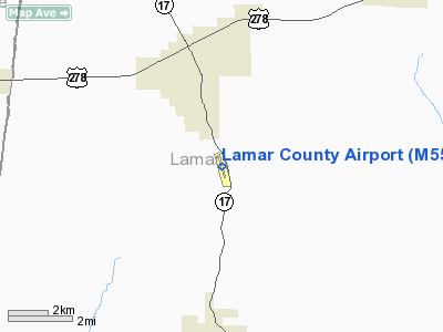
Location
& QuickFacts
|
FAA Information Effective: |
2007-01-18 |
|
Airport
Identifier: |
M55 |
|
Airport
Status: |
Operational |
|
Longitude/Latitude: |
088-06-55.7130W/33-50-48.1880N
-88.115476/33.846719 (Estimated) |
|
Elevation: |
463 ft / 141.12 m (Surveyed) |
|
Land: |
75
acres |
|
From
nearest city: |
6 nautical miles N of Vernon, AL |
|
Location: |
Lamar County, AL |
|
Magnetic Variation: |
01E (1985) |
Owner
& Manager
|
Ownership: |
Publicly owned |
|
Owner: |
Lamar County Comsn |
|
Address: |
Po Box 338
Vernon, AL 35592 |
|
Phone number: |
205-695-9119 |
|
Manager: |
Johnny Rodgers
PROBATE JUDGE |
|
Address: |
Po Box 338
Vernon, AL 35592 |
|
Phone number: |
205-695-9119 |
Airport
Operations and Facilities
|
Airport Use: |
Open to public |
|
Wind
indicator: |
Yes |
|
Segmented
Circle: |
No |
|
Control
Tower: |
No |
|
Lighting
Schedule: |
DUSK-DAWN
ACTVT MIRL RY 16/34-CTAF. |
|
Beacon
Color: |
Clear-Green (lighted land airport)
OTS INDEFLY. |
|
Landing
fee charge: |
No |
|
Sectional
chart: |
Memphis |
|
Region: |
ASO - Southern |
|
Boundary
ARTCC: |
ZME - Memphis |
|
Tie-in
FSS: |
ANB - Anniston |
|
FSS
on Airport: |
No |
|
FSS
Toll Free: |
1-800-WX-BRIEF |
|
NOTAMs
Facility: |
ANB (NOTAM-d service avaliable) |
Airport
Communications
Airport
Services
|
Airframe Repair: |
NONE |
|
Power Plant Repair: |
NONE |
|
Bottled
Oxygen: |
NONE |
|
Bulk
Oxygen: |
NONE |
|
Runway Information
Runway 16/34
|
Dimension: |
3613 x 75 ft / 1101.2 x 22.9 m |
|
Surface: |
ASPH, Fair Condition |
|
Weight
Limit: |
Single wheel: 16000 lbs. |
|
Edge
Lights: |
Medium |
|
|
Runway 16 |
Runway 34 |
|
Longitude: |
088-07-01.0110W |
088-06-50.3650W |
|
Latitude: |
33-51-05.5050N |
33-50-30.8840N |
|
Elevation: |
463.00
ft |
457.00
ft |
|
Alignment: |
127 |
127 |
|
Traffic
Pattern: |
Left |
Left |
|
Markings: |
Nonstandard, Good Condition
CNTRLN MARKINGS ONLY. |
Nonstandard, Good Condition
CNTRLN MARKINGS ONLY. |
|
VASI: |
pulsating/steady burning on left side |
pulsating/steady burning on left side |
|
Obstruction: |
, 50:1 slope to clear
+5 FT BRUSH 82 FT TO 127 FT R OF CNTRLN, 91 FT TO 167 FT FM
RY END. |
32 ft trees, 317.0 ft from runway, 21 ft right
of centerline, 3:1 slope to clear
+ 6 FT TO + 19 FT BRUSH, 92 FT TO 123 FT L OF CNTRLN, 155
FT TO 178 FT FM RWY END. |
|
Radio Navigation
Aids
|
ID |
Type |
Name |
Ch |
Freq |
Var |
Dist |
|
FDF |
NDB |
Fayette |
|
204.00 |
00E |
17.1 nm |
|
AIV |
NDB |
Aliceville |
|
254.00 |
|
44.2 nm |
|
STF |
NDB |
Bryan |
|
281.00 |
02E |
44.4 nm |
|
OTB |
VOR/DME |
Tupelo |
035X |
109.80 |
04E |
40.8 nm |
|
CBM |
VORTAC |
Caledonia |
099X |
115.20 |
00E |
20.3 nm |
|
HAB |
VORTAC |
Hamilton |
041X |
110.40 |
02E |
21.6 nm |
|
IGB |
VORTAC |
Bigbee |
109X |
116.20 |
04E |
29.5 nm |
|
LDK |
VORTAC |
Crimson |
125X |
117.80 |
03E |
45.7 nm |
Remarks
Based
Aircraft
|
Aircraft
based on field: |
4 |
|
Single
Engine Airplanes: |
4 |
Operational Statistics
Time Period: 2005-07-28
- 2006-07-27
|
Aircraft
Operations: |
31/Week |
|
General
Aviation Local: |
9.0% |
|
General
Aviation Itinerant: |
91.0% |
Lamar County Airport
Address:
Lamar County, AL
Tel:
205-695-9119
Images
and information placed above are from
http://www.airport-data.com/airport/M55/
We
thank them for the data!
| General
Info |
| Country |
United
States |
| State |
ALABAMA
|
| FAA ID |
M55
|
| Latitude |
33-50-48.188N
|
| Longitude |
088-06-55.713W
|
| Elevation |
463 feet
|
| Near City |
VERNON
|
We don't guarantee the information is fresh and accurate. The data may
be wrong or outdated.
For more up-to-date information please refer to other sources.
|
|


