 |
|
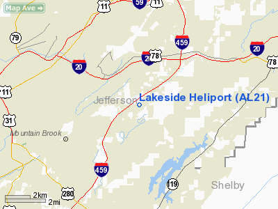
Location
& QuickFacts
|
FAA Information Effective: |
2007-01-18 |
|
Airport
Identifier: |
AL21 |
|
Airport
Status: |
Operational |
|
Longitude/Latitude: |
086-40-38.9530W/33-30-43.3770N
-86.677487/33.512049 (Estimated) |
|
Elevation: |
645 ft / 196.60 m (Estimated) |
|
Land: |
0
acres |
|
From
nearest city: |
1 nautical miles NE of Birmingham, AL |
|
Location: |
Jefferson County, AL |
|
Magnetic Variation: |
00W (1985) |
Owner
& Manager
|
Ownership: |
Privately owned |
|
Owner: |
Drummond Co, Incf |
|
Address: |
5109 East Lake Blvd
Birmingham, AL 35217 |
|
Phone
number: |
205-849-0751 |
|
Manager: |
Edwin Banks |
|
Address: |
5109 East Lake Blvd
Birmingham, AL 35217 |
|
Phone number: |
205-849-0751 |
Airport
Operations and Facilities
|
Airport Use: |
Private |
|
Wind
indicator: |
Yes |
|
Segmented
Circle: |
No |
|
Control
Tower: |
No |
|
Landing
fee charge: |
No |
|
Sectional
chart: |
Atlanta |
|
Region: |
ASO - Southern |
|
Boundary
ARTCC: |
ZTL - Atlanta |
|
Tie-in
FSS: |
ANB - Anniston |
|
FSS
on Airport: |
No |
|
FSS
Toll Free: |
1-800-WX-BRIEF |
|
Runway Information
Helipad H1
|
Dimension: |
80 x 45 ft / 24.4 x 13.7 m |
|
Surface: |
CONC, |
|
|
Runway H1 |
Runway |
|
Traffic
Pattern: |
Left |
Left |
|
Radio Navigation
Aids
|
ID |
Type |
Name |
Ch |
Freq |
Var |
Dist |
|
BH |
NDB |
Mcden |
|
224.00 |
01W |
8.4 nm |
|
BEQ |
NDB |
Bessemer |
|
368.00 |
00E |
17.2 nm |
|
PLR |
NDB |
Pell City |
|
257.00 |
01E |
21.6 nm |
|
SCD |
NDB |
Sylacauga |
|
284.00 |
03W |
27.2 nm |
|
GGY |
NDB |
Gragg-wade |
|
338.00 |
01E |
39.7 nm |
|
ARF |
NDB |
Saratoga |
|
296.00 |
02W |
50.0 nm |
|
TDG |
VOR/DME |
Talladega |
025X |
108.80 |
02E |
32.0 nm |
|
GAD |
VOR/DME |
Gadsden |
070X |
112.30 |
02E |
40.7 nm |
|
VUZ |
VORTAC |
Vulcan |
091X |
114.40 |
02E |
14.6 nm |
|
OKW |
VORTAC |
Brookwood |
047X |
111.00 |
00E |
33.1 nm |
|
LDK |
VORTAC |
Crimson |
125X |
117.80 |
03E |
45.7 nm |
|
BHM |
VOT |
Birmingham Muni |
|
110.00 |
|
5.0 nm |
Remarks
- VFR
PVT USE. COORD USE OF HELI WITH BHM GADO; ESTAB 2-WAY COMS WITH BHM
ATCT PRIOR TO ENTERING BHM ARPT CTL ZONE/TFC AREA & OBTAIN APPROVAL.
Lakeside Heliport
Address:
Jefferson County, AL
Tel:
205-849-0751
Images
and information placed above are from
http://www.airport-data.com/airport/AL21/
We
thank them for the data!
| General
Info |
| Country |
United
States |
| State |
ALABAMA
|
| FAA ID |
AL21
|
| Latitude |
33-30-43.377N
|
| Longitude |
086-40-38.953W
|
| Elevation |
645 feet
|
| Near City |
BIRMINGHAM
|
We don't guarantee the information is fresh and accurate. The data may
be wrong or outdated.
For more up-to-date information please refer to other sources.
|
|


