 |
|
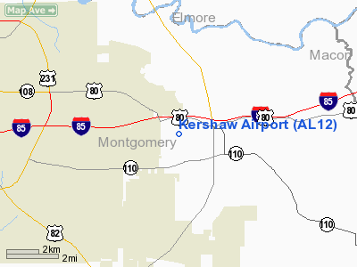
Location
& QuickFacts
|
FAA Information Effective: |
2007-01-18 |
|
Airport
Identifier: |
AL12 |
|
Airport
Status: |
Operational |
|
Longitude/Latitude: |
086-07-29.8670W/32-21-30.5010N
-86.124963/32.358472 (Estimated) |
|
Elevation: |
225 ft / 68.58 m (Surveyed) |
|
Land: |
0
acres |
|
From
nearest city: |
6 nautical miles E of Montgomery, AL |
|
Location: |
Montgomery County, AL |
|
Magnetic Variation: |
00W (1985) |
Owner
& Manager
|
Ownership: |
Privately owned |
|
Owner: |
Kershaw Mfg Company, Inc |
|
Address: |
P.o. Box 17340
Montgomery, AL 36117 |
|
Phone
number: |
205-271-1000 |
|
Manager: |
Royce Kershaw, Jr. |
|
Address: |
P.o. Box 17340
Montgomery, AL 36117 |
|
Phone number: |
205-271-1000 |
Airport
Operations and Facilities
|
Airport Use: |
Private |
|
Wind
indicator: |
Yes |
|
Segmented
Circle: |
No |
|
Control
Tower: |
No |
|
Lighting
Schedule: |
RDO-CTL
ACTVT MIRL RY 09/27 122.850. |
|
Sectional
chart: |
Atlanta |
|
Region: |
ASO - Southern |
|
Boundary
ARTCC: |
ZTL - Atlanta |
|
Tie-in
FSS: |
ANB - Anniston |
|
FSS
on Airport: |
No |
|
FSS
Toll Free: |
1-800-WX-BRIEF |
|
Runway Information
Runway 09/27
|
Dimension: |
4600 x 50 ft / 1402.1 x 15.2 m |
|
Surface: |
ASPH, |
|
Edge
Lights: |
Medium |
|
|
Runway 09 |
Runway 27 |
|
Traffic
Pattern: |
Left |
Left |
|
Obstruction: |
|
190 ft tower, 5200.0 ft from runway |
|
Radio Navigation
Aids
|
ID |
Type |
Name |
Ch |
Freq |
Var |
Dist |
|
TO |
NDB |
Blood |
|
365.00 |
01W |
31.8 nm |
|
DER |
NDB |
Alexander City |
|
382.00 |
01W |
32.4 nm |
|
GGY |
NDB |
Gragg-wade |
|
338.00 |
01E |
38.6 nm |
|
PRN |
NDB |
Persimmon/dcmsnd |
|
359.00 |
00E |
39.4 nm |
|
SE |
NDB |
Pollk |
|
344.00 |
01W |
41.1 nm |
|
XNE |
NDB |
Spring Hill |
|
281.00 |
00E |
41.2 nm |
|
XBR |
NDB |
Brantley |
|
410.00 |
00E |
48.6 nm |
|
SCD |
NDB |
Sylacauga |
|
284.00 |
03W |
50.0 nm |
|
MXF |
TACAN |
Maxwell |
097X |
|
03E |
12.4 nm |
|
TGE |
VOR/DME |
Tuskegee |
120X |
117.30 |
02E |
24.3 nm |
|
JYU |
VOR/DME |
Junior |
083X |
113.60 |
01W |
44.0 nm |
|
MGM |
VORTAC |
Montgomery |
058X |
112.10 |
03E |
12.8 nm |
Remarks
- PVT
USE; VFR WX CONDS ONLY. ALL OPERATIONS CONDUCTED SOUTH OF RWY &
RWY CENTERLINE EXTENDED.
Based
Aircraft
|
Aircraft
based on field: |
1 |
|
Multi
Engine Airplanes: |
1 |
Kershaw Airport
Address:
Montgomery County, AL
Tel:
205-271-1000
Images
and information placed above are from
http://www.airport-data.com/airport/AL12/
We
thank them for the data!
| General
Info |
| Country |
United
States |
| State |
ALABAMA
|
| FAA ID |
AL12
|
| Latitude |
32-21-30.501N
|
| Longitude |
086-07-29.867W
|
| Elevation |
225 feet
|
| Near City |
MONTGOMERY
|
We don't guarantee the information is fresh and accurate. The data may
be wrong or outdated.
For more up-to-date information please refer to other sources.
|
|


