 |
|
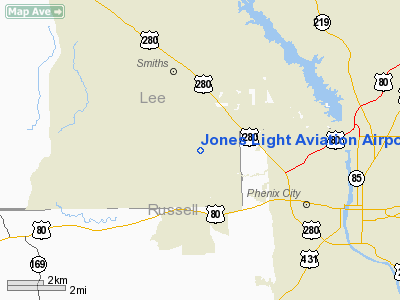
Jones Light Aviation Airport |
Location
& QuickFacts
|
FAA Information Effective: |
2007-01-18 |
|
Airport
Identifier: |
AL56 |
|
Airport
Status: |
Operational |
|
Longitude/Latitude: |
085-04-59.7670W/32-30-00.5070N
-85.083269/32.500141 (Estimated) |
|
Elevation: |
440 ft / 134.11 m (Estimated) |
|
Land: |
8
acres |
|
From
nearest city: |
6 nautical miles SE of Smiths, AL |
|
Location: |
Lee County, AL |
|
Magnetic Variation: |
01W (1985) |
Owner
& Manager
|
Ownership: |
Privately owned |
|
Owner: |
Joseph R. Jones |
|
Address: |
4160 Lee Rd 430
Smiths, AL 36877 |
|
Phone number: |
205-298-7107 |
|
Manager: |
Joseph R. Jones |
|
Address: |
4160 Lee Rd 430
Smiths, AL 36877 |
|
Phone number: |
205-298-7107 |
Airport
Operations and Facilities
|
Airport Use: |
Private |
|
Wind
indicator: |
Yes |
|
Segmented
Circle: |
No |
|
Control
Tower: |
No |
|
Landing
fee charge: |
No |
|
Sectional
chart: |
Atlanta |
|
Region: |
ASO - Southern |
|
Boundary
ARTCC: |
ZTL - Atlanta |
|
Tie-in
FSS: |
ANB - Anniston |
|
FSS
on Airport: |
No |
|
FSS
Toll Free: |
1-800-WX-BRIEF |
|
Runway Information
Runway 05/23
|
Dimension: |
2000 x 100 ft / 609.6 x 30.5 m |
|
Surface: |
TURF, |
|
|
Runway 05 |
Runway 23 |
|
Traffic
Pattern: |
Left |
Left |
|
Obstruction: |
15
ft road |
, 600.0 ft from runway |
|
Radio Navigation
Aids
|
ID |
Type |
Name |
Ch |
Freq |
Var |
Dist |
|
AWS |
NDB |
Lawson |
|
335.00 |
02W |
12.8 nm |
|
PIM |
NDB |
Pine Mountain |
|
272.00 |
03W |
23.2 nm |
|
EQQ |
NDB |
Coweta County |
|
234.00 |
03W |
49.2 nm |
|
DER |
NDB |
Alexander City |
|
382.00 |
01W |
49.9 nm |
|
LSF |
VOR/DME |
Lawson |
051X |
111.40 |
02W |
11.1 nm |
|
TGE |
VOR/DME |
Tuskegee |
120X |
117.30 |
02E |
29.7 nm |
|
CSG |
VORTAC |
Columbus |
118X |
117.10 |
01E |
7.7 nm |
|
EUF |
VORTAC |
Eufaula |
029X |
109.20 |
02E |
33.1 nm |
|
LGC |
VORTAC |
Lagrange |
103X |
115.60 |
01E |
33.6 nm |
Remarks
Based
Aircraft
|
Aircraft
based on field: |
7 |
|
Single
Engine Airplanes: |
5 |
|
Ultralights: |
2 |
Jones Light Aviation Airport
Address:
Lee County, AL
Tel:
205-298-7107
Images
and information placed above are from
http://www.airport-data.com/airport/AL56/
We
thank them for the data!
| General
Info |
| Country |
United
States |
| State |
ALABAMA
|
| FAA ID |
AL56
|
| Latitude |
32-30-00.507N
|
| Longitude |
085-04-59.767W
|
| Elevation |
440 feet
|
| Near City |
SMITHS
|
We don't guarantee the information is fresh and accurate. The data may
be wrong or outdated.
For more up-to-date information please refer to other sources.
|
|


