 |
|
Location
& QuickFacts
|
FAA Information Effective: |
2007-01-18 |
|
Airport
Identifier: |
0AL3 |
|
Airport
Status: |
Operational |
|
Longitude/Latitude: |
086-56-25.0000W/31-25-50.0000N
-86.940278/31.430556 (Estimated) |
|
Elevation: |
295 ft / 89.92 m (Estimated) |
|
Land: |
0
acres |
|
From
nearest city: |
1 nautical miles NW of Evergreen, AL |
|
Location: |
Conecuh County, AL |
|
Magnetic Variation: |
00E (1990) |
Owner
& Manager
|
Ownership: |
Privately owned |
|
Owner: |
Evergreen Hospital |
|
Address: |
101 Crestview Avenue
Evergreen, AL 36401 |
|
Phone number: |
205-578-2480 |
|
Manager: |
Evergreen Hospital |
|
Address: |
101 Crestview Avenue
Evergreen, AL 36401 |
|
Phone number: |
205-578-2480 |
Airport
Operations and Facilities
|
Airport Use: |
Private
MEDICAL USE. |
|
Segmented
Circle: |
No |
|
Control
Tower: |
No |
|
Sectional
chart: |
New Orleans |
|
Region: |
ASO - Southern |
|
Boundary
ARTCC: |
ZJX - Jacksonville |
|
Tie-in
FSS: |
ANB - Anniston |
|
FSS
on Airport: |
No |
|
FSS
Toll Free: |
1-800-WX-BRIEF |
|
Runway Information
Helipad H1
|
Dimension: |
24
x 24 ft / 7.3 x 7.3 m |
|
Surface: |
CONC, |
|
|
Runway H1 |
Runway |
|
Traffic
Pattern: |
Left |
Left |
|
Radio Navigation
Aids
|
ID |
Type |
Name |
Ch |
Freq |
Var |
Dist |
|
JUY |
NDB |
Judd |
|
264.00 |
02W |
29.2 nm |
|
PRN |
NDB |
Persimmon/dcmsnd |
|
359.00 |
00E |
30.3 nm |
|
XBR |
NDB |
Brantley |
|
410.00 |
00E |
34.1 nm |
|
TO |
NDB |
Blood |
|
365.00 |
01W |
49.0 nm |
|
BVG |
NDB |
Boll Weevil |
|
352.00 |
03E |
49.4 nm |
|
NSE |
TACAN |
Whiting |
070X |
|
01E |
42.7 nm |
|
NGS |
TACAN |
Santa Rosa |
063X |
|
01E |
49.0 nm |
|
UIA |
VOR |
Andalusia |
|
110.20 |
00E |
29.1 nm |
|
MVC |
VORTAC |
Monroeville |
115X |
116.80 |
04E |
21.2 nm |
|
CEW |
VORTAC |
Crestview |
106X |
115.90 |
03E |
38.7 nm |
Remarks
- PRVDD
PR USE; ALL APCH/DEP ARE FROM 220-330 DEGS; TKOF/LNDG MKD; & WIND
INDICATOR MNTND.
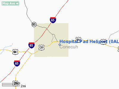
Hospital Pad Heliport
Address:
Conecuh County, AL
Tel:
205-578-2480
Images
and information placed above are from
http://www.airport-data.com/airport/0AL3/
We
thank them for the data!
| General
Info |
| Country |
United
States |
| State |
ALABAMA
|
| FAA ID |
0AL3
|
| Latitude |
31-25-50.000N
|
| Longitude |
086-56-25.000W
|
| Elevation |
295 feet
|
| Near City |
EVERGREEN
|
We don't guarantee the information is fresh and accurate. The data may
be wrong or outdated.
For more up-to-date information please refer to other sources.
|
|


