 |
|
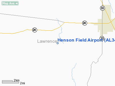
Location
& QuickFacts
|
FAA
Information Effective: |
2007-01-18 |
|
Airport
Identifier: |
AL34 |
|
Airport
Status: |
Operational |
|
Longitude/Latitude: |
087-23-10.0780W/34-26-49.3440N
-87.386133/34.447040 (Estimated) |
|
Elevation: |
685 ft / 208.79 m (Estimated) |
|
Land: |
73 acres |
|
From
nearest city: |
4 nautical miles SW of Moulton, AL |
|
Location: |
Lawrence County, AL |
|
Magnetic Variation: |
00E (1985) |
Owner & Manager
|
Ownership: |
Privately owned |
|
Owner: |
Buddy Washington |
|
Address: |
14797 County Road 7
Moulton, AL 35650 |
|
Phone number: |
205-974-4800 |
|
Manager: |
Buddy Washington |
|
Address: |
14797 County Road 7
Moulton, AL 35650 |
Airport
Operations and Facilities
|
Airport
Use: |
Private |
|
Wind
indicator: |
Yes |
|
Segmented Circle: |
Yes |
|
Control
Tower: |
No |
|
Landing
fee charge: |
No |
|
Sectional chart: |
Atlanta |
|
Region: |
ASO - Southern |
|
Boundary
ARTCC: |
ZME - Memphis |
|
Tie-in FSS: |
ANB - Anniston |
|
FSS on Airport: |
No |
|
FSS Toll Free: |
1-800-WX-BRIEF |
Airport
Communications
Airport
Services
|
Airframe
Repair: |
MINOR |
|
Power
Plant Repair: |
MINOR |
|
Runway Information
Runway 09/27
|
Dimension: |
3500
x 30 ft / 1066.8 x 9.1 m |
|
Surface: |
TURF, |
|
|
Runway 09 |
Runway 27 |
|
Traffic
Pattern: |
Left |
Right |
|
Radio Navigation
Aids
|
ID |
Type |
Name |
Ch |
Freq |
Var |
Dist |
|
CPP |
NDB |
Cole Spring |
|
230.00 |
01W |
28.3 nm |
|
CWH |
NDB |
Capshaw |
|
350.00 |
01W |
35.9 nm |
|
HUA |
NDB |
Redstone |
|
287.00 |
00W |
37.7 nm |
|
GZS |
NDB |
Giles/dcmsnd |
|
375.00 |
00E |
45.3 nm |
|
LRT |
NDB |
Lawrenceburg |
|
269.00 |
00E |
47.8 nm |
|
FDF |
NDB |
Fayette |
|
204.00 |
00E |
48.9 nm |
|
DCU |
VOR/DME |
Decatur |
075X |
112.80 |
01W |
25.2 nm |
|
MSL |
VORTAC |
Muscle Shoals |
112X |
116.50 |
01E |
16.5 nm |
|
HAB |
VORTAC |
Hamilton |
041X |
110.40 |
02E |
34.6 nm |
|
RQZ |
VORTAC |
Rocket |
059X |
112.20 |
02E |
42.8 nm |
|
HSV |
VOT |
Huntsville |
|
111.00 |
|
44.2 nm |
Remarks
- GLIDERS
ON AND INVOF ARPT.
- VFR;
PVT USE ONLY.
Based
Aircraft
|
Aircraft
based on field: |
5 |
|
Single
Engine Airplanes: |
1 |
|
Gliders: |
4 |
Henson Field Airport
Address:
Lawrence County, AL
Tel:
205-974-4800
Images
and information placed above are from
http://www.airport-data.com/airport/AL34/
We
thank them for the data!
| General
Info |
| Country |
United
States |
| State |
ALABAMA
|
| FAA ID |
AL34 |
| Latitude |
34-26-49.344N
|
| Longitude |
087-23-10.078W
|
| Elevation |
685 feet
|
| Near City |
MOULTON
|
We don't guarantee the information is fresh and accurate. The data may
be wrong or outdated.
For more up-to-date information please refer to other sources.
|
|


