 |
|
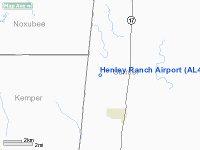
Location
& QuickFacts
|
FAA Information Effective: |
2007-01-18 |
|
Airport
Identifier: |
AL43 |
|
Airport
Status: |
Operational |
|
Longitude/Latitude: |
088-20-00.1200W/32-54-30.4650N
-88.333367/32.908462 (Estimated) |
|
Elevation: |
200 ft / 60.96 m (Estimated) |
|
Land: |
60
acres |
|
From
nearest city: |
4 nautical miles NW of Geiger, AL |
|
Location: |
Sumter County, AL |
|
Magnetic Variation: |
01E (1985) |
Owner
& Manager
|
Ownership: |
Privately owned |
|
Owner: |
T. W. Henley |
|
Address: |
Rt 1, Box 131
Emelle, AL 35459 |
|
Phone number: |
205-455-2419 |
|
Manager: |
Alan Henley |
|
Address: |
Rt 1, Box 131
Emelle, AL 35459 |
|
Phone number: |
205-455-2405 |
Airport
Operations and Facilities
|
Airport Use: |
Private |
|
Wind
indicator: |
Yes |
|
Segmented
Circle: |
Yes |
|
Control
Tower: |
No |
|
Sectional
chart: |
Memphis |
|
Region: |
ASO - Southern |
|
Boundary
ARTCC: |
ZME - Memphis |
|
Tie-in
FSS: |
ANB - Anniston |
|
FSS
Toll Free: |
1-800-WX-BRIEF |
|
Runway Information
Runway 10/28
|
Dimension: |
3000 x 50 ft / 914.4 x 15.2 m |
|
Surface: |
TURF, |
|
|
Runway 10 |
Runway 28 |
|
Traffic
Pattern: |
Left |
Left |
|
Radio Navigation
Aids
|
ID |
Type |
Name |
Ch |
Freq |
Var |
Dist |
|
AIV |
NDB |
Aliceville |
|
254.00 |
|
14.4 nm |
|
RZO |
NDB |
Marengo |
|
391.00 |
01E |
33.8 nm |
|
EOG |
NDB |
Greensboro |
|
417.00 |
01E |
38.6 nm |
|
LMS |
NDB |
Louisville |
|
212.00 |
00E |
39.3 nm |
|
MPE |
NDB |
Philadelphia |
|
219.00 |
01E |
40.5 nm |
|
STF |
NDB |
Bryan |
|
281.00 |
02E |
40.8 nm |
|
ME |
NDB |
Savoy |
|
356.00 |
01E |
45.5 nm |
|
BCZ |
NDB |
Choctaw |
|
228.00 |
01E |
48.9 nm |
|
NMM |
TACAN |
Meridian |
056X |
|
01E |
22.5 nm |
|
NJW |
TACAN |
Joe Williams |
61Y |
|
01E |
26.2 nm |
|
EWA |
VORTAC |
Kewanee |
085X |
113.80 |
04E |
33.2 nm |
|
IGB |
VORTAC |
Bigbee |
109X |
116.20 |
04E |
35.8 nm |
|
MEI |
VORTAC |
Meridian |
117X |
117.00 |
05E |
39.8 nm |
|
CBM |
VORTAC |
Caledonia |
099X |
115.20 |
00E |
44.4 nm |
|
LDK |
VORTAC |
Crimson |
125X |
117.80 |
03E |
45.3 nm |
Remarks
Based
Aircraft
|
Aircraft
based on field: |
9 |
|
Single
Engine Airplanes: |
7 |
|
Multi
Engine Airplanes: |
1 |
|
Helicopters: |
1 |
Henley Ranch Airport
Address:
Sumter County, AL
Tel:
205-455-2419, 205-455-2405
Images
and information placed above are from
http://www.airport-data.com/airport/AL43/
We
thank them for the data!
| General
Info |
| Country |
United
States |
| State |
ALABAMA
|
| FAA ID |
AL43
|
| Latitude |
32-54-30.465N
|
| Longitude |
088-20-00.120W
|
| Elevation |
200 feet
|
| Near City |
GEIGER
|
We don't guarantee the information is fresh and accurate. The data may
be wrong or outdated.
For more up-to-date information please refer to other sources.
|
|


