 |
|
Location
& QuickFacts
|
FAA Information Effective: |
2007-01-18 |
|
Airport
Identifier: |
AL27 |
|
Airport
Status: |
Operational |
|
Longitude/Latitude: |
085-33-56.8580W/34-06-20.3500N
-85.565794/34.105653 (Estimated) |
|
Elevation: |
610 ft / 185.93 m (Estimated) |
|
Land: |
0
acres |
|
From
nearest city: |
7 nautical miles SE of Centre, AL |
|
Location: |
Cherokee County, AL |
|
Magnetic Variation: |
01W (1985) |
Owner
& Manager
|
Ownership: |
Privately owned |
|
Owner: |
Donald Ray Smith Jr. |
|
Address: |
7785 Hwy 411 N.
Centre, AL 35960 |
|
Phone number: |
256-475-6823 |
|
Manager: |
Donald Ray Smith Jr. |
|
Address: |
7785 Hwy 411 N.
Centre, AL 35960 |
|
Phone number: |
256-475-6823 |
Airport
Operations and Facilities
|
Airport Use: |
Private
PERSONAL USE ONLY. |
|
Wind
indicator: |
Yes |
|
Segmented
Circle: |
No |
|
Control
Tower: |
No |
|
Sectional
chart: |
Atlanta |
|
Region: |
ASO - Southern |
|
Boundary
ARTCC: |
ZTL - Atlanta |
|
Tie-in
FSS: |
ANB - Anniston |
|
FSS
Toll Free: |
1-800-WX-BRIEF |
|
Runway Information
Runway 18/36
|
Dimension: |
2000 x 50 ft / 609.6 x 15.2 m |
|
Surface: |
TURF, |
|
|
Runway 18 |
Runway 36 |
|
Traffic
Pattern: |
Left |
Left |
|
Radio Navigation
Aids
|
ID |
Type |
Name |
Ch |
Freq |
Var |
Dist |
|
OYD |
NDB |
Floyd |
|
388.00 |
02W |
23.1 nm |
|
FTP |
NDB |
Fort Payne |
|
426.00 |
01W |
25.5 nm |
|
ARF |
NDB |
Saratoga |
|
296.00 |
02W |
33.9 nm |
|
EVZ |
NDB |
Cartersville |
|
308.00 |
04W |
36.4 nm |
|
OUK |
NDB |
Calhoun |
|
323.00 |
02W |
36.4 nm |
|
GPQ |
NDB |
Carrollton |
|
278.00 |
02W |
39.0 nm |
|
PLR |
NDB |
Pell City |
|
257.00 |
01E |
47.4 nm |
|
GAD |
VOR/DME |
Gadsden |
070X |
112.30 |
02E |
26.9 nm |
|
TDG |
VOR/DME |
Talladega |
025X |
108.80 |
02E |
39.8 nm |
|
RMG |
VORTAC |
Rome |
101X |
115.40 |
01E |
22.5 nm |
Remarks
- PRVDD
OPNS CONDUCTED IN VFR WEATHER CONDITIONS LNDG FOR PRIVATE USE.
Based Aircraft
|
Aircraft
based on field: |
1 |
|
Single
Engine Airplanes: |
1 |
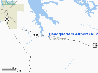
Headquarters Airport
Address:
Cherokee County, AL
Tel:
256-475-6823
Images
and information placed above are from
http://www.airport-data.com/airport/AL27/
We
thank them for the data!
| General
Info |
| Country |
United
States |
| State |
ALABAMA
|
| FAA ID |
AL27
|
| Latitude |
34-06-20.350N
|
| Longitude |
085-33-56.858W
|
| Elevation |
610 feet
|
| Near City |
CENTRE
|
We don't guarantee the information is fresh and accurate. The data may
be wrong or outdated.
For more up-to-date information please refer to other sources.
|
|


