 |
|
|
|
|
|
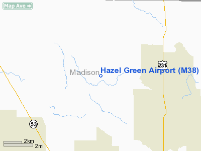
Location
& QuickFacts
|
FAA Information Effective: |
2007-01-18 |
|
Airport
Identifier: |
M38 |
|
Airport
Status: |
Operational |
|
Longitude/Latitude: |
086-38-48.9850W/34-54-58.3150N
-86.646940/34.916199 (Estimated) |
|
Elevation: |
814 ft / 248.11 m (Estimated) |
|
Land: |
30
acres |
|
From
nearest city: |
4 nautical miles W of Hazel Green, AL |
|
Location: |
Madison County, AL |
|
Magnetic Variation: |
00W (1985) |
Owner
& Manager
|
Ownership: |
Privately owned |
|
Owner: |
Hazel Green Flyers Inc |
|
Address: |
342 Opp Reynolds Rd
Hazel Green, AL 35750 |
|
Phone
number: |
256-828-5901 |
|
Manager: |
Al Berisford |
|
Address: |
386 Opp Reynolds Road
Hazel Green, AL 35750 |
|
Phone number: |
256-828-9205 |
Airport
Operations and Facilities
|
Airport Use: |
Open to public |
|
Wind
indicator: |
Yes |
|
Segmented
Circle: |
No |
|
Control
Tower: |
No |
|
Lighting
Schedule: |
DUSK-DAWN
ACTVT LIRL RY 07/25 - CTAF. |
|
Beacon
Color: |
Clear-Green (lighted land airport)
OTS INDEFLY. |
|
Landing
fee charge: |
No |
|
Sectional
chart: |
Atlanta |
|
Region: |
ASO - Southern |
|
Boundary
ARTCC: |
ZME - Memphis |
|
Tie-in
FSS: |
ANB - Anniston |
|
FSS
on Airport: |
No |
|
FSS
Toll Free: |
1-800-WX-BRIEF |
|
NOTAMs
Facility: |
ANB (NOTAM-d service avaliable) |
Airport
Communications
Airport
Services
|
Fuel available: |
100LL |
|
Airframe Repair: |
MAJOR |
|
Power Plant Repair: |
MAJOR |
|
Bottled
Oxygen: |
NONE |
|
Bulk
Oxygen: |
NONE |
|
Runway Information
Runway 07/25
|
Dimension: |
2670 x 40 ft / 813.8 x 12.2 m |
|
Surface: |
ASPH, Poor Condition |
|
Weight
Limit: |
Single wheel: 10000 lbs. |
|
Edge
Lights: |
Low |
|
|
Runway 07 |
Runway 25 |
|
Traffic
Pattern: |
Left |
Left |
|
Markings: |
Basic, Fair Condition |
Basic, Fair Condition |
|
Displaced
threshold: |
0.00 ft |
550.00
ft |
|
Obstruction: |
65 ft tree, 1433.0 ft from runway, 139 ft left
of centerline, 18:1 slope to clear |
56 ft trees, 200.0 ft from runway
APCH RATIO 13:1 TO DSPLCD THLD.
ROAD 35 FT FM THLD; 56 FT TREES 160-200 FT FM THLD 90 FT L
& R. |
|
Radio Navigation
Aids
|
ID |
Type |
Name |
Ch |
Freq |
Var |
Dist |
|
SYI |
FAN MARKER |
Bomar |
|
|
01W |
35.3 nm |
|
CWH |
NDB |
Capshaw |
|
350.00 |
01W |
10.8 nm |
|
HUA |
NDB |
Redstone |
|
287.00 |
00W |
13.2 nm |
|
TNY |
NDB |
Kelso |
|
358.00 |
01W |
14.1 nm |
|
GZS |
NDB |
Giles/dcmsnd |
|
375.00 |
00E |
24.7 nm |
|
BGF |
NDB |
Boiling Fork |
|
263.00 |
02W |
32.5 nm |
|
CPP |
NDB |
Cole Spring |
|
230.00 |
01W |
34.1 nm |
|
LRT |
NDB |
Lawrenceburg |
|
269.00 |
00E |
35.8 nm |
|
LUG |
NDB |
Verona |
|
251.00 |
00W |
36.0 nm |
|
ULH |
NDB |
Burwi |
|
332.00 |
03W |
38.4 nm |
|
UOS |
NDB |
Sewanee |
|
275.00 |
02E |
40.8 nm |
|
ARF |
NDB |
Saratoga |
|
296.00 |
02W |
45.0 nm |
|
PBC |
NDB |
Maury County |
|
365.00 |
01W |
47.0 nm |
|
UXM |
VOR |
Tullahoma Regional |
|
109.65 |
03W |
34.2 nm |
|
DCU |
VOR/DME |
Decatur |
075X |
112.80 |
01W |
21.6 nm |
|
SYI |
VOR/DME |
Shelbyville |
027X |
109.00 |
01W |
40.1 nm |
|
RQZ |
VORTAC |
Rocket |
059X |
112.20 |
02E |
7.2 nm |
|
MSL |
VORTAC |
Muscle Shoals |
112X |
116.50 |
01E |
43.5 nm |
|
HSV |
VOT |
Huntsville |
|
111.00 |
|
7.3 nm |
Remarks
Based
Aircraft
|
Aircraft
based on field: |
20 |
|
Single
Engine Airplanes: |
18 |
|
Gliders: |
2 |
Operational Statistics
Time Period: 1996-10-30
- 1997-10-29
|
Aircraft
Operations: |
217/Week |
|
General
Aviation Local: |
28.8% |
|
General
Aviation Itinerant: |
71.2% |
Hazel Green Airport
Address:
Madison County, AL
Tel:
256-828-5901,
256-828-9205
Images
and information placed above are from
http://www.airport-data.com/airport/M38/
We
thank them for the data!
| General
Info |
| Country |
United
States |
| State |
ALABAMA
|
| FAA ID |
M38
|
| Latitude |
34-54-58.315N
|
| Longitude |
086-38-48.985W
|
| Elevation |
814 feet
|
| Near City |
HAZEL
GREEN |
We don't guarantee the information is fresh and accurate. The data may
be wrong or outdated.
For more up-to-date information please refer to other sources.
|
|


