 |
|
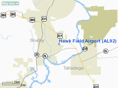
Location
& QuickFacts
|
FAA Information Effective: |
2007-01-18 |
|
Airport
Identifier: |
AL92 |
|
Airport
Status: |
Operational |
|
Longitude/Latitude: |
086-24-12.9230W/33-18-26.4020N
-86.403590/33.307334 (Estimated) |
|
Elevation: |
420 ft / 128.02 m (Estimated) |
|
Land: |
10
acres |
|
From
nearest city: |
2 nautical miles S of Harpersville, AL |
|
Location: |
Shelby County, AL |
|
Magnetic Variation: |
01W (1990) |
Owner
& Manager
|
Ownership: |
Privately owned |
|
Owner: |
William G Gayle |
|
Address: |
P O Box 10452
Birmingham, AL 35202 |
|
Phone
number: |
205-323-0099 |
|
Manager: |
William G Gayle |
|
Address: |
P O Box 10452
Birmingham, AL 35202 |
|
Phone number: |
205-672-3103 |
Airport
Operations and Facilities
|
Airport Use: |
Private |
|
Wind
indicator: |
Yes |
|
Segmented
Circle: |
No |
|
Control
Tower: |
No |
|
Sectional
chart: |
Atlanta |
|
Region: |
ASO - Southern |
|
Boundary
ARTCC: |
ZTL - Atlanta |
|
Tie-in
FSS: |
ANB - Anniston |
|
FSS
Toll Free: |
1-800-WX-BRIEF |
|
Runway Information
Runway 11/29
|
Dimension: |
3400 x 75 ft / 1036.3 x 22.9 m |
|
Surface: |
TURF, |
|
|
Runway 11 |
Runway 29 |
|
Traffic
Pattern: |
Left |
Left |
|
Radio Navigation
Aids
|
ID |
Type |
Name |
Ch |
Freq |
Var |
Dist |
|
SCD |
NDB |
Sylacauga |
|
284.00 |
03W |
9.1 nm |
|
PLR |
NDB |
Pell City |
|
257.00 |
01E |
17.0 nm |
|
BH |
NDB |
Mcden |
|
224.00 |
01W |
25.3 nm |
|
BEQ |
NDB |
Bessemer |
|
368.00 |
00E |
26.1 nm |
|
GGY |
NDB |
Gragg-wade |
|
338.00 |
01E |
29.2 nm |
|
DER |
NDB |
Alexander City |
|
382.00 |
01W |
34.0 nm |
|
TDG |
VOR/DME |
Talladega |
025X |
108.80 |
02E |
24.2 nm |
|
GAD |
VOR/DME |
Gadsden |
070X |
112.30 |
02E |
43.3 nm |
|
VUZ |
VORTAC |
Vulcan |
091X |
114.40 |
02E |
33.1 nm |
|
OKW |
VORTAC |
Brookwood |
047X |
111.00 |
00E |
42.7 nm |
|
BHM |
VOT |
Birmingham Muni |
|
110.00 |
|
23.4 nm |
Remarks
Based Aircraft
|
Aircraft
based on field: |
2 |
|
Single
Engine Airplanes: |
1 |
|
Multi
Engine Airplanes: |
1 |
Hawk Field Airport
Address:
Shelby County, AL
Tel:
205-323-0099,
205-672-3103
Images
and information placed above are from
http://www.airport-data.com/airport/AL92/
We
thank them for the data!
| General
Info |
| Country |
United
States |
| State |
ALABAMA
|
| FAA ID |
AL92
|
| Latitude |
33-18-26.402N
|
| Longitude |
086-24-12.923W
|
| Elevation |
420 feet
|
| Near City |
HARPERSVILLE
|
We don't guarantee the information is fresh and accurate. The data may
be wrong or outdated.
For more up-to-date information please refer to other sources.
|
|


